Description
I have a growing number of Alaska scenery projects. By request I am combining all of them into one download (the individual sceneries will remain updated too). If you like to just download one folder rather than individual sceneries, this is for you. This description was getting too long so for more detail on each scenery, follow the link - you can still download everything at once from this page.
Many of the following sceneries require additional libraries for the full experience, they are:
- Emerald Object Library
- MSFS Object Library
- Ethnicfs Cars Library
- Generic Bridges Model Library
- Duke Newcomb Model Library
- Bush Backcountry Library
- Note: All of these libraries were developed for MSFS2020 but are all fully functional and/or updated in MSFS2024. If the authors update them for 2024, my sceneries will be updated accordingly.
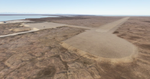
Below are the sceneries included in this pack, if you prefer them individually just click the links and download from there:
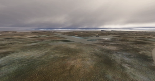
- Bear Island Strip
ICAO: N764
- Fictional
- Brooker Mtn Kantishna, Ak
ICAO: N765
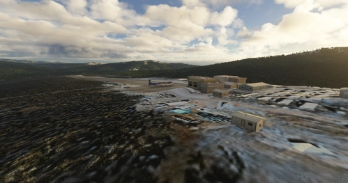
- Chitina River, Ak
I've corrected the span of river from it's confluence with the Nzina River to it's confluence with the Copper River. As I have time I will continue to work on river corrections in the area.
- ICAO: N774
- Foreplay Kantishna, Ak
ICAO: N766
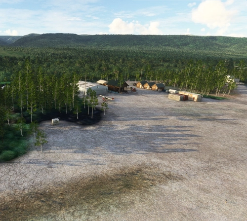
- McCarthy, Ak
ICAO's:
North's House N760
- McCarthy 2 N762
- McCarthy 3 N7641
- McCarthy 4 N768
- Swift Creek AK31
- Fireweed 0AK8
- McCarthy, Ak PAMX
ICAO: PAMX
- Ultima Thule Lodge
ICAO: N761
- FlyAlaska Lodge
ICAO: N769
- Jakes Bar
ICAO: AK0
- Peavine and Glacier Creek
ICAO's
N770
- N771
- N772
- Long Lake, Ak
ICAO: 4AK3
- Young Creek, Ak
ICAO: 0AK5
- May Creek, Ak
ICAO: MYK
- Norths Favorite Landing Spots
ICAO: None, these are off airport landing spots, follow the headings from PAMX and explore to find them
- Fictional
Towhead Mtn - fantastic mountain spot with a beautiful view of the Chitina River, watch the sunset from here
- Star Lake - fascinating little lake shaped like a star. Old fishing camp if you follow the old goatpath on foot
- Hidden Creek - beautiful secluded spot west of Kennicott Glacier with towering cliffs on both sides
- McCarthy Creek - headwaters of McCarthy Creek at McCarthy Glacier, curved final narrow strip - proceed with caution
- The Bowl - very challenging dangerous strip in the bottom of a bowl
- Monahan Creek - hillside landing spot next to a marsh, not far from Bremner Mine
- Horn Valley - steep narrow valley with short creek side strip, very scenic spot with camping spot
- Dan Creek, Ak
ICAO: N773
- McCarthy 5
ICAO: N775
- Bremner Mine
ICAO: N776
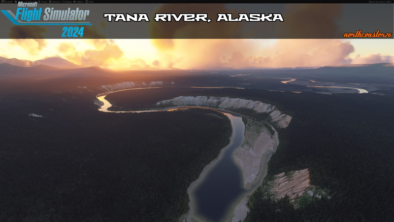
- Tana River
River channel correction from confluence near Jakes Bar AK0 to source at Tana Glacier
- Tebay Lakes
ICAO: N777
- McCarthy Creek Homestead
ICAO: N778
- Donoho Lakes
ICAO: N786
- Cliff Bar
ICAO: N783
- Pack Bar
ICAO: N784
- Nikolai Bar
ICAO: N781
- Chitistone Falls
ICAO: N785
- Grand Parapet
ICAO: N780
- Fosse
ICAO: N788
- Amphitheater Creek
ICAO: N787
- Doubtful Creek
ICAO: N788
- Big Bend Lakes
ICAO: N789
- Upper Tana Strip
ICAO: N792
- Middle Tana Strip
ICAO: N793
- Lower Tana Strip
ICAO: N794
- Ali's Valley
ICAO: N791\
- Hubert's Landing
ICAO: N795
- Nelson Mtn
ICAO: N796
- Haganita River
ICAO: N797
- Erickson Creek
ICAO: N799
- Canyon Creek
ICAO: N800
- The Slot
ICAO: N801
- Hawkins Bench
ICAO: N802
- MacColl Ridge
ICAO: N798
If you enjoy my sceneries, please go show the library creators your appreciation, the work they do is far more valuable to the community than anything I do
Constructive criticism always welcome, any issues/errors/scenery oddities feel free to message me on discord - northcoaster76. Happy Flying!
Comments(65)
Log in to join the discussion
Log In4 months ago
4 months ago
If you'd like to continue to receive scenery updates, join my discord and I can provide them by other means.
3 months ago
The download button is still incredibly easy to find. If you really want any type of change, find and patronize competitive platforms
4 months ago
4 months ago
4 months ago
4 months ago
your "one in all" package is the pur luxury. Thank you very much for your always great work 👍👍👍😊
5 months ago
5 months ago
There is one little "snag": This folder has a file called "northcoaster76-hidden-splendor"
This is not in Alaska but in Utah. You offer it in this download:
https://de.flightsim.to/file/87596/hidden-splendor-airstrip-utah
5 months ago
Did I really accidentally get hidden splendor in there? Lol oops, beautiful little airstrip anyway! Thanks for catching that.
7 months ago
7 months ago
7 months ago
7 months ago
7 months ago
7 months ago
Can you share which ICAOs are not functioning correctly for you please? I want to investigate because I just checked in sim and they are all showing correctly on the world map, show up in the search, and are visible with POI/airport markers on.
7 months ago
7 months ago
7 months ago
your all in one package is very comfortable. I love it. Thank you very much and peace and all the best wishes from the Westerwald Germany.
We have St. Nicholas Day today.
Northcoaster76's Alaska Scenery Project
A collection of backcountry/bush strips in the McCarthy, AK area. A range of opportunities here, everything from a Kodiak to a supercub will find a challenge here.
User Reviews
18 reviews
More Information
Version History
VARIOUS MINOR FIXES, SEE INDIVIDUAL SCENERIES FOR DETAILS ADDED HAWKINS BENCH, CANYON CREEK, THE SLOT, MACCOLL RIDGE, AND ERICKSON CREEK STRIPS
Featured in Collections(1)
Related

Swiss mountains tree fix (trees on mountains removed)
A comprehensive mod fixing tree placement on Swiss mountains, particularly removing inaccurately placed trees on mountain peaks. The update includes a shift to more realistic conifer trees in the Alps and an expansion to border areas of France, Italy, and Austria. From Alpstein Säntis to Stockhorn, numerous locations across Switzerland have been meticulously corrected for a more authentic flight experience.
by THEOLI4D

Shorter Trees / Tree Height Modification VERSION 4.0 for MFS2020 (shorter, realistic trees)
Experience realistic and shorter trees in Microsoft Flight Simulator with the Shorter Trees / Tree Height Modification VERSION 4.0 add-on. Compatible with the latest version of MSFS, this mod provides adjusted tree heights for a more authentic flying experience. Update includes enhanced tree coloration blending seamlessly with photogrammetry trees. Installation is simple - just copy the folder into your community folder and enjoy a new perspective from the skies.
by ARIF STUDIOS - Adnan Arif

AUSTRIA 10m DEM - High Resolution Terrain Elevation Data from LIDAR Imaging
Explore the stunning terrain of Austria with this mod featuring high-resolution LIDAR data, offering a mesh resolution of 10m for a more realistic flight experience. Flatten lakes, rivers, and eliminate any terrain artifacts as you soar over the Austrian landscape. Divided into regions for convenience and performance optimization, this mod enhances the mountain shapes to mirror reality and provides a smoother flying experience. Experience Austria like never before with enhanced elevation data and realistic terrains.
by Troglodytus

SWITZERLAND 20m DEM - High Resolution Terrain Elevation Data from LIDAR Imaging
Explore the beauty of Switzerland with this mod offering high resolution terrain elevation data using LIDAR imaging. The mesh resolution is 20m, providing exceptional detail with a height resolution of 0.1m. Update includes extreme LIDAR meshes for specific regions. Please note potential performance impacts and report any bugs for further improvements. Fly VFR over Switzerland with enhanced realism and accuracy.
by Troglodytus
3 months ago
Love your work, and love all the updates thanks so much.