Description
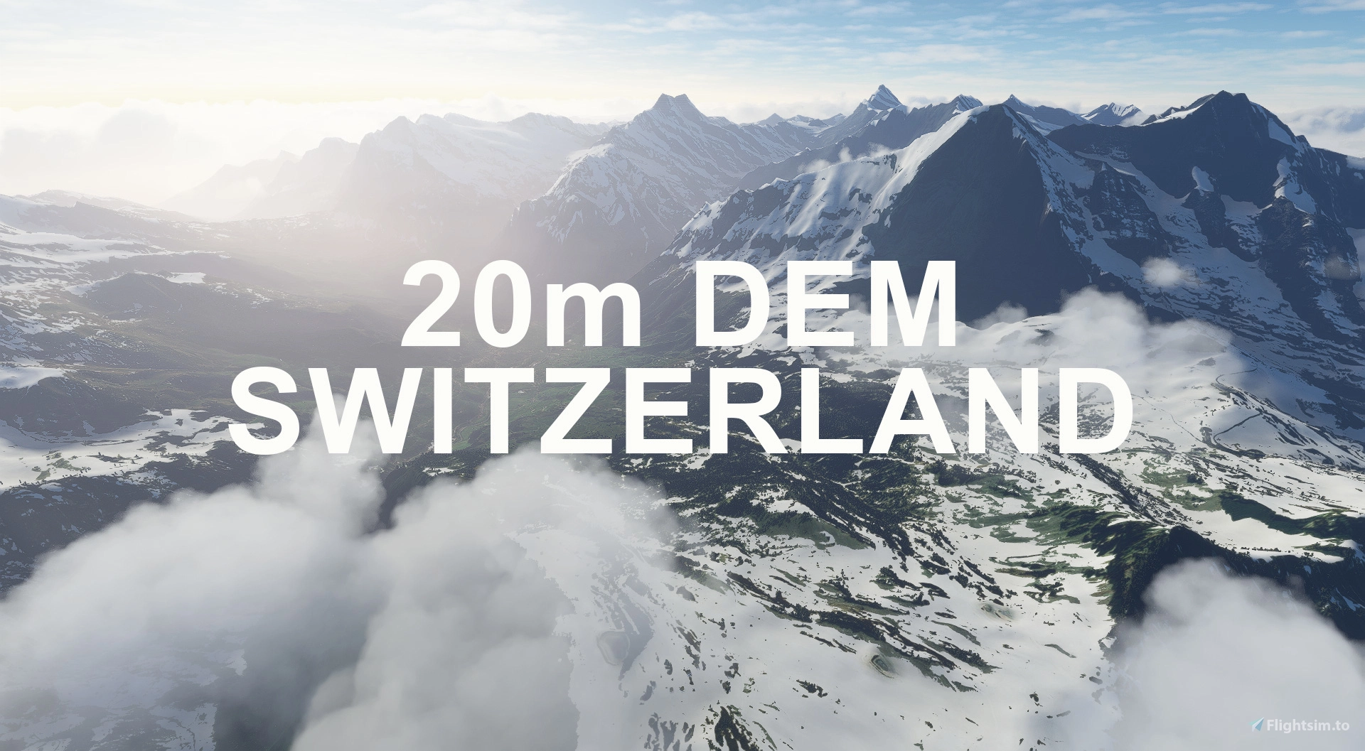
This mod contains customized height profiles for Switzerland. The mod contains high definition LIDAR DEM data with a mesh resolution of 20m, whereas the MSFS uses a lateral resolution of about 50m or worse. The height resolution is as good as 0.1m.
The mod does not only provide mountain shapes being very close to reality, but also flattens lakes & rivers and gets rid of any terrain artifacts.
Update 1.2:
Additionally included are 3 extreme LIDAR meshes with a resolution of 1m for Matterhorn, 2m for Jungrau-Aletsch region and 2m Säntis.
If you suffer any major stutters or problems, simply delete these 3 folders!
Disclaimer: The creator of this mod is not responsible for any problems, damage, incompatibilites to other mods or performance issues that might occur.
Please note, that this mod is a very high resolution mesh covering the whole of Switzerland. The elevation data is applied through terraforming rectangles, thus loaded at a certain distance from the player. When travelling fast or at high alitude (wide range of view) there might be too many new rectangles loaded simultaneously and thus stutters might occur.
If you have any stutters you can try and reduce your ingame render settings or uninstall!
If you are mainly flying airliners in high altitude, there is probably no benefit for you in using this mod.
As it stands, the famous Matterhorn mountain, is extremely realistic on the Swiss side, but has bumps on the Italian side. I hope you will excuse this glitch for the time being.
Please report any bugs with sceneries or airports and I will see what I can do!
If you use the Austria DEM as well, you can rename the folder "troglodytus-demswitzerland..." into "aaa-troglodytus-demswitzerland". This way in overlapping regions the higher quality Austrian mesh will be used.
The elevation data used was a LIDAR 20m height profile of Switzerland compiled by Sonny (http://data.opendataportal.at/dataset/a949dd6f-9f19-4727-872c-b70d35adb550)
It was then transfered into MSFS using MSFS Toolkit by Nool Aerosystems (https://msfs.nool.ee/)
Thank you both and for anyone reading this: Please go ahead and support them!
Enjoy your VFR flights above Switzerland!
Comments(214)
Log in to join the discussion
Log Inalmost 2 years ago
over 1 year ago
over 4 years ago
Do you still support this mod? Or is it obsolete because of MS Updates? Since SU08 I'm experiencing major stutters when using your DEM mods.
over 4 years ago
yes im getting the same with fsdreamteams switzerland mesh unplayable stutters, think this is an asobo fix
about 4 years ago
I would say this mod and the fsdreamteams mod are obsolete at this point. With WU6 we got very good terrain data for Switzerland. There is no need for these mods anymore, from my point of view.
These mods were amazing before WU6 however.
But now, the DEM in the sim is good enough or even better.
over 4 years ago
Hi Troglodytus
Can you please exclude the LSZC Buochs region?
Because with the new Flylogic Buochs Scenery the Mesh in Buochs is absolutly messed up.
Thanks, and maybe it would be possible to fix the sinkhole behind the Pilatus Aircraft Factory on Bürgenstock?
Thanks a lot
best regards
over 4 years ago
which one would you prefer? The standart DACH scenery or your mesh?
over 4 years ago
I personally still use the DEMs, as the generic mesh tends to pop and flicker when flying close to ground. I am sure you have whitnessed the effect of this ground "morphin" as you got closer to it. This effect is reduced with this mod.
over 4 years ago
okay, thanks for your advice
over 4 years ago
Hallo, wenn steht "installation noch offen" im Inhaltsmanager, ist das ein Problem?
over 4 years ago
Servus, das habe ich leider noch nie gehört oder gelesen. Magst Du mir vielleicht einen Screenshot davon per Nachricht schicken? Vielleicht kann ich dir dann besser weiterhelfen!
Danke!
almost 5 years ago
Sorry for this weird request, but do you think a patch of the "extreme" resolution mesh could "fix" the Hirschensprung in the Alpine Rhine Valley? It seems like it would be a fun challenge to fly through that chasm, but I guess we would have to be really, really lucky with the position of the data points, because it's so narrow.
coordinates: 47.303611, 9.547795
more info and pic: https://de.wikipedia.org/wiki/Hirschensprung
almost 5 years ago
Thank you for the request, it looks really cool. I will see what I can do. No promises though!
SWITZERLAND 20m DEM - High Resolution Terrain Elevation Data from LIDAR Imaging
Explore the beauty of Switzerland with this mod offering high resolution terrain elevation data using LIDAR imaging. The mesh resolution is 20m, providing exceptional detail with a height resolution of 0.1m. Update includes extreme LIDAR meshes for specific regions. Please note potential performance impacts and report any bugs for further improvements. Fly VFR over Switzerland with enhanced realism and accuracy.

User Reviews
35 reviews
Location
More Information
Version History
Since World Update 6, the generic mesh data is really high quality. However, here is a short pro and con list for the use of this Addon: CON * Default mesh is now higher quality, when being very close to the ground/mountains PRO * The mountains still look better from far away, as the LOD scaling is very different. Default mountains get round at a certain distance * This mod does not cause "pop ins" of high quality when flying close to mountains. Changes v1.3: * Excluded photogrammetry areas of Basel, Konstanz * Excluded LSZN Hausen am Albis * Excluded LSGS Sion * Excluded LSZR Altenrhein * Excluded LSGC Les Eplatures * Excluded LSZF Birrfeld * Excluded LSZQ Bressaucourt * Excluded Areas around Matterhorn, Jungfrau and Saentis. You can choose to use the included folders with high definition meshes or the default one. * Recompiled with new algorithm * Adjusted falloff distance for better blending with surrounding areas
Related

Swiss mountains tree fix (trees on mountains removed)
A comprehensive mod fixing tree placement on Swiss mountains, particularly removing inaccurately placed trees on mountain peaks. The update includes a shift to more realistic conifer trees in the Alps and an expansion to border areas of France, Italy, and Austria. From Alpstein Säntis to Stockhorn, numerous locations across Switzerland have been meticulously corrected for a more authentic flight experience.
by THEOLI4D

Shorter Trees / Tree Height Modification VERSION 4.0 for MFS2020 (shorter, realistic trees)
Experience realistic and shorter trees in Microsoft Flight Simulator with the Shorter Trees / Tree Height Modification VERSION 4.0 add-on. Compatible with the latest version of MSFS, this mod provides adjusted tree heights for a more authentic flying experience. Update includes enhanced tree coloration blending seamlessly with photogrammetry trees. Installation is simple - just copy the folder into your community folder and enjoy a new perspective from the skies.
by ARIF STUDIOS - Adnan Arif

AUSTRIA 10m DEM - High Resolution Terrain Elevation Data from LIDAR Imaging
Explore the stunning terrain of Austria with this mod featuring high-resolution LIDAR data, offering a mesh resolution of 10m for a more realistic flight experience. Flatten lakes, rivers, and eliminate any terrain artifacts as you soar over the Austrian landscape. Divided into regions for convenience and performance optimization, this mod enhances the mountain shapes to mirror reality and provides a smoother flying experience. Experience Austria like never before with enhanced elevation data and realistic terrains.
by Troglodytus
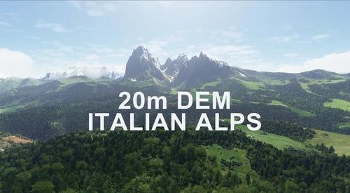
ITALIAN ALPS 20m DEM - High Resolution Terrain Elevation Data from LIDAR Imaging
Explore the beauty of the Italian Alps with this mod featuring high-resolution terrain elevation data obtained from LIDAR imaging. With a mesh resolution of 20m and a height resolution of 0.1m, this addon provides realistic mountain shapes, flattens lakes and rivers, and eliminates terrain artifacts. Please note potential performance issues related to loading distances when using this mod, especially in high-speed or high-altitude flights. Experience realistic scenery across the Alps and enjoy your VFR flights above Italy!
by Troglodytus
3 months ago