Description
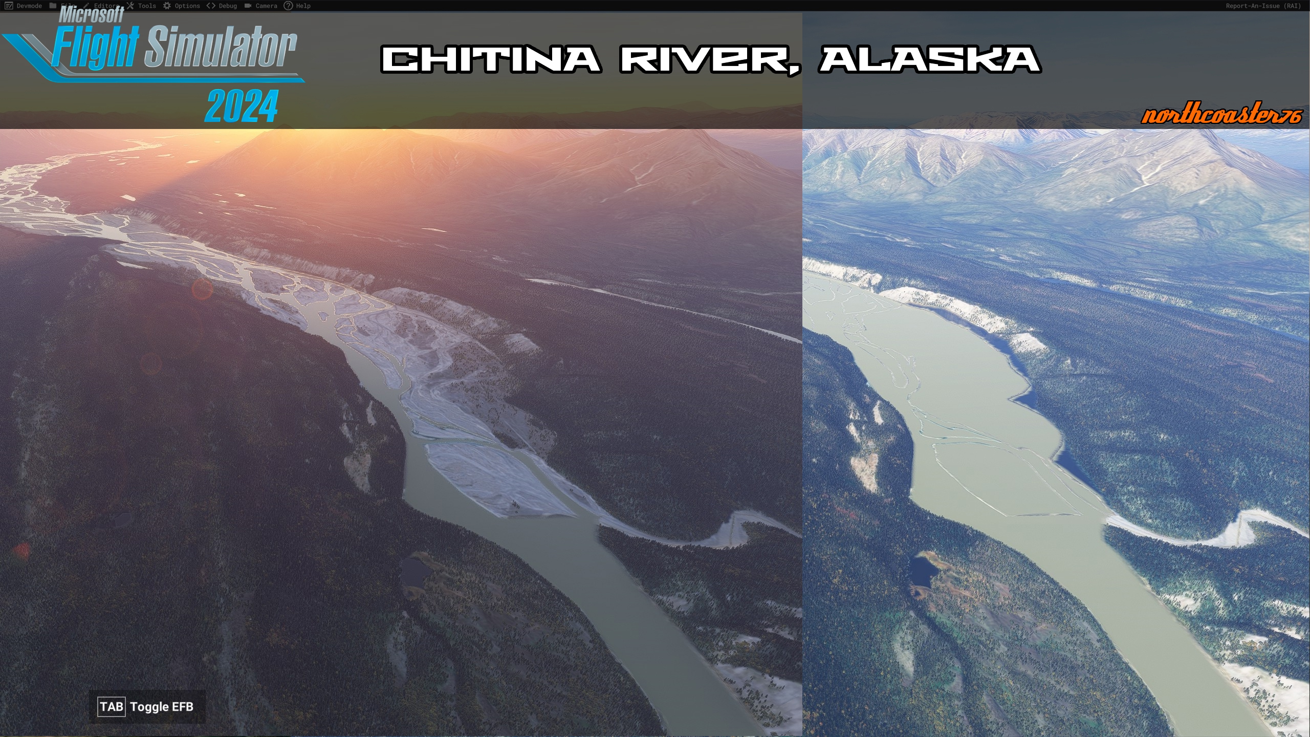
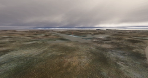
The Chitina River is shown as a giant contiguous body of water in the sim when in reality it is a complex multi threaded river channel with hundreds of gravel bars. Pictures show the before and after, should be pretty obvious which is which.
I've corrected the span of river from it's confluence with the Nizina River to it's confluence with the Copper River. As I have time I will continue to work on river corrections in the area.
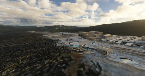
One unnamed backcountry landing strip exists near the confluence of the Nizina River and the Chitina River. I've given it a fictional name of Nizina's End but if someone knows what it's actually called, please let me know. ---JimmyAk has found Wrangell Mtn Air refers to it as Nizina Chitina Confluence and they use it for emergency landing training (fun fact).
ICAO: N774
If you appreciate my work just leave me a rating and a comment or message me on discord.
Comments(1)
Log in to join the discussion
Log InChitina River, Ak
This add-on modifies the Chitina River in Microsoft Flight Simulator to accurately reflect its complex multi-threaded channel, correcting the representation of the rivers span from the Nzina River confluence to the Copper River. The enhancement includes the addition of numerous gravel bars, improving the realism and visual fidelity of the river environment. Future updates may address additional river corrections in the surrounding area.
User Reviews
1 reviews
Location
More Information
Version History
EDITED PARKING FOR NEOFLY COMPATIBILITY
Featured in Collections(1)
Related
Northcoaster76's Alaska Scenery Project
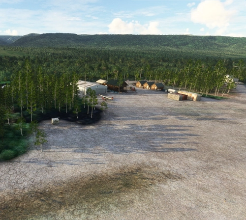
A collection of backcountry/bush strips in the McCarthy, AK area. A range of opportunities here, everything from a Kodiak to a supercub will find a challenge here.
by northcoaster76
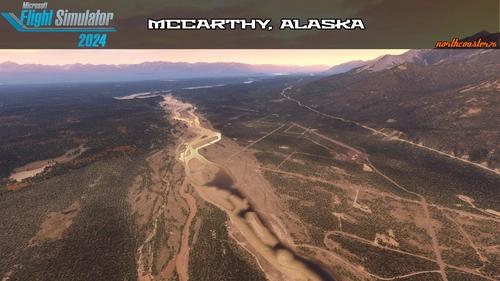
McCarthy, Ak (literally, almost all of it)
This add-on enhances the McCarthy, Alaska area by refining and decorating several private airstrips, including AK31 Swift Creek Airport and 0AK8 Fireweed Airport, based on satellite imagery. The project includes detailed landscaping with new buildings, decorations, and improved roadways, making the area more immersive for exploration. Additionally, the add-on corrects the paths of the Kennicott and Copper Rivers, enhancing their visual representation within the simulator. Libraries for objects are required for full functionality.
by northcoaster76
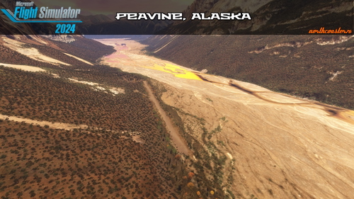
Peavine and Glacier Creek McCarthy, Ak
Experience two backcountry airstrips in Alaska, located approximately 15 miles from McCarthy. Peavine (ICAO: N770) features a 1650-foot gravel strip with nearby public cabins, offering stunning views of cliffs and a glacial river. Glacier Creek (ICAO: N771) has a 1400-foot gravel runway and one public cabin near aircraft parking, with no additional services available at either location.
by northcoaster76
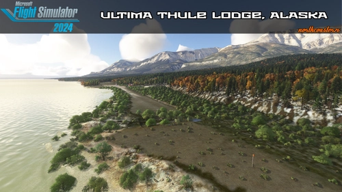
Ultima Thule Lodge McCarthy, Ak
Experience the Ultima Thule Lodge, a fictional backcountry destination modeled after the real lodge in the Wrangell St Elias area of Alaska. This add-on features comfortable lodging, gourmet meals, and an accurately represented flight strip for aviation enthusiasts. Visitors can engage in daily adventures led by a backcountry pilot, with easy access via a shuttle flight from McCarthy. Please note that this representation is not affiliated with the actual Ultima Thule Lodge.
by northcoaster76
3 months ago