Description
Description
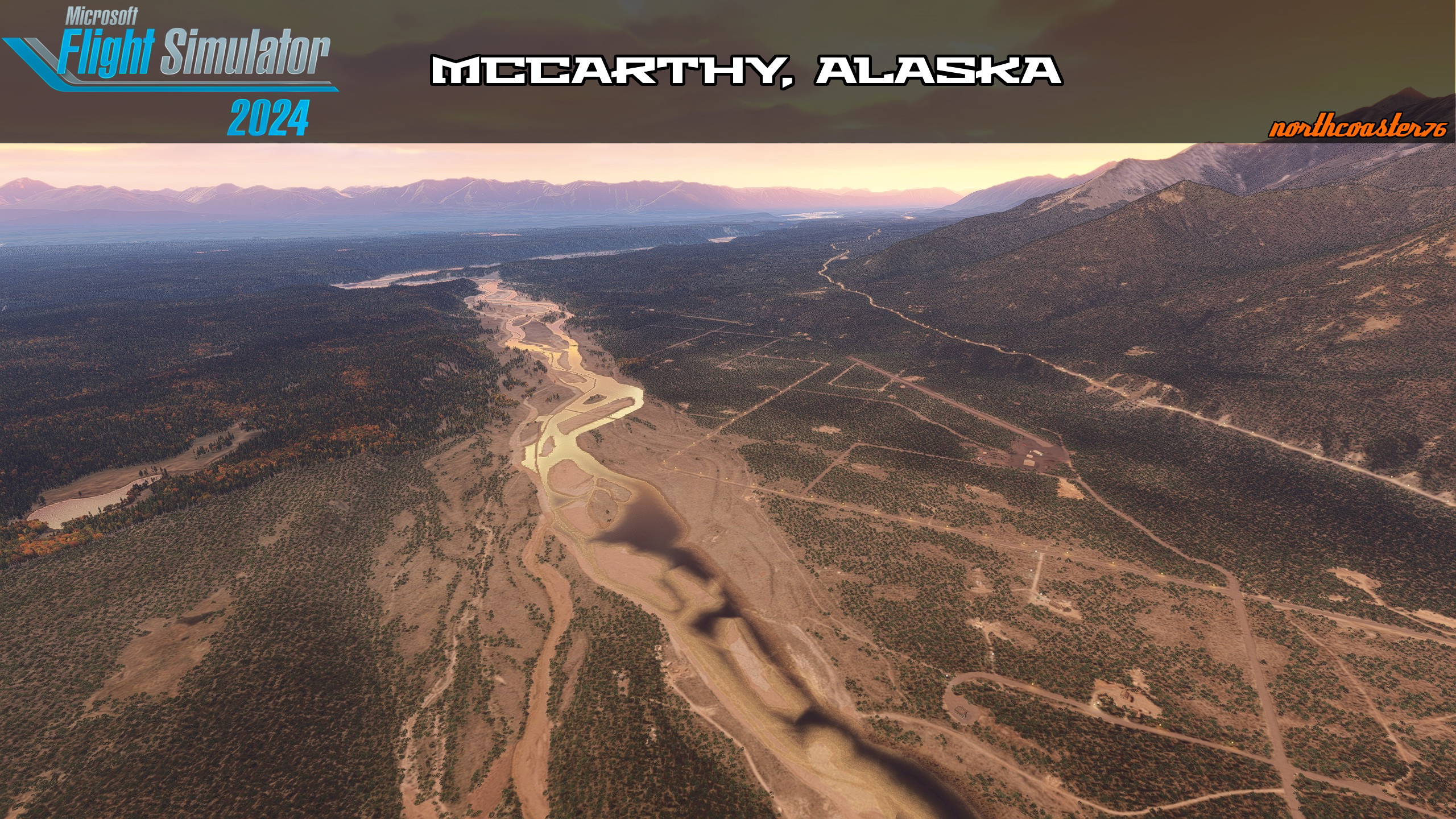
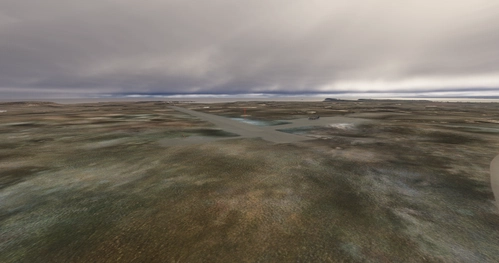
Nestled in near the Wrangell St Elias National Park, McCarthy, Ak, has about 100 residents and sees plenty of tourism each year. It's remote location near the Wrangell Mountains and multiple glaciers makes it a fantastic vacation location as well as a bush flying paradise. The scenery is breathtaking with mountain ranges, lakes, huge natural rivers, and glaciers. I felt that the sim was underrepresenting this area so I've fixed a massive area for those interested in small private airstrips, larger public airstrips, gravel bar hopping, mountain and glacier viewing, ground vehicle exploration, and the tourism industry (multiple fly in vacation lodges utilize PAMX for shuttling visitors from far away places).
The Airstrips
- There are numerous private airstrips near McCarthy, Ak, they do not have ICAO codes and are not listed anywhere however they are visible on the satellite imagery so I've cleaned up and decorated 4 of them
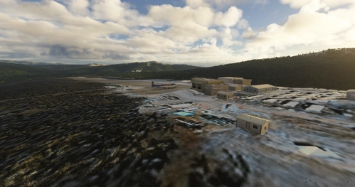
- North's House N760
- 2 GA parking spots
- Runway 35-17. Narrow. Approximately 750'
- No room for error, hit the center or hit the trees. No go around
- Taxiway leads to parking area and hangar and residential area
- Also accessible by road
- McCarthy 2 - N762
- 2 GA parking spots
- Runway 10-28, approximately 600'
- Short rough, utility strip for adjacent construction and gravel pit operations
- Not accessible by road
- McCarthy 3 N7641
- 2 GA parking spots near residential homes
- Runway 34-18, curved. Approximately 1480"
- NOTAM - curve is approximately halfway down runway at about 15 degrees off heading, be prepared to make the curve or stop by half of total runway length
- Grass field with residential homes at south end and near halfway point.
- Also accessible by road
- McCarthy 4 N768
- 2 GA parking spots
- Runway 27-09
- Grass runway, smooth. Approximately 2000'
- Residential homes at West end near parking
- Also accessible by road
- North's House N760
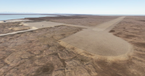
- AK31 Swift Creek Airport, another one near McCarthy but registered but the sim did a very poor job on it so I've cleaned it up and decorated it as close as I can based on satellite imagery
- 0AK8 Fireweed Airport, again the sim did a very poor job on this one so I've entirely redone it as close as I can to the images that I've found
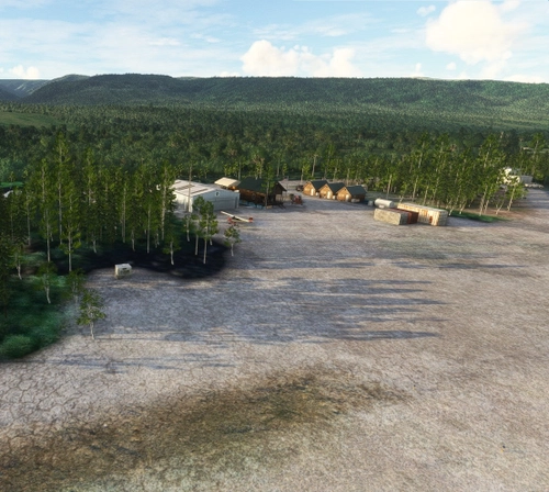
The Decoration
- With the new walk around mode I can't help but decorate on the tiniest level so I have gone through a good portion of the area placing buildings and decorations around them to give the area some life - new houses, sheds, firewood stacks, cars, static planes, etc - go explore and find stuff!
The Roads
- A huge undertaking but I have cleaned 90% of the roads in the area of rocks and veg and then shaped them and textured them. You can literally drive a land vehicle (Juice Goosin') from one end of this project to the other(North's house to PAMX) all on nice graveled roads
The Rivers
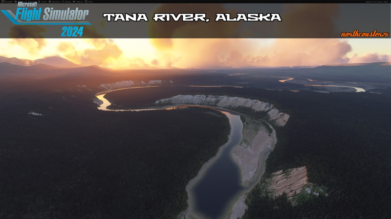
- The Kennicott River flows through McCarthy on it's way to it's confluence with the Nzina River. Both of these rivers have their start at glaciers.
- I've gone through and corrected their paths and fixed the water on both of these rivers so gravel bars are plentiful and it looks incredible
Now this project is expansive and I have no doubt that you'll all find little oddities that need addressing. Grab screenshots/descriptions and message me on discord (northcoaster76) and I'll continue to fix and improve things.
If you appreciate my work just leave me a rating and a comment or message me on discord. You should also go leave some feedback for the creators of the libraries used, the detail in my work would not be possible without them.
Dependencies
Comments(26)
Log in to join the discussion
Log Inabout 1 year ago
over 1 year ago
One question - I don't have stars for them (custom sceneries stars) on the world map. Is there some way to fix it?
over 1 year ago
over 1 year ago
over 1 year ago
over 1 year ago
over 1 year ago
Found this: https://www.explorenorth.com/library/aviation/airports/yukon-haines_junction.html
Might be helpful. I rely heavily on google satellite imagery and if it's a small bush strip then shortfield.com can be super helpful.
over 1 year ago
over 1 year ago
over 1 year ago
Why not make a fictive ICAO on airfields that do not have ICAO codes? That would be of great help for all of us who are looking for bush airfields in a totaly unknown state
over 1 year ago
over 1 year ago
over 1 year ago
over 1 year ago
over 1 year ago
over 1 year ago
over 1 year ago
I am looking forward to the next changes .
best wishes
over 1 year ago
Looking forward to further expansion of this area and project!
over 1 year ago
Next project is cleaning up the chitina river like I did for the Kennecott and (part of) nzina as well as various other airstrips in the area.
McCarthy, Ak (literally, almost all of it)
This add-on enhances the McCarthy, Alaska area by refining and decorating several private airstrips, including AK31 Swift Creek Airport and 0AK8 Fireweed Airport, based on satellite imagery. The project includes detailed landscaping with new buildings, decorations, and improved roadways, making the area more immersive for exploration. Additionally, the add-on corrects the paths of the Kennicott and Copper Rivers, enhancing their visual representation within the simulator. Libraries for objects are required for full functionality.
User Reviews
8 reviews
More Information
Version History
FIXED HANGAR PARKING AT NORTH'S HOUSE FIXED TEXTURE ISSUE AT MCCARTHY 3 EDITED PARKING FOR NEOFLY COMPATIBILITY AT MULTIPLE STRIPS
Featured in Collections(1)
Related

Swiss mountains tree fix (trees on mountains removed)
A comprehensive mod fixing tree placement on Swiss mountains, particularly removing inaccurately placed trees on mountain peaks. The update includes a shift to more realistic conifer trees in the Alps and an expansion to border areas of France, Italy, and Austria. From Alpstein Säntis to Stockhorn, numerous locations across Switzerland have been meticulously corrected for a more authentic flight experience.
by THEOLI4D

Shorter Trees / Tree Height Modification VERSION 4.0 for MFS2020 (shorter, realistic trees)
Experience realistic and shorter trees in Microsoft Flight Simulator with the Shorter Trees / Tree Height Modification VERSION 4.0 add-on. Compatible with the latest version of MSFS, this mod provides adjusted tree heights for a more authentic flying experience. Update includes enhanced tree coloration blending seamlessly with photogrammetry trees. Installation is simple - just copy the folder into your community folder and enjoy a new perspective from the skies.
by ARIF STUDIOS - Adnan Arif

AUSTRIA 10m DEM - High Resolution Terrain Elevation Data from LIDAR Imaging
Explore the stunning terrain of Austria with this mod featuring high-resolution LIDAR data, offering a mesh resolution of 10m for a more realistic flight experience. Flatten lakes, rivers, and eliminate any terrain artifacts as you soar over the Austrian landscape. Divided into regions for convenience and performance optimization, this mod enhances the mountain shapes to mirror reality and provides a smoother flying experience. Experience Austria like never before with enhanced elevation data and realistic terrains.
by Troglodytus

SWITZERLAND 20m DEM - High Resolution Terrain Elevation Data from LIDAR Imaging
Explore the beauty of Switzerland with this mod offering high resolution terrain elevation data using LIDAR imaging. The mesh resolution is 20m, providing exceptional detail with a height resolution of 0.1m. Update includes extreme LIDAR meshes for specific regions. Please note potential performance impacts and report any bugs for further improvements. Fly VFR over Switzerland with enhanced realism and accuracy.
by Troglodytus
about 1 year ago