Description
"One of the smallest and most controversial airfields in America, Blaine Municipal Airport (4W6), has survived 28 years of lawsuits and ballot issues, aimed at shutting it down to make way for industrial and retail development.
Today, the 42-acre facility in northwest Washington, at the edge of the U.S.-Canadian border, is facing a much brighter future. A close 4-3 city council vote Oct. 9 approved moving ahead with the airport’s master plan, which includes a $16.8 million runway improvement, additional hangars and a marketing program."
That was the optimistic news story in 2006. Two years later, the Blaine city council caved in to real estate developers and closed the airport. In it's final year, Blaine Mun airport still had 8,000 airport operations. What a tradgedy!
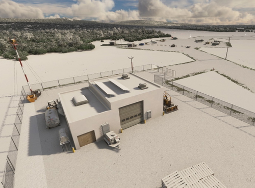
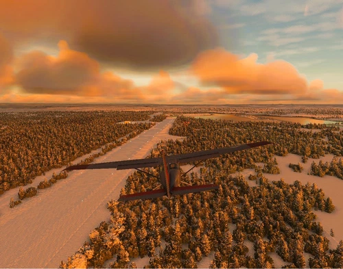
I have restored and reopened the airport so my fellow GA sim pilots can fly into and enjoy visiting the beautiful little border town of Blaine, Washington. I hope you get out of your plane and explore the place. Enjoy!
Many thanks to the creators of the Required and Recommended libraries. If you have not previously installed these libraries in your Community folder, some objects may not be visible in your sim. In this case I am saying that the “Animated Human 3D Models Library” is Required. Remember, you only have to install these one time. Also, go to the sim marketplace and download the free UK2000 Scenery Common Library. All Microsoft World Updates should be installed also.
Easter Egg re-hidden.
Dependencies
Comments(16)
Log in to join the discussion
Log Inalmost 2 years ago
over 2 years ago
5 stars! This is nice eye candy!
Cheers
D
over 2 years ago
(PS: you shoud move the GPS Coordinates here to Blaine and not to Chehalis...not that I'm flying in the wrong direction again😉)
over 2 years ago
over 2 years ago
over 2 years ago
over 2 years ago
I do have a bit of a wishlist though.
I have all sorts of libraries (for sure all that you have listed) but can't seem to get the Spruce Goose Cafe to show.
The real airport doesn't seem to have ever had PAPIs.
RW14 should be displaced quite a bit more than it is. Also the gas station canopy is right in the apch path and there was never an obstruction there IRL (actually that corner was always a Burger King with parking lot and trees in line with the runway).
There should be a bunch of T hangars east of the runway.
And this is more of a wishful request, but it would be really next level if you grabbed the older satellite photo from Google Earth and loaded it as a ground texture, because this will always look better than a tiled grass texture.
over 2 years ago
over 2 years ago
Back to MSFS menu i see the right Location..(North was the right way)
Very nice scenery with big trouble on the crossroad 😉
Thank you
almost 3 years ago
almost 3 years ago
almost 3 years ago
almost 3 years ago
The missing hangar is "gen_open_hangar07-65x14x5-cbj" from "MSFS 2020 object library 200+ models - towers hangars to cones v14-8"
The missing beacon tower is: "OCE_APT_PTPN_AIRPORT_BEACON_TOWER" a standard object from WU13 I believe.
Please let me know if loading these helps. This is my most ambitious "story telling" creation yet, so I'm hoping everyone gets the full effect.
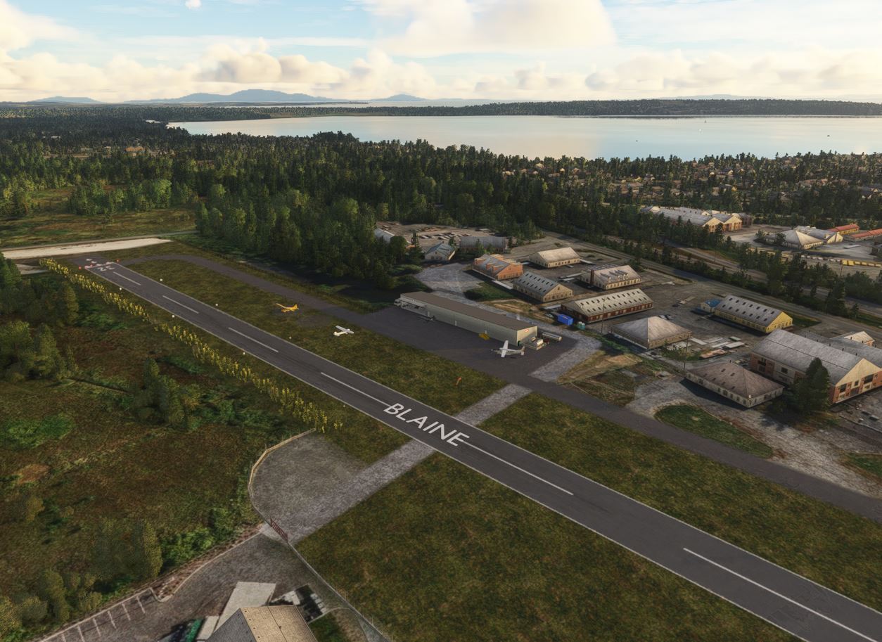
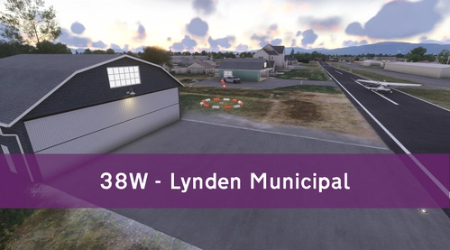
Blaine Municipal Airport (4W6)
Discover the revived Blaine Municipal Airport (4W6) in northwest Washington, a historic airfield with a controversial past. Fly into this small 42-acre facility near the U.S.-Canadian border, now equipped with a $16.8 million runway upgrade and more hangars. Explore the charming town of Blaine and enjoy your general aviation adventures in this scenic area. Make sure to have the required libraries installed for the full experience.
User Reviews
5 reviews
Location
More Information
Version History
I made several changes thanks to some excellent observations by foxquakes. Thanks to FreakyD for "loaning" me his Spruce Goose Cafe from his Jefferson County airport. I have now replaced it with a permanent one. I hope you enjoy this latest updated version. Much to explore!
Featured in Collections(1)
Related
Nikolai Airport (PAFS)
Nikolai: Population 125 -- This is the first of many Native villages along the Iditarod Trail. In 1963, the local residents cleared their own airstrip. This made year-round access to the outside world possible. This is Iditarod checkpoint #7. To learn more about the Iditarod, it's airports, and the race itself, go to the Iditarod.com website.
by 55tom55
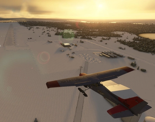
Galbraith Lake Airport (PAGB)
This airport, just off the Dalton Highway, was a major supply link during the construction of the Alaska pipeline during the 70's. The Dalton Highway, also called the Haul Road, is one of the northern-most roads in the world. It also has a camp site for motor homes and trailers for the weary Dalton highway travelers.
by 55tom55
Koyuk Alfred Adams Airport (PAKK)
Koyuk is a small village of 350 residents. The village is located on the northern bank of the Koyuk River where it drains into Norton Bay, about 130 miles from Nome. Koyuk Alfred Adams Airport is one of 24 airstrips and airports on the Iditarod Trail that runs from Anchorage to Nome.
by 55tom55
Skwentna Airport (PASW)
Skwentna has a population of about 30 people and lies on the south bank of the Skwentna River at its junction with Eight Mile Creek. This small village is located west of the Mat-Su Valley and is a 70-mile flight from Anchorage. The first permanent settlers did not show up until after the Alaska Road Commission cut the Iditarod National Historic Trail in 1908. Roadhouses were later constructed along the trail, including the Old Skwentna Roadhouse, to service the prospectors, trappers, and Alaska Natives who used sled dogs to transport goods over the trail.
by 55tom55
almost 2 years ago