Description
Welcome to the GSS' British Columbia Coast Mountains & Glaciers project
The releases consists these aerodomes:
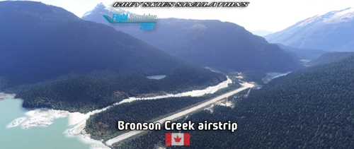
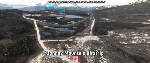
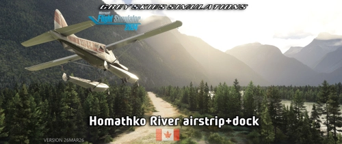
this Scar Creek airstrip Homathko River airstrip & float plane base (XGS15)
FEATURES
- Missing airfield/airstrip added into Microsoft Flight Simulator 2020 and 2024
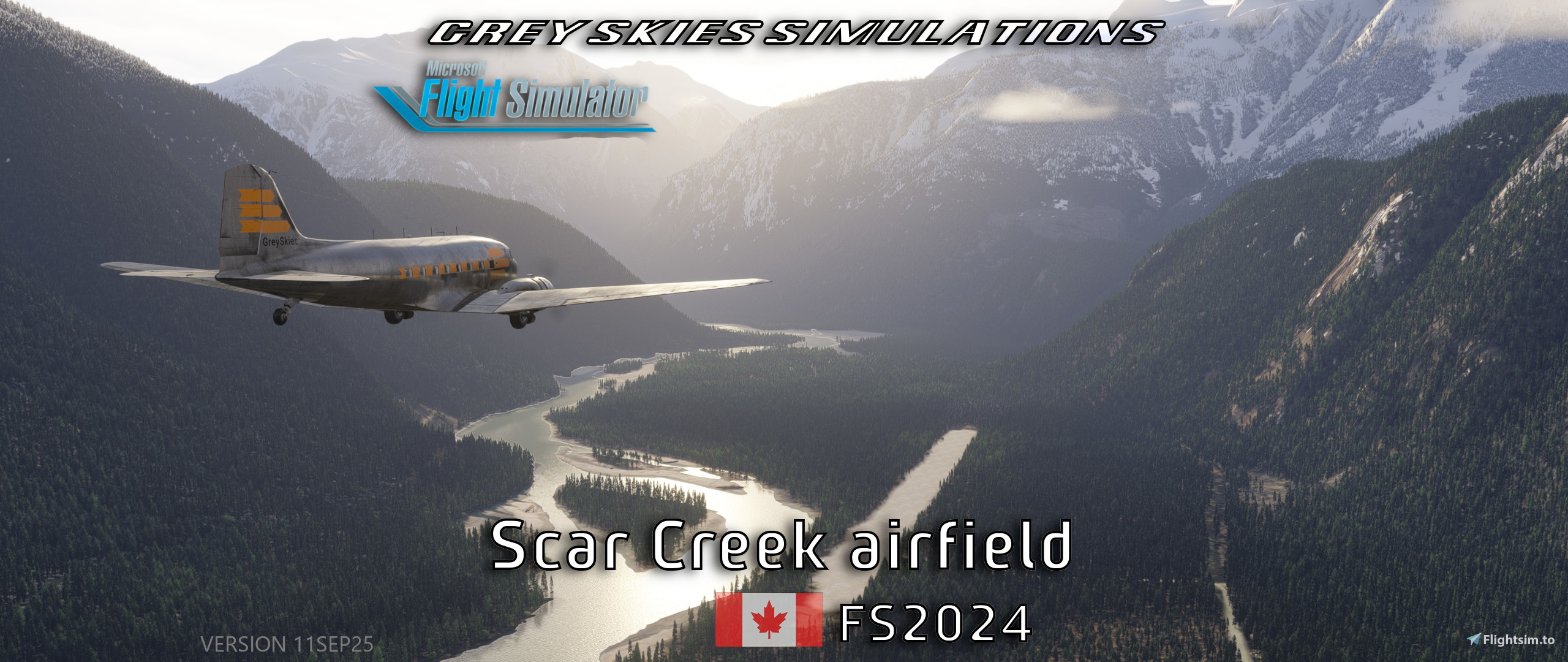
- Gravel runway, 3000 x 110 feet.
- STOL challenge with a 46° slope. It’s towards to Pointer Peak nearby a logging road.
- Mystery strip for those who dare (see readme).
- Plummer Hut at Claw Peak (helicopter access), see notes
FS24: location is perpetually snow covered
- Location is 51.373746 -125.164374 or start from helipads
- Heli operating area is tighter and marked with sticks. It is a helipad-style by default, ready to go. Upon using Heli parking 5, it is advisable to slew onto the marked operating area.
- -
- FS20: summer scenery is available
- Helicopter starting locations.
- Custom aerial, objects and effects.
- Water starting on Homathko River.
- At least one undisclosed landing challenge within viewing distance of the field.
- Wildlife. Moose are known to traverse near the airfield area.
- Extensive terraforming/watermasking utilized and guesstimated objects placed.
- Landmark Point of Interests.
- Orbx PNW flashbacks.
- Located in the heart of British Columbia’s glacier territory, Homathko Glacier is to the East. Nearest water feature is the abeam Homathko River.
- Readme.
NOTES
- FS2024 release starting from release 27MAR26 is designed to be used with Bijan’s Seasons Enhanced 2024 (payware) and default Bing aerials.
Warning: If you don’t have BSE installed, you won’t have particularly pleasant times. However:
- A crude version with cleared approach sectors is available with the said update, to be used with non-Bijan trees.
download section says "FS24: Alternate & crude Non-Bijan version v11SEP25" Managing files is quite messy on this site.
- Version 11SEP25 remains available until further notice.
- Nature & human action seem to take their toll on this area. Updated aerial image as the Homathko River has made its way onto the strip. Also, buildings from the village have vanished in latest images. I remember this as the 1st bush field I got into, so I try to preserve the area. Updated ZL19 aerial image in September 2025.
- FS24 introduced a bug in SU4 which causes spawns to be offset to defined parking location. This may be fixed in SU5.
- I haven’t added a water runway as is messes with nearby terrain work.
- Color matching custom FS20 and FS24 was particularly difficult and not perfect in SEP25.
- Tested otherwise with default aerial imagery.
- Tested with 75% scale REX Accuseason trees. Preferably Bijan and by last resort, default trees in FS24.
- Added a real building at Claw Peak. FS24 version has a custom hut and better area in general. In FS20, this piece of scenery is a placeholder (not worked too much on). The building model is from 3rd party library. Aerial imagery has improved on this area since initial release and, now this feature is feasible.
- Petrolia/Butler Airfield Airport has currently the old CBA7 identifier in real life. CBA7 is still assigned to Scar Creek in MSFS by default.
- POI spellings as seen in Google Earth.
- Public information is scarce and supplied details may lead to updates. For example, an old Canada Flight Supplement could be handy (for other CAN strips as well).
- In case of discrepancies regarding this document, other sources are primary (file description etc).
INSTALLATION INSTRUCTIONS
- check download location for latest recommended prequisites and instructions
- (always remove old scenery package from the Community-folder, if installed previously)
- move greyskies-airport-cba7-scar-creek-airport into the Community-folderof your chosen simulator version
Note: Only 1 folder.
- MSFS Addons Linker / ModManFX are recommended in general for managing your mods
RECOMMENDED LIBRARIES FOR DESIGNED FIDELITY
(as published on 18MAY23 & after update 27MAR26)
- FS2024: Standard MSFS content from Microsoft&Asobo. Necessary libraries ought to be automagically downloaded by FS24.
- FS2020:All World Updates up to WU12 New Zealand.
- as listed in Dependencies section on the bottom of the page
- Bijan Seasons Enhanced (payware).
BACKGROUND INFORMATION
Scar Creek Airport (TC LID: CBA7) was a small general aviation airport located near Scar Creek, British Columbia BC, Canada. Royal BC Air Force operated a weekly public route service between Comox and Prince George that stopped here in both directions. The airport was listed as abandoned in the 15 March 2007 Canada Flight Supplement.
Scar Creek is an unincorporated Post Office settlement in central British Columbia, within the Tsilhqot′in Nation Indigenous Administrative District. A dirt road connects the settlement to Tatlayoko Lake, but this is only passable in the summer months. source1 source 2
LICENSE
All rights reserved, you may not (for example) in any way modify, convert or redistribute the files without my permission.
MY OTHER UPLOADS
https://flightsim.to/profile/GreySkies/uploads
LIVE-STREAMING
I do stream sometimes.
latest revision: 27MAR26
Dependencies
Comments(7)
Log in to join the discussion
Log Inabout 2 months ago
Can you reproduce the crash by spawning at the airport directly? Any stutters or weirdness before the CTD?
about 2 months ago
Your question: No, when spawning direct at the airport it worked.
BTW, my environment might have changed meanwhile as SWS had updated the Kodiak before leveling it up to be fully compatible to MSFS2024. I can't really recall which version was in use.
10 months ago
Results will matter in development time, quantity and quality.
10 months ago
10 months ago
Results will matter in development time, quantity and quality.
about 3 years ago
The scenery is well done now. Thanks for doing the corrections at Scar Creek.
Oh, I saw the moose crossing the runway.
Scar Creek Airfield, British Columbia BC, Canada (CBA7) + Plummer Hut
Discover a hidden gem in Microsoft Flight Simulator 2020/2024—an off-grid airstrip set deep in British Columbia's glacier territory. Featuring a 3,000 ft sand runway, a 46° STOL slope, helicopter and water start points, a mystery strip, and even moose sightings, this location offers rugged adventure. Explore handcrafted terrain near Homathko Glacier, with bush-flying challenges and stunning scenery for pilots who dare to land where few have.

User Reviews
1 reviews
Location
More Information
Version History
- This update is only for FS2024. - Major change: vegetation changed to Bijan Seasons Enhanced payware product. A crude version with cleared approach sectors is available with the this update, to be used with non-Bijan trees. Version 11SEP25 remains available until further notice. - Plummer Hut modeled near Claw Peak and terrain worked on. Heli operating area is tighter and marked with sticks. It is a helipad-style by default, ready to go. Upon using Heli parking 5, it is advisable to slew onto the marked operating area. - Custom campfire at the airfield. Note that the fire effect its colour is tuned for sunset/sunrise ToD. - Added heli parking at main field. - Parking spots renumbered (readme). - Runway material changed to more natural. - Tuned tree locations. - Fixed mismatching utility truck flashers. - Straightened bridge near the camp. - Aerial image recolored. - Autogen building & streetlight exclusion zone enlargened. - Refueling area boundaries are shown with white cones as on my other sceneries (GSS' Common library required).
Featured in Collections(1)

Related
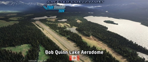
Bob Quinn Lake Aerodome (CBW4), British Columbia BC, Canada
Bob Quinn Lake Aerodome (CBW4) is a detailed scenery add-on for Microsoft Flight Simulator, located in British Columbia, Canada, within the Kitimat-Stikine district. It features a gravel runway measuring 4,251 feet, including challenges such as ditches and mounds. The package coordinates with additional airstrips in the Galore Creek area and includes custom aerial images, flight plans, and helicopter starting locations. Designed primarily for use in FS20 and updated for MSFS 2024, it adds realism to aviation operations in the region.
by Grey Skies Simulations
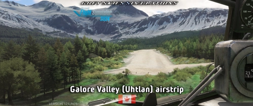
Galore Valley (Uhtlan) Airstrip, Galore Creek, British Columbia BC, Canada
The Galore Valley (Uhtlan) Airstrip add-on introduces a handcrafted, challenging airstrip located in Galore Creek, British Columbia. Featuring a sloped gravel runway and limited go-around options, this add-on includes three helicopter starting locations and custom aerial imagery. The airstrip serves as an aviation support hub for local mining operations and is designed to complement the nearby Bob Quinn Lake aerodome (CBW4).
by Grey Skies Simulations
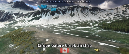
Cirque Airstrip, Galore Creek, British Columbia BC, Canada
Discover the Cirque Airstrip located in Galore Creek, British Columbia, part of the GSS Tongass Fjords project. This handcrafted airstrip features a challenging sloped runway and is surrounded by rugged terrain, making it ideal for adventurous exploration. The package includes custom aerial imagery and models, and is designed for use with the nearby Bob Quinn Lake aerodome. Elevation at the airstrip is 2,962 feet, with a gravel runway measuring 1,732 x 121 feet.
by Grey Skies Simulations
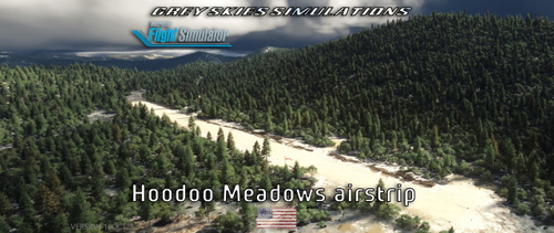
4D2 - Hoodoo Meadows airstrip, Idaho, USA
Hoodoo Meadows airstrip (4D2) is located in Idaho and is noted as the states highest official backcountry airport with an elevation of 8,262 feet. The airstrip features a sloped, uneven gravel and dirt runway measuring 1,900 x 50 feet, and includes distinct markings and natural obstacles. Additional facilities include helicopter starting locations and a water launch site at Yellowjacket Lake, alongside custom models and landmark points of interest in a scenic mountainous area.
by Grey Skies Simulations
2 months ago
I like your scenery, but my sim had a CTD after landing and while turning around after taxiing for no recognizable reasons (it wasn't the crossing wildlife).
EDIT: Forgot to write: MSFS2024 is in use.