Description
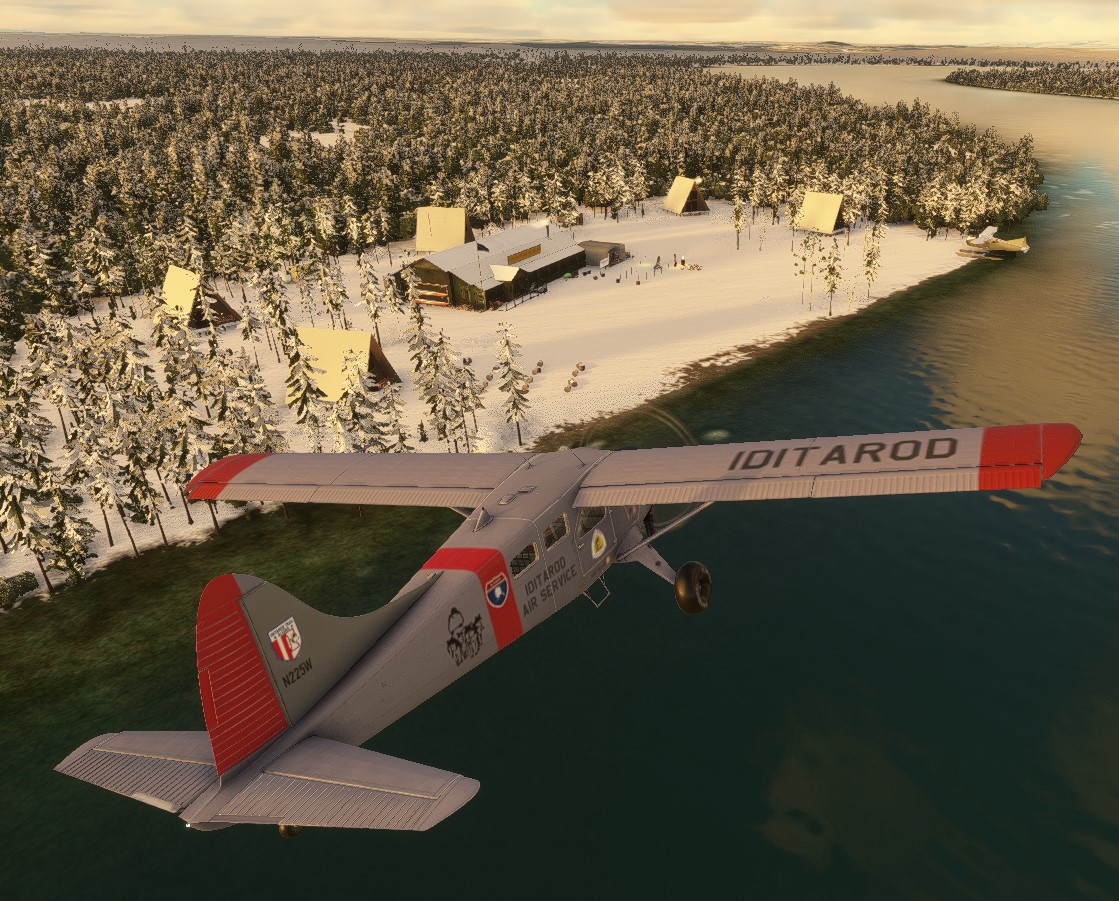
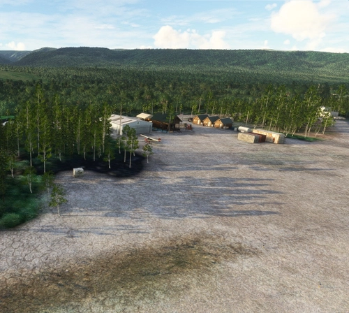
Iditarod Checkpoint #2
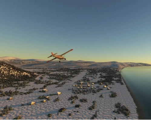
Yentna Bend Strip is one of 24 airstrips and airports on the Iditarod Trail that runs from Anchorage to Nome. The Iditarod Airforce is a group of pilots who volunteer their time and planes to service the 24 race checkpoints.
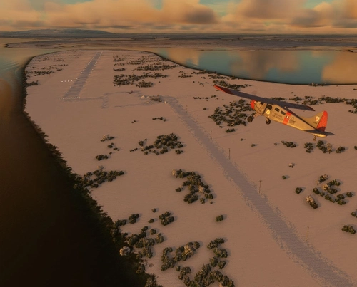
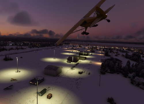
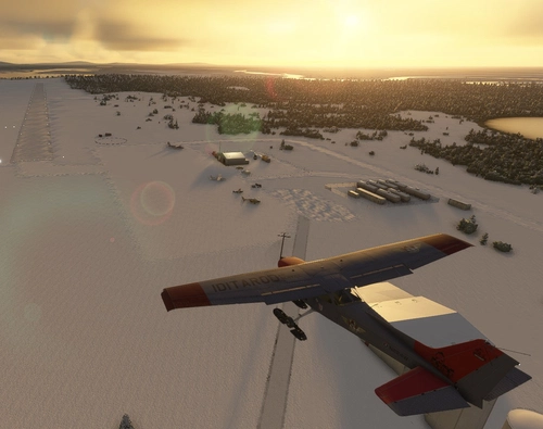
Yentna Bend Strip is not included in MSFS 2020. I have created it from aerial photos and images I found on the internet and from the data on the AirNav and SkyVector web sites. It is a simple 1000-foot (300 M) dirt/turf strip. The Yentna Bend Roadhouse, which is the checkpoint and rest stop for the sled dog racers, is located across the river, about 1000 meters NE of the strip.
The actual ICAO, FAA, and IATA airport code for Yentna Bend strip is 0AK2. However, MSFS 2020 has that code given to Cape Simpson Airport. There are some sources on the internet that have it also. So I have given Yentna Bend Strip "0AK4" in order to add it to the sim. If someone has a better solution, please let me know. (BTW: Cape Simpson airport is closed).
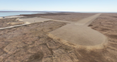
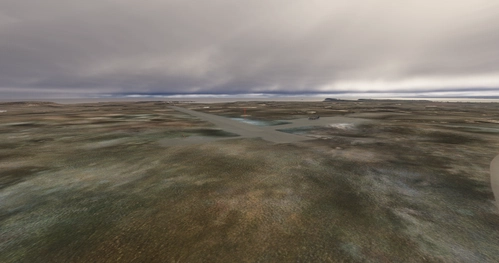
Dimensions: 1000 x 75 feet (300 x 25 meters)
Surface: Dirt/Turf
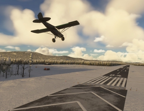
Runway: 03 / 21
To learn more about the Iditarod, its airports, and the race itself, go to the Iditarod.com website. I’ve included a link to a short video, Wings of the Iditarod that features the Iditarod Airforce.
To replicate Iditarod conditions, I recommend setting your sim Weather parameters to:
Month = March. Snow Depth = 29”. Temperature = 0 degrees.
Installation:
Copy the airport folder inside of the Zip file into your MSFS Community folder.
Many thanks to the creators of the Required and Recommended libraries. If you have not previously installed these libraries in your Community folder, some objects may not be visible in your sim. Remember, you only have to install these one time. Also, go to the sim marketplace and download the free UK2000 Scenery Common Library. All Microsoft World Updates should be installed also.
Easter Egg is hidden at the village.
Note: "Parking Dock 99" is the seaplane parking at the village, half a mile NE of the airstrip.
Dependencies
Comments(13)
Log in to join the discussion
Log Inover 1 year ago
over 1 year ago
Question: is there a listing (in addition to the picture map) of all these airfields, to make then easier to download, or perhaps merge also to one large package?
How about flight plan file trough all these, would also be convenient.
I manage well w/o, and interesting to research area and maps one by one.

over 1 year ago
almost 3 years ago
almost 3 years ago
thank you for your work.
Why do I have a concrete grid track?
almost 3 years ago
over 4 years ago
I am getting a checkerboard pattern on the runway, like lighter and darker textures of snow in repeating squares. I have the listed dependencies and your other airports seem to work fine. Any idea what I'm doing wrong?
Thanks for your airports. They're great.
almost 5 years ago
What a project wish you the Best :) Fly the area quite a bit, was on my Bucket List to be at race at some point
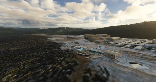
Yentna Bend Strip (0AK4)
Yentna Bend Strip was not originally included in MSFS 2020. I have created it from aerial photos and images I found on the internet and from the data on the AirNav and SkyVector web sites. It is a simple 1000 foot dirt/turf strip. The only real feature is the Yentna Bend Roadhouse which is the checkpoint and reststop for the sled dog racers.

User Reviews
2 reviews
Location
More Information
Version History
Version 2 is a major update that separates the airstrip and the actual Iditarod checkpoint. All scenery has been replaced and signage added. Enjoy this more accurate rendition.
Featured in Collections(2)
Related
McGrath Airport (PAMC)
McGrath: Population 400 -- McGrath is located in the interior of Alaska. The only way to get here is by airplane, unless you’re crazy enough to drive a snow-machine or mush your dog team on the Historic Iditarod Trail. The airport covers an area of 641 acres at an elevation of 341 feet. It has two runways: 16/34 is 6,000 by 100 feet with an asphalt surface and 5/23 is 2,000 by 60 feet with a gravel surface. It handles an average of 30 flights per day, 80% commercial, and 20% general aviation.
by 55tom55
Nikolai Airport (PAFS)
Nikolai: Population 125 -- This is the first of many Native villages along the Iditarod Trail. In 1963, the local residents cleared their own airstrip. This made year-round access to the outside world possible. This is Iditarod checkpoint #7. To learn more about the Iditarod, it's airports, and the race itself, go to the Iditarod.com website.
by 55tom55
PAOM Nome AK Version 3 20
Another complete rebuild of my PAOM scenery
by Mountainair
Skwentna Airport (PASW)
Skwentna has a population of about 30 people and lies on the south bank of the Skwentna River at its junction with Eight Mile Creek. This small village is located west of the Mat-Su Valley and is a 70-mile flight from Anchorage. The first permanent settlers did not show up until after the Alaska Road Commission cut the Iditarod National Historic Trail in 1908. Roadhouses were later constructed along the trail, including the Old Skwentna Roadhouse, to service the prospectors, trappers, and Alaska Natives who used sled dogs to transport goods over the trail.
by 55tom55
over 1 year ago
It's actually there in Flightsim.to. Yentna Bend is documented there as a USA airport.