Description
Experience British Columbia!
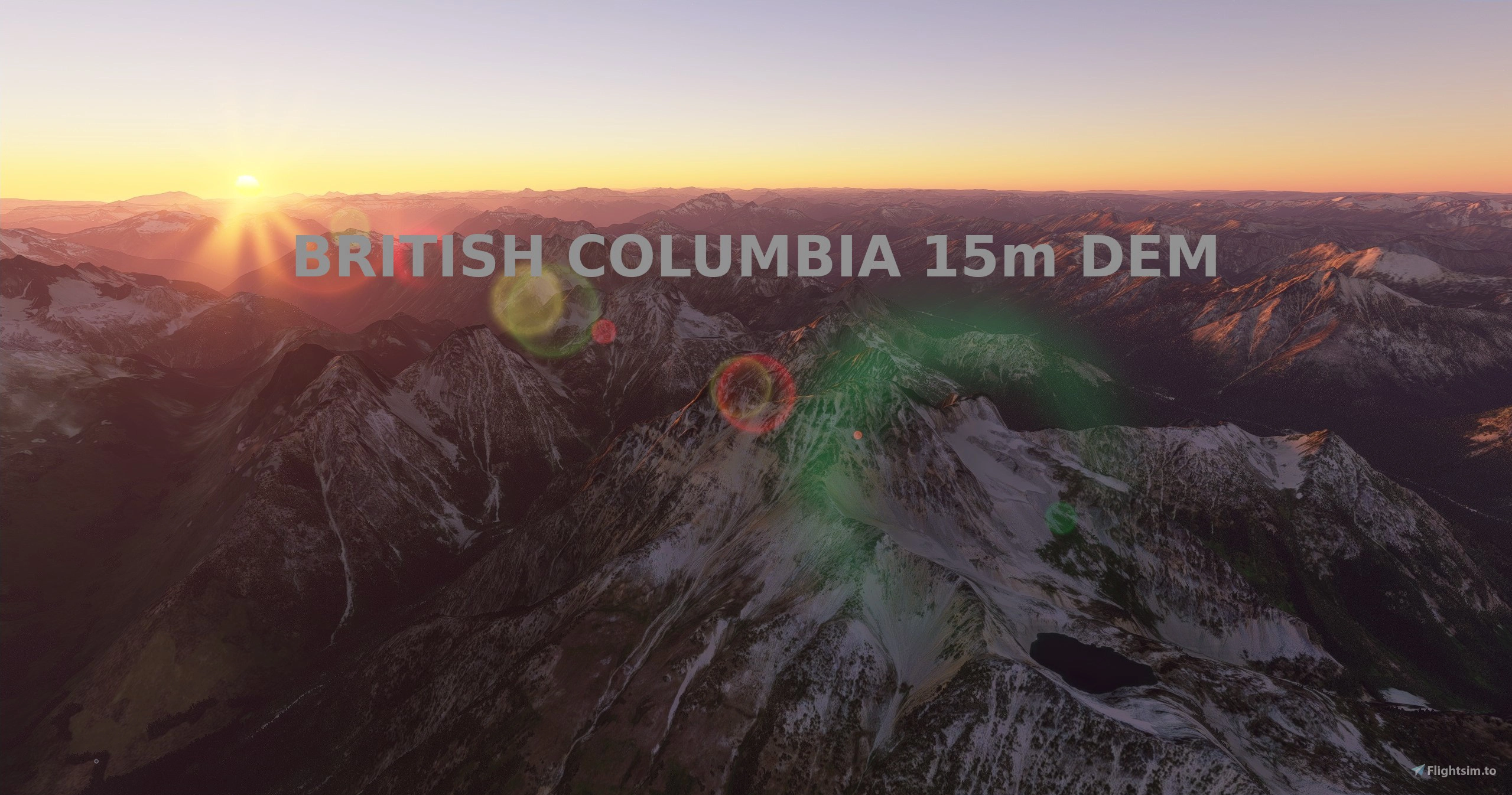
This mod contains customized height profiles for the entirety of British Columbia, Canada. The mod contains high definition LIDAR DEM data with a mesh resolution of 15m. The height resolution is as good as 0.1m.
The mod does not only provide mountain shapes being very close to reality, but also flattens lakes & rivers and gets rid of any terrain artifacts. It also includes over 150 airports excluded from height modification.
INSTALLATION
PLEASE NOTE: This mod has 2 files. Download both files to get complete coverage.
Just unzip the downloaded files and place the unzipped files into your community folder.
IMPORTANT: There is a first part to this mod, available here. After downloading both mods, you should have 4 files!
There is a separate mod for Vancouver Island, available here.
IMPORTANT
Disclaimer: The creator of this mod is not responsible for any problems, damage, incompatibilites to other mods or performance issues that might occur.
Please note, that this mod is a high resolution mesh covering British Columbia. The elevation data is applied through terraforming rectangles, thus loaded at a certain distance from the player. When travelling fast or at high altitude (wide range of view) there might be too many new rectangles loaded simultaneously and thus stutters might occur. To my knowledge, this is the largest area available using the heightmap method for elevation. Therefore, it could be very buggy or cause bad performance. In my testing, I saw a minor performance impact, but your results may vary. A common issue is stutters when new rectangles are loaded, so that may be more common with this mod, since there are so many rectangles.
If you have any stutters you can try and reduce your ingame render settings or uninstall!
If you are mainly flying airliners in high altitude, there is probably no benefit for you in using this mod.
Scenery Issues
Please report any bugs with sceneries or airports and I will see what I can do!
Credits
The elevation data used was a LIDAR 15m height profile of British Columbia from the government of Canada (https://maps.canada.ca/czs/index-en.html). Contains information licensed under the Open Government Licence – Canada.
It was then transfered into MSFS using MSFS Toolkit by Nool Aerosystems (https://msfs.nool.ee/)
Thank you both and for anyone reading this: Please go ahead and support them!
Thank you Troglodytus for your help!
Enjoy your VFR flights above British Columbia!
Comments(13)
Log in to join the discussion
Log Inover 3 years ago
In SU10 this mesh fixes the horribly warped coastlines of lakes (cliffs where there shouldn't be cliffs for instance), but then the water in the sim defies the laws of physics and slopes up the shores. Seems like some bug in the sim that needs to be fixed at this point.
over 4 years ago
There are some performance issues with each of these meshes and SU7. They work, and I haven't CTD'd, but since installing whenever I am flying over the region I get regular chop and audio cuts. It stops after removing the mesh which I've done as I fly a lot in the area and I was getting a little bit frustrating. Note - this isn't a bash on this product, it's a job very well done. It just has some issues with SU7. Still much respect for the work though. Cheers
over 4 years ago
I am having the same issues running SU8, the visuals and audio keep cutting in and out. Remove the mod from the community packages folder, and all runs as it should..........
almost 5 years ago
Hi, does this mod affects my fps performance?
almost 5 years ago
It's possible. I didn't notice any performance decrease in my testing. There may be some stutters when large areas of heightmaps are loaded, though.
almost 5 years ago
oh oh, sorry one more glitch, night lights in the Vancouver area now are ghosted and float about 1000' in there air. Other than that its perfect!
about 5 years ago
excellent! Thank you very much for your work. Trying it now.
about 5 years ago
Hope you enjoy it!
about 5 years ago
Excellent. Totally can tell the difference. Only problem is, Vancouver City disappears when this is installed. Remove it and the buildings all come back. Let me know if there is an update. Thanks for your work!
about 5 years ago
Part 1 of the mod just received an update the reduces the size of the exclusion zone around Vancouver. Photogrammetry shouldn't be missing anymore.
British Columbia, 15m DEM - High Resolution Terrain Elevation Data from LIDAR Imaging Part 2
Enhance your flying experience over British Columbia with this mod featuring high-resolution LIDAR DEM data for accurate terrain elevation. Includes realistic mountain shapes, flattened lakes & rivers, and over 150 airports. Note: Download both files for full coverage. Explore the beauty of British Columbia with improved terrain details while flying in Microsoft Flight Simulator.

User Reviews
2 reviews
Location
More Information
Version History
No version history available.
Related

Swiss mountains tree fix (trees on mountains removed)
A comprehensive mod fixing tree placement on Swiss mountains, particularly removing inaccurately placed trees on mountain peaks. The update includes a shift to more realistic conifer trees in the Alps and an expansion to border areas of France, Italy, and Austria. From Alpstein Säntis to Stockhorn, numerous locations across Switzerland have been meticulously corrected for a more authentic flight experience.
by THEOLI4D

Shorter Trees / Tree Height Modification VERSION 4.0 for MFS2020 (shorter, realistic trees)
Experience realistic and shorter trees in Microsoft Flight Simulator with the Shorter Trees / Tree Height Modification VERSION 4.0 add-on. Compatible with the latest version of MSFS, this mod provides adjusted tree heights for a more authentic flying experience. Update includes enhanced tree coloration blending seamlessly with photogrammetry trees. Installation is simple - just copy the folder into your community folder and enjoy a new perspective from the skies.
by ARIF STUDIOS - Adnan Arif

AUSTRIA 10m DEM - High Resolution Terrain Elevation Data from LIDAR Imaging
Explore the stunning terrain of Austria with this mod featuring high-resolution LIDAR data, offering a mesh resolution of 10m for a more realistic flight experience. Flatten lakes, rivers, and eliminate any terrain artifacts as you soar over the Austrian landscape. Divided into regions for convenience and performance optimization, this mod enhances the mountain shapes to mirror reality and provides a smoother flying experience. Experience Austria like never before with enhanced elevation data and realistic terrains.
by Troglodytus

SWITZERLAND 20m DEM - High Resolution Terrain Elevation Data from LIDAR Imaging
Explore the beauty of Switzerland with this mod offering high resolution terrain elevation data using LIDAR imaging. The mesh resolution is 20m, providing exceptional detail with a height resolution of 0.1m. Update includes extreme LIDAR meshes for specific regions. Please note potential performance impacts and report any bugs for further improvements. Fly VFR over Switzerland with enhanced realism and accuracy.
by Troglodytus
over 1 year ago