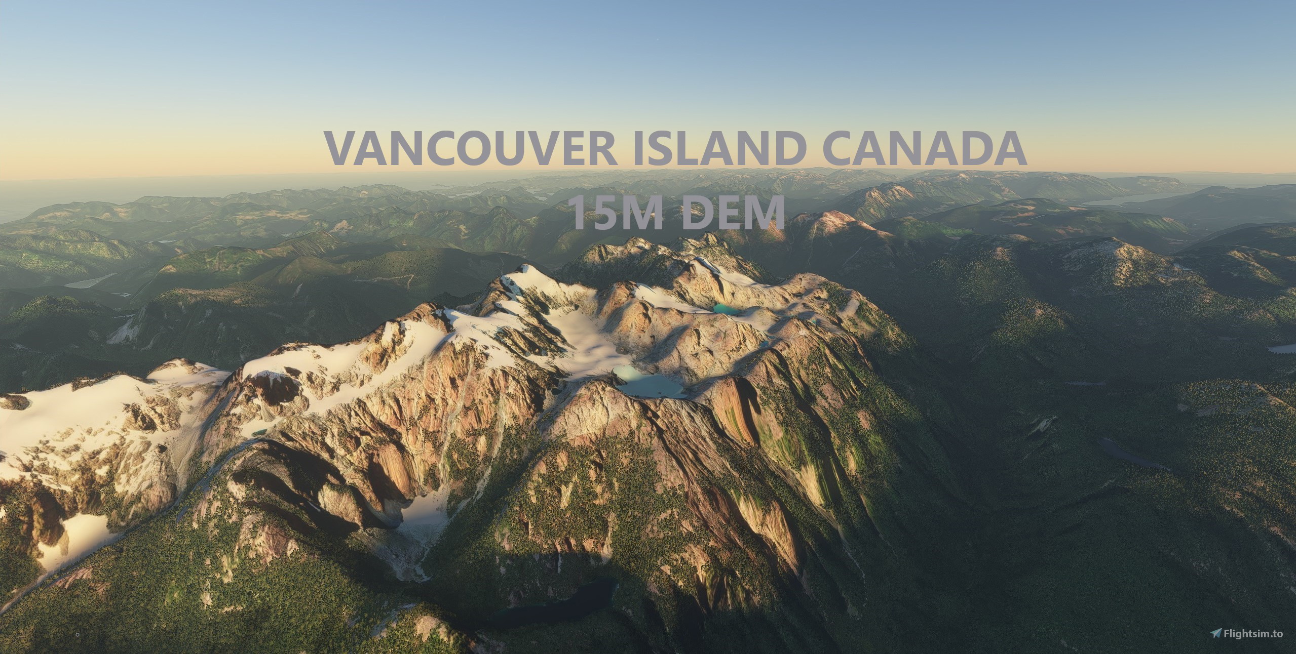
Description
Experience Vancouver Island!
This mod contains customized height profiles for Vancouver Island, an island in British Columbia, Canada. The mod contains high definition LIDAR DEM data with a mesh resolution of 15m. The height resolution is as good as 0.1m.
The mod does not only provide mountain shapes being very close to reality, but also flattens lakes & rivers and gets rid of any terrain artifacts. It also already includes most airports excluded from height modification.
INSTALLATION
PLEASE NOTE: This mod has 3 download options. The default option is just the northern portion of the island. Option 2 is just the southern portion of the island. Option 3 is both the northern and southern portions of the island. I split it up this way because in World Update 2, Microsoft enhanced some of the elevation maps for the southern portion of the island. So the default mesh may be higher resolution than the mod, or cause weird issues. In my testing, I didn't find any issues and the mod resolution did seem to improve the scenery.
Whichever option you choose, choose only 1. If you decide to switch, just delete the mod from the community folder and add the new option.
Just unzip the downloaded file and place the unzipped file into your community file.
IMPORTANT
Disclaimer: The creator of this mod is not responsible for any problems, damage, incompatibilites to other mods or performance issues that might occur.
Please note, that this mod is a high resolution mesh covering Vancouver Island. The elevation data is applied through terraforming rectangles, thus loaded at a certain distance from the player. When travelling fast or at high altitude (wide range of view) there might be too many new rectangles loaded simultaneously and thus stutters might occur.
If you have any stutters you can try and reduce your ingame render settings or uninstall!
If you are mainly flying airliners in high altitude, there is probably no benefit for you in using this mod.
Affected Sceneries
Please report any bugs with sceneries or airports and I will see what I can do!
Credits
The elevation data used was a LIDAR 15m height profile of Vancouver Island from the government of Canada (https://maps.canada.ca/czs/index-en.html). Contains information licensed under the Open Government Licence – Canada.
It was then transfered into MSFS using MSFS Toolkit by Nool Aerosystems (https://msfs.nool.ee/)
Thank you both and for anyone reading this: Please go ahead and support them!
Thank you Troglodytus for your help!
Enjoy your VFR flights above Vancouver Island!
Comments(68)
Log in to join the discussion
Log Inover 2 years ago
over 3 years ago
Happy to report that 😊 SU10 has removed the stutters I was getting..
over 4 years ago
There are some performance issues with each of these meshes and SU7. They work, and I haven't CTD'd, but since installing whenever I am flying over the region I get regular chop and audio cuts. It stops after removing the mesh which I've done as I fly a lot in the area and I was getting a little bit frustrating. Note - this isn't a bash on this product, it's a job very well done. It just has some issues with SU7. Still much respect for the work though. Cheers
over 4 years ago
There appear to be stutter issues with various mesh addons, since the latest SU or WU.. Hopefully, someone can troubleshoot what is causing this. It is just annoying enough to make this excellent mesh questionable. I really do not want to turn it off, since the coastline where I live is borked without it..
over 4 years ago
This seems to be the case with a lot of meshes (DEMs), i.e. DEM Slovenia.
about 4 years ago
Unfortunately, this has not been fixed in SU9 either... this really is disappointing... First MS screws up Vancouver Island coastlines in WU2, and then this mesh which fixes it, stops working after SU7.. I have reported this to MS Zendesk several times..
almost 4 years ago
Unfortunately, this still has not been fixed as of WU 10.
Supposedly, WU 10 brings new and improved elevation data, but Southern Vancouver Island is still borked, and the mesh addon still causes annoying pauses.
Not sure what is worse.. screwed up coast lines where I live, or stutters and pauses when the mesh is active..
over 3 years ago
SU10 may just have fixed it..
over 4 years ago
I love this mesh since I live on Vancouver Island, however I have just got the lovely Qualicum Beach CAT4 airport and notice that the airport is very bumpy..
https://flightsim.to/file/13930/cat4-qualicum-beach-airport
Is there any way, you can go back and flatten the area?
Edit: RTMM fix just arrived.. no need for action.
https://flightsim.to/file/22292/cat4-qualicum-beach-airport-flatten-for-use-with-vancouver-mesh
over 4 years ago
Beautiful scenery but...could just be me but after WU6, the sim gets stuck at the loading screen. The bar goes to full, then stops. Happens to most of the DEM
almost 5 years ago
Can't say it works properly in newest update for me flying east out of Port Alberni - on east coast side of VI south of Comox - there is several water height issues where there are a series of grid like elevation changes in water. - Hope you can get it back ro where it should be - though global update is promising multiple elevation fixes and meshes.
about 5 years ago
Amazing!
Does anyone know how to fix the water height issue in the Gorge area of Victoria?
about 5 years ago
I think the exclude is too large and thats why we are seeing it.
about 5 years ago
I'll need to update the exclusion zones to fix that. I'm not sure how far the photogrammetry extends from Victoria so I made the exclusion zone pretty large.
about 5 years ago
It exists with or without your Fantastic work. I'm just hoping someone might have a line on a fix.
about 5 years ago
Hi Victoria Photogrammetry is now working fine for me, however, I am unsure if it is too large an exclude as Portage Inlet is now like the default scenery and has cliffs around it - anyone else noticed it? (Icebergs are back for me but that is a clash with another add on I need to invest) just hoping someone else may of noticed the Icebergs and found a fix. Thanks again great work. The BC DEM is FAB! to go with it.
about 5 years ago
Portage Inlet is inside the exclusion zone. I couldn't find a map of which areas of Victoria included photogrammetry so I included a pretty large area. I'm working on some other updates for the scenery now so I can exclude Portage Inlet from the exclusion zone 😃
Vancouver Island, Canada, 15m DEM - High Resolution Terrain Elevation Data from LIDAR Imaging
Explore Vancouver Island in detail with this mod featuring high resolution LIDAR DEM data at a 15m mesh resolution. Experience accurate mountain shapes, flattened lakes, and rivers, with terrain artifacts removed. Choose between different download options for the northern, southern, or entire island for an improved scenery experience. Enhance your VFR flights above Vancouver Island with this detailed and realistic terrain elevation data.

User Reviews
8 reviews
Location
More Information
Version History
Excluded city of Victoria after reports of missing photogrammetry (only south and full files updated)
Related
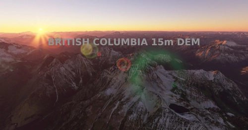
British Columbia, 15m DEM - High Resolution Terrain Elevation Data from LIDAR Imaging Part 1
Explore British Columbia like never before with this mod featuring high-resolution LIDAR DEM data offering detailed mountain shapes, lakes, and rivers. Enhance your simulator experience with 15m mesh resolution and over 150 airports unaffected by height modifications. Take your virtual flights to new heights with this comprehensive terrain elevation data for MSFS.
by PlaneGuy04
British Columbia, 15m DEM - High Resolution Terrain Elevation Data from LIDAR Imaging Part 2
Enhance your flying experience over British Columbia with this mod featuring high-resolution LIDAR DEM data for accurate terrain elevation. Includes realistic mountain shapes, flattened lakes & rivers, and over 150 airports. Note: Download both files for full coverage. Explore the beauty of British Columbia with improved terrain details while flying in Microsoft Flight Simulator.
by PlaneGuy04
about 1 year ago