Description
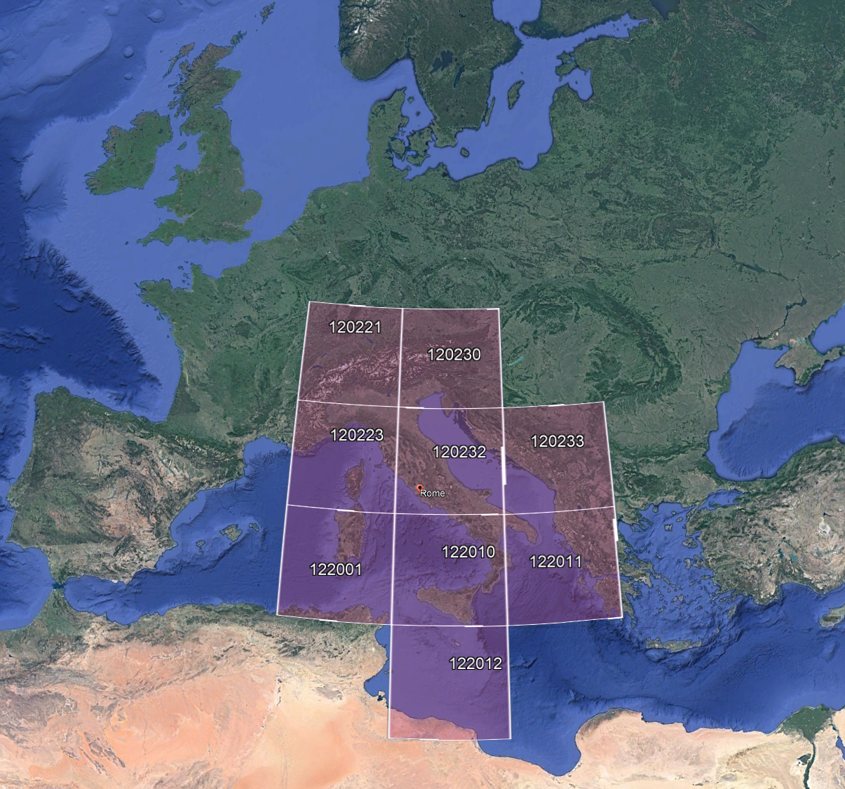
Alternative DEM for Italy - 20 Meter resolution
With this higher terrain resolution (now very poor default), you get superior relief quality, like mountines, hills and sea coast.
Install by extracting to Community folder as usual
Documentation and basic implementation to create native DEMs will be made available at github.com/muumimorko/MSFS2020_CGLTools
Please post technical question and comments at FSDeveloper.com forum: MSFS - Everything about CGL generation
Release notes:
v1.0 first public release
v1.1 removed thin wall where end DEM10 data and start DEM25 data
Known issues:
- Edges of covered areas don't blend to the original in-game/bing DEM
- Peak elevations might have small "spikes"
- Sub-optimal file size
Credits:
DEM10 by TINITALY (CC BY 4.0 license) https://doi.org/10.13127/TINITALY/1.0
Tarquini S., Isola I., Favalli M., Battistini A. (2007) TINITALY, a digital elevation model of Italy with a 10 m-cell size (Version 1.0) [Data set]. Istituto Nazionale di Geofisica e Vulcanologia (INGV)
DEM25 by EU-DEM v1.1 - Copernicus data and information policy Regulation (EU)
Creator: Chris
This work is licensed under CC BY-NC-SA 4.0.
To view a copy of this license, visit creativecommons.org/licenses/by-nc-sa/4.0
This license requires that reusers give credit to the creator.It allows reusers to distribute, remix, adapt, and build upon the material in any medium or format, for noncommercial purposes only.
If others modify or adapt the material, they must license the modified material under identical terms.
Comments(67)
Log in to join the discussion
Log Inover 3 years ago
Hi, your Canary Islands mesh and Italian Alps mesh are still working. Is there a possibility that you expand the Alps? Austria, Switzerland, France. I think many people would be very grateful to you. Best regards
over 3 years ago
is this working on update 11?
over 3 years ago
sadly not
about 4 years ago
hope for an update for SU9 and WU10.. i miss this "mod"
about 4 years ago
Great add-on, fps-friendly (mid-end system GPU RTX 2060 super), the landscape looks fantastic! As you approach the mountains the details starts to pop-in, but it's OK to me.
Unfortunately it is not working properly after SU9 (missing features/mountains, holes, step bumps and so on). tested at LICP / Palermo (Italy).
Any chance for an update?
about 4 years ago
Will there be an update? :D
about 4 years ago
go to somolaco icao LINO do not work well need corrections
about 4 years ago
Does it work and does it make sense to use it with MSFS Google Map Replacement?
over 4 years ago
Very cool, i came here from project coastline. perhaps my Sim but with ORBX LOWI i hat a bumby RW and a sunken airport :-D - last but not least, thx for your work. perhaps in a next update. hold on. stay safe :-D
over 4 years ago
Very nice, thank you.
about 5 years ago
Is it possible for you to make a 10m resolution for the Area around Stuttgart up to Heilbronn in Germany?
about 5 years ago
Austria,
Switzerland,
Slovenia,
Croatia,
Bosnia and Herzegovina,
Montenegro,
Serbia,
Kosovo,
Macedonia,
Albania and
a great deal of Greece!!!!!!!!!!!!!!!
over 4 years ago
Don't forget the island of Corsica, Malta and even some bits of Hungary, Tunisia and Libya :)
over 5 years ago
over 5 years ago
over 5 years ago
ItalyDEM
Enhance the terrain resolution of Italy with this Alternative DEM add-on offering 20-meter resolution, providing superior relief quality for mountains, hills, and coastlines in Microsoft Flight Simulator. Extract the files to your Community folder for installation and enjoy improved topographical details. Check out the release notes and credited sources for more information.

User Reviews
29 reviews
More Information
Version History
Removed thin wall where end DEM10 data and start DEM25 data.
Related

Swiss mountains tree fix (trees on mountains removed)
A comprehensive mod fixing tree placement on Swiss mountains, particularly removing inaccurately placed trees on mountain peaks. The update includes a shift to more realistic conifer trees in the Alps and an expansion to border areas of France, Italy, and Austria. From Alpstein Säntis to Stockhorn, numerous locations across Switzerland have been meticulously corrected for a more authentic flight experience.
by THEOLI4D

Shorter Trees / Tree Height Modification VERSION 4.0 for MFS2020 (shorter, realistic trees)
Experience realistic and shorter trees in Microsoft Flight Simulator with the Shorter Trees / Tree Height Modification VERSION 4.0 add-on. Compatible with the latest version of MSFS, this mod provides adjusted tree heights for a more authentic flying experience. Update includes enhanced tree coloration blending seamlessly with photogrammetry trees. Installation is simple - just copy the folder into your community folder and enjoy a new perspective from the skies.
by ARIF STUDIOS - Adnan Arif

AUSTRIA 10m DEM - High Resolution Terrain Elevation Data from LIDAR Imaging
Explore the stunning terrain of Austria with this mod featuring high-resolution LIDAR data, offering a mesh resolution of 10m for a more realistic flight experience. Flatten lakes, rivers, and eliminate any terrain artifacts as you soar over the Austrian landscape. Divided into regions for convenience and performance optimization, this mod enhances the mountain shapes to mirror reality and provides a smoother flying experience. Experience Austria like never before with enhanced elevation data and realistic terrains.
by Troglodytus

SWITZERLAND 20m DEM - High Resolution Terrain Elevation Data from LIDAR Imaging
Explore the beauty of Switzerland with this mod offering high resolution terrain elevation data using LIDAR imaging. The mesh resolution is 20m, providing exceptional detail with a height resolution of 0.1m. Update includes extreme LIDAR meshes for specific regions. Please note potential performance impacts and report any bugs for further improvements. Fly VFR over Switzerland with enhanced realism and accuracy.
by Troglodytus
over 3 years ago
enti di MSFS non funziona più. Spero in un update