
Description
Welcome to Weatherby USFS Airport!
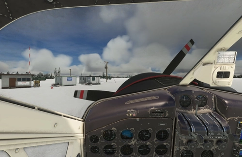
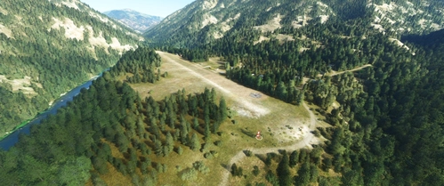
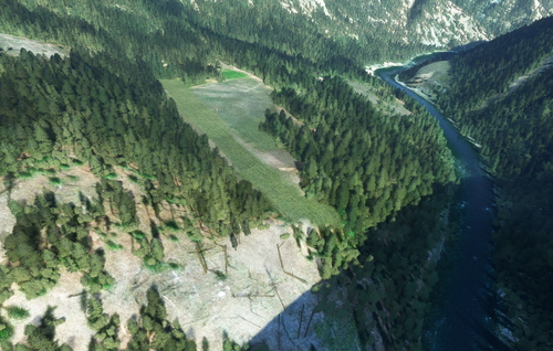
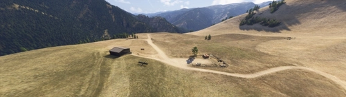
Weatherby USFS lies roughly 40nm north-east from Boise well into the Idaho backcountry.
Situated in a narrow valley right next to the Middle Fork Boise River at an elevation of 4500' makes it an interesting yet challening place to fly to.
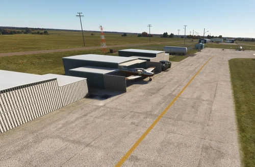
The airport, which is owned by the US Forest Service, serves as ideal stop-over point between the Snake River Plain to the south and the Idaho Mountains to the north.
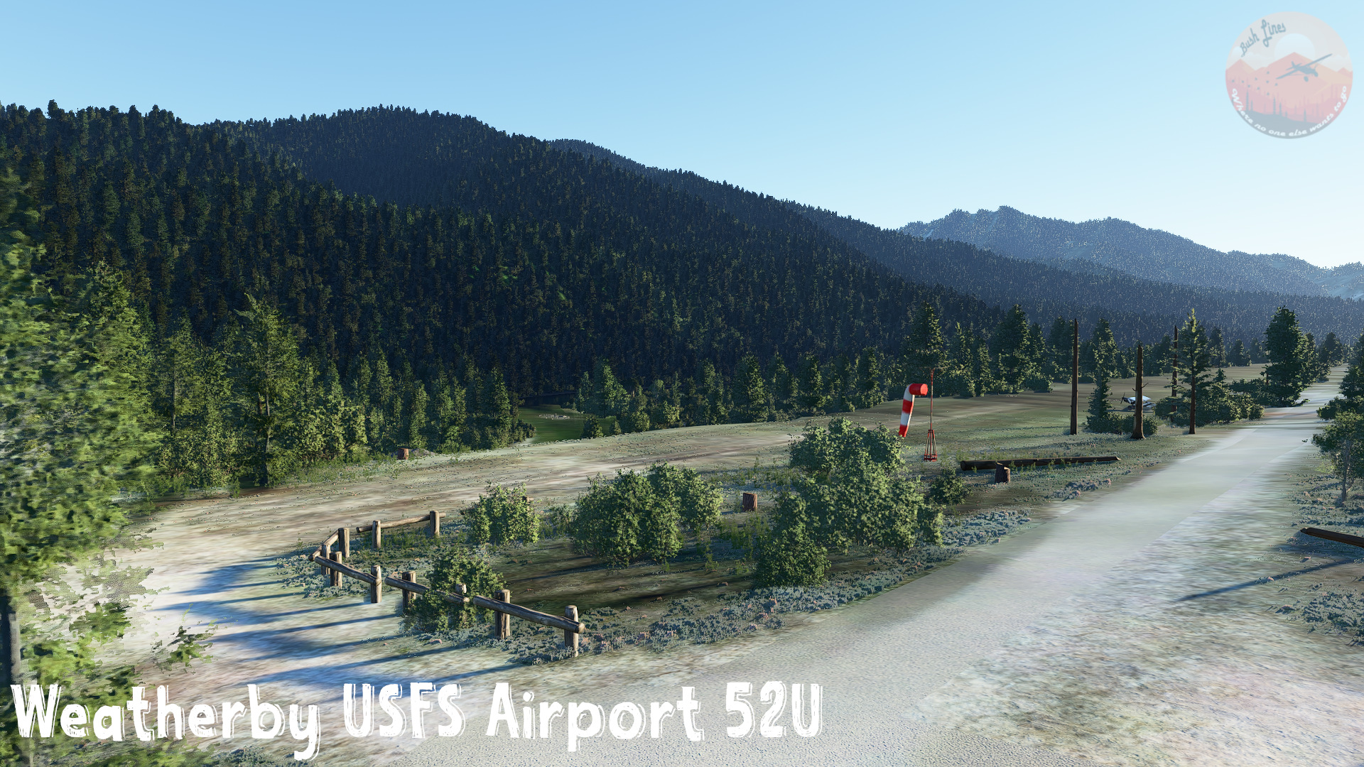
A 2200 x 60 feet turf/dirt runway gives you enough space to set up your tent and enjoy the surrounding area for some superb hiking or fishing.
Recommended landing is upstream with a left pattern (RWY03) and take-off downstream (RWY21), if wind conditions permit.
The more challening approach, however, is coming from the canyon above.
Don't expect any service or maintenaince, especially in the winter.
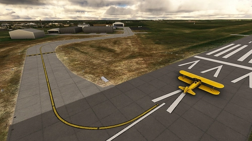
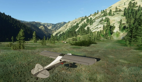
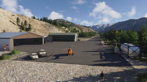
This airport is the first one made by me, which includes a number of custom created objects.
Since I'm still very new to creating custom objects, it took me quite some time and may not be perfect, but I still hope you like it.
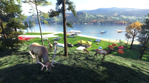
I tried to re-create a backcountry-ish feel to it by adding a lot of natural elements.
However, I tried not to overload the scenery due to performance concerns.
Please do not share, copy, re-distribute etc. the objects I've created.
If you really want, ask for permission first please.
If you like the airport, consider giving a small donation (even one dollar/euro helps)
Any donations will be used for paying for more textures, PBR materials and storage space to continue creating sceneries for you!
It's never expected, but always highly welcome!
PayPal Donation (for the life of me, I can't figure out how to add these fancy buttons)
Check out my other sceneries:
San Juan Islands
Channel Islands National Park
USFS Big Prairie Ranger Station
Meadow Creek USFS Airport
Spotted Bear USFS Airport
Enjoy!
Dependencies
Comments(10)
Log in to join the discussion
Log Inabout 3 years ago
Very nice bush strip, great job! I don't know if you are watching these comments, but I have one little gripe. The road that parallels the strip has what I call
about 3 years ago
That you call what? I guess you mean that overlay layer that is automatically put over them?
about 3 years ago
Sorry, it didn't put the whole comment in, it got cut off. Weird. They are what I call "road blur", that Asobo adds on top of roads - it tends to stand out when roads are near an airport/scenery mod. It's visible in your first picture. I'm a developer too and I usually put down a polygon on top of the road, any material and then put transparency to 0 and it removes the blur.
about 3 years ago
Yea, it was one of my first airstrips and I didn't really care at that time. I put it on my list of things that needs fixing when I come around updating the scenery.
almost 4 years ago
That was a wild approach through the canyon in the Quest Kodiak. Great scenery and works in SU9/WU10
about 5 years ago
about 5 years ago
about 5 years ago
Thank You & Always Happy Landings & and avoid these dangerous Potholes if you can,
Captain Warstein (Germany)
about 5 years ago
Weatherby USFS Airport 52U, Idaho, USA
Discover the secluded charm of Weatherby USFS Airport 52U in Idaho, USA. This backcountry airstrip, nestled in the Idaho wilderness, offers a unique flying experience with its challenging terrain and scenic surroundings. Owned by the US Forest Service, this airport provides a perfect stopover for pilots exploring the rugged beauty of the region. Experience a custom-crafted airfield with natural elements and a turf/dirt runway, ideal for adventurous aviators seeking a true wilderness escape.
User Reviews
5 reviews
Location
More Information
Version History
1.1.0 Fixed tree/vegetation height around airstrip (you can use the airstrip again without hitting trees on final and take-off) Added custom windsock (you now need my Bush & Backcountry library for the scenery to work) Compiled with latest SDK
Related

San Juan Islands, Washington
Experience the beauty and serenity of the San Juan Islands in Washington with this detailed add-on for Microsoft Flight Simulator. Discover over 20 airports and airstrips, each offering a unique flying experience in this picturesque region. From coastal environments to mountainous terrain, embark on adventures in the heart of nature. Enhance your simulation with recommended add-ons for an immersive exploration of this stunning archipelago.
by Wookie042

Flying B Ranch Landing Strip 12ID, Idaho, USA
Experience the challenge of landing at Flying B Ranch, a private airstrip in the Idaho backcountry. With a 2100 foot grass runway surrounded by steep terrain, pilots must have backcountry and mountain flying experience. Navigate the unique landing procedures and make sure to announce your intentions on the multicom frequency 122.9. Explore this custom-built airstrip with lodge and cabins to accommodate up to 40 guests.
by Wookie042

Channel Islands National Park, California
Discover Channel Islands National Park in California, located 20nm off Santa Barbara. This pack includes unpaved airstrips such as Point Bennett, San Miguel Island, Bechers Bay, Christy, and Santa Cruz Ranch, offering a unique flying experience. Explore these islands away from the mainlands hustle, where peace and challenging terrain await. Installation is easy - just drop the folders into your community folder and soar into this scenic escape!
by Wookie042

Lime Village Airport, 2AK, Alaska
Lime Village is a small isolated alaskan village roughly 160nm from Anchorage to the west across the Alaska Range and 96nm south of McGrath. The village with a population of 13-30 people sits right on the bank of Stony River and features a small airport, which mainly serves the community of Lime Village and other smaller communities and cabins in the area.
by Wookie042


over 2 years ago
Best Regards from Warstein in Germany,
Captain Moonlight