Description
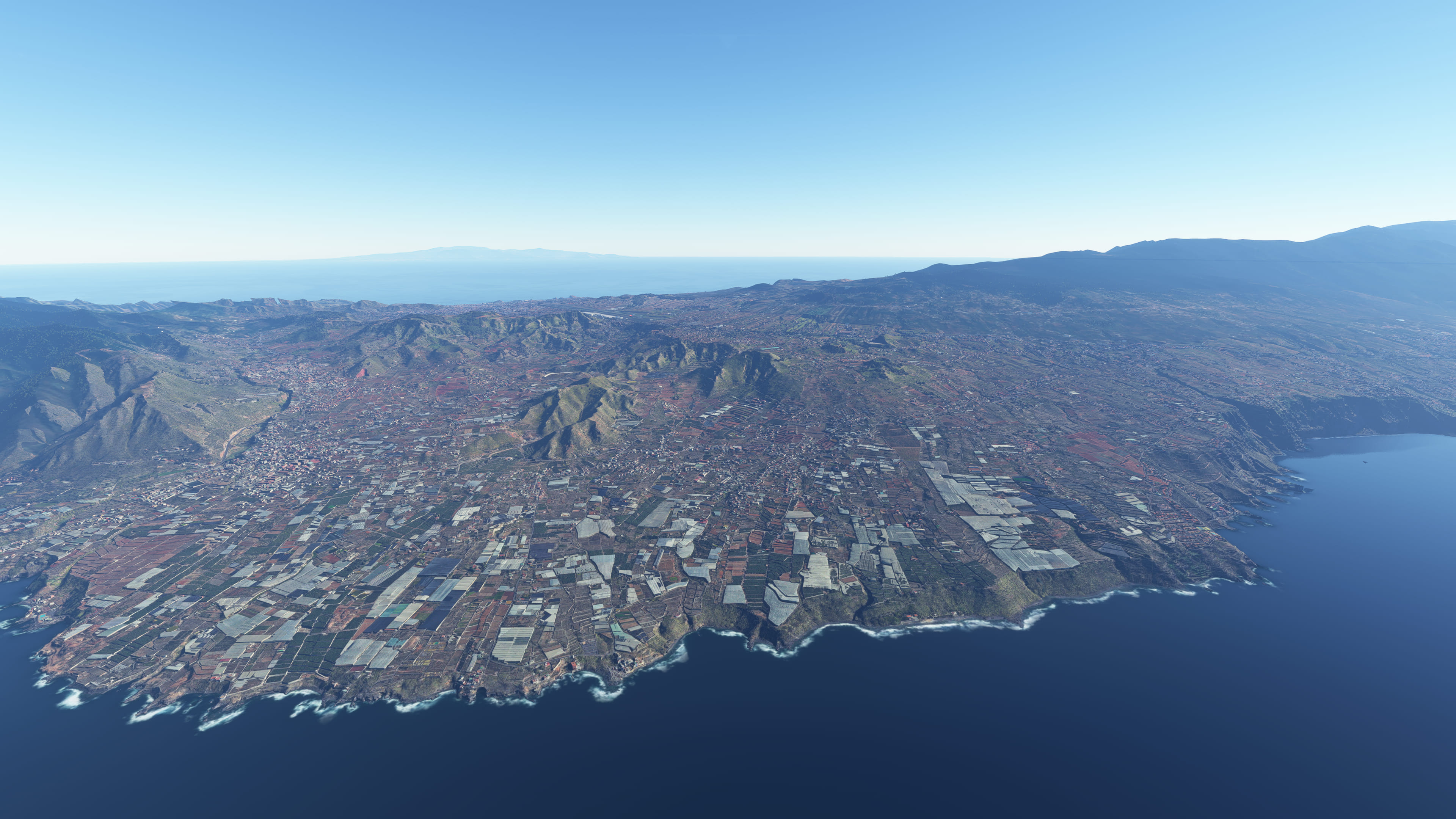
Area around Tegueste, Tacoronte and GCXO RW12 Approach on Tenerife Island based on Google Maps photogrammetry
This is part of multiple packages that cover Tenerife photogrammetry. I recommend using them together, here is a list of them:
Sceneries on Tenerife
- Santa Cruz de Tenerife area - GCXO Approach RW 30
- Tegueste and Tacoronte area - GCXO Approach RW 12
- Puerto de la Cruz area
Install
1. It's recommended to use a better DEM to improve blending with default scenery. I recommend installing Mikeaat 20M DEM for Canary Islands. Also, you can use Taburet 5M DEM if you want as it's compatible (payware).
2. Download and unzip on Community folder
Credits
Jonahex111 (Goolge Earth Decoder)
thalixte (Optimization tool for Google Earth Decoder)
Google Maps
Comments(2)
Log in to join the discussion
Log Inover 4 years ago
Hi Ezro, great to see you continuing on these islands, I guess I know where I'm flying today... thanks as always :)
I see that in your descriptions you advise the mikeat 20m DEM and the payware taburet 5m DEM, but did you know there's an even better one, a *2m* DEM that's freeware made by spritelyoldman? Here it is, if you like it please point people to it: https://flightsim.to/file/22276/canarydem
Tegueste and Tacoronte - GCXO Approach RW 12, Tenerife, Spain
Explore the Tegueste and Tacoronte area, along with the GCXO RW12 Approach on Tenerife Island, with this detailed photogrammetry scenery for Microsoft Flight Simulator. Part of a series covering Tenerife, enhance your flight experience by combining this package with others in the collection. Ensure to follow installation recommendations for optimal results.

Supporters
User Reviews
1 reviews
Location
More Information
Version History
Small fixes to match new version of Santa Cruz scenery
Related
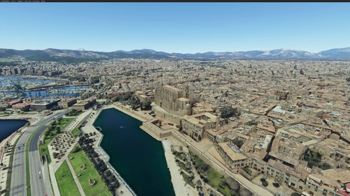
Palma de Mallorca, Islas Baleares, Spain
Explore Palma de Mallorca and its surrounding areas with this Microsoft Flight Simulator add-on, featuring high-detail photogrammetry based on Google Maps. Choose between a Full version with intricate textures or a Lite version for a simplified experience, suitable for less powerful machines. Despite some minor limitations in certain areas, this scenery offers a captivating upgrade from the MSFS default landscape.
by ezro
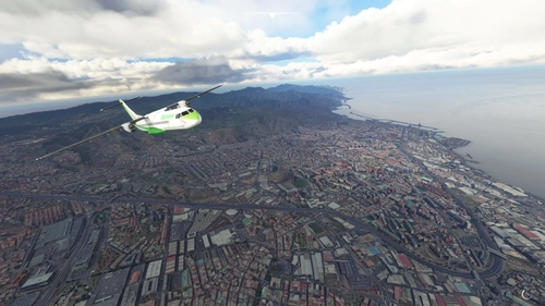
Santa Cruz de Tenerife (GCXO photogrammetry approach and La Laguna), Islas Canarias, Spain
Explore Santa Cruz de Tenerife in Microsoft Flight Simulator with this photogrammetry scenery add-on including La Laguna and GCXO Tenerife Norte approach. Updated for February 2023, it is compatible with World Update 8 Iberia and various airport add-ons. Discover more photogrammetry packages covering Tenerife for an immersive flying experience.
by ezro
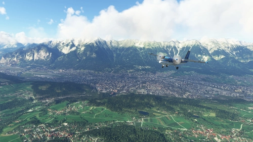
Innsbruck City / LOWI Approach, Austria (ORBX LOWI Compatible)
Experience Innsbruck city and LOWI Approach like never before with this add-on based on Google Maps photogrammetry. Compatible with ORBX LOWI Airport, this scenery brings stunning detail to your simulator. Simply download, unzip, and enjoy a realistic and immersive flight experience. Credits to Jonahex111, thalixte, and Google Maps for their contributions to this impressive add-on.
by ezro
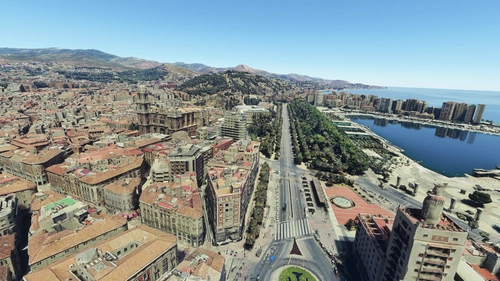
Malaga, Andalucia, Spain (including nearby Torremolinos and Benalmadena)
Explore the stunning photogrammetry scenery of Malaga, Torremolinos, and Benalmadena in Spain, meticulously recreated based on Google Maps. Ensure proper installation by downloading and unzipping both files in the same folder. Please note some minor discrepancies with default scenery. Credits to Jonahex111, thalixte, and Google Maps for their contributions.
by ezro
over 4 years ago
Good morning, Ezro.
I have observed a problem with textures along Tenerife north coast: in front of Santa Ursula, the terrain is flat and with Bing textures (sorry I don´t know how to attach screenshots).
Regards