Description
LFNC / HEMS Missions & DZ
EN :
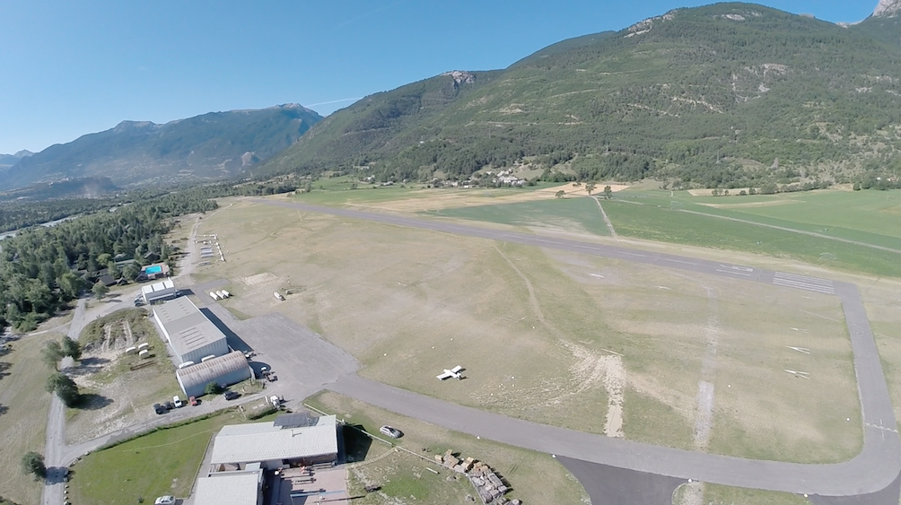
Little airfield in the Alps, mainly use for glider in summer or helicopter company. OACI : LFNC
6 missions available & 4 DZ.
Briefing available for HEMS missions. All missions are possible at night.
You can find the Helipad of Briançon (12 Nm on the north in the valley, made by Smvrf) here : https://flightsim.to/file/9963/helipad-briancon-hospital
Please download the object libraries for a better experience and the possibility to use helipads (and many thanks to their creators or letting us use them), see the dependance page for more informations.
In version 0.6, additional implementations on ski areas, DZ, rescue, ..
FR :
Petit aérodrome dans les Alpes, principalement utilisé pour les planeurs en été ou les hélicoptères. OACI : LFNC
6 missions disponibles & 4 DZ.
Briefing disponible pour les missions HEMS. Toutes les missions sont possibles de nuit.
Vous pouvez trouver l'héliport de Briançon (12 Nm au nord dans la vallée, réalisé par Smvrf) ici : https://flightsim.to/file/9963/helipad-briancon-hospital
N'hésitez pas à télécharger les bibliothèques d'objets pour une meilleure expérience et la possibilité d'utiliser les héliports (et un grand merci à leurs créateurs pour nous avoir permis de les utiliser), voir la page de dépendance pour plus d'informations.
Dans la version 0.6, implémentations supplémentaires sur les domaines skiables, DZ, secours, ..
Dependencies
Comments(10)
Log in to join the discussion
Log Inover 3 years ago
It seems like the 40th anniversary edition has this as a handcrafted airport. It wasn't there before.
almost 4 years ago
Nice work, thank you.
about 4 years ago
Attention le mesh italie 20m est incompatible de notre coté des alpes .penser a le désactivé pour lfnc
over 4 years ago
Merci beaucoup!! :)
over 4 years ago
Je viens de décoller de St Crepin avec un Discus. J'ai vraiment eu l'impression d'y être. Très beau travail
over 5 years ago
over 5 years ago
LFNC - Mont-Dauphin Saint-Crépin + HEMS Missions
Discover LFNC - Mont-Dauphin Saint-Crépin, a picturesque airfield in the Alps perfect for gliding and helicopter operations. This add-on offers 6 missions and 4 DZ, including nighttime operations and detailed HEMS mission briefings. Explore the beautiful scenery and enhanced features like ski areas and rescue operations in version 0.6.

User Reviews
6 reviews
Location
More Information
Version History
Add objects on LFNC area ; Add TRAIN Accident scenario 44°38'23.4"N 6°34'29.5"E ; Add MOUTAIN evacuation 1 scenario 44°41'20.6"N 6°32'37.0"E ; Add MOUTAIN evacuation 2 scenario 44°47'58.9"N 6°32'2.6"E ; Add DZ Guillestre 44°39'35.0"N 6°37'24.8"E ; Add DZ Vars 44°32'56.1"N 6°42'5.5"E ; Add DZ Embrun 44°33'25.5"N 6°29'4.1"E & city relief improvements ; Update of English & French briefing in pdf files ; Update of others area for SimUpdate compatibility ; Add POI for scenarios ;
over 3 years ago
Merci pour ce très beau travail. Une belle découverte