Description
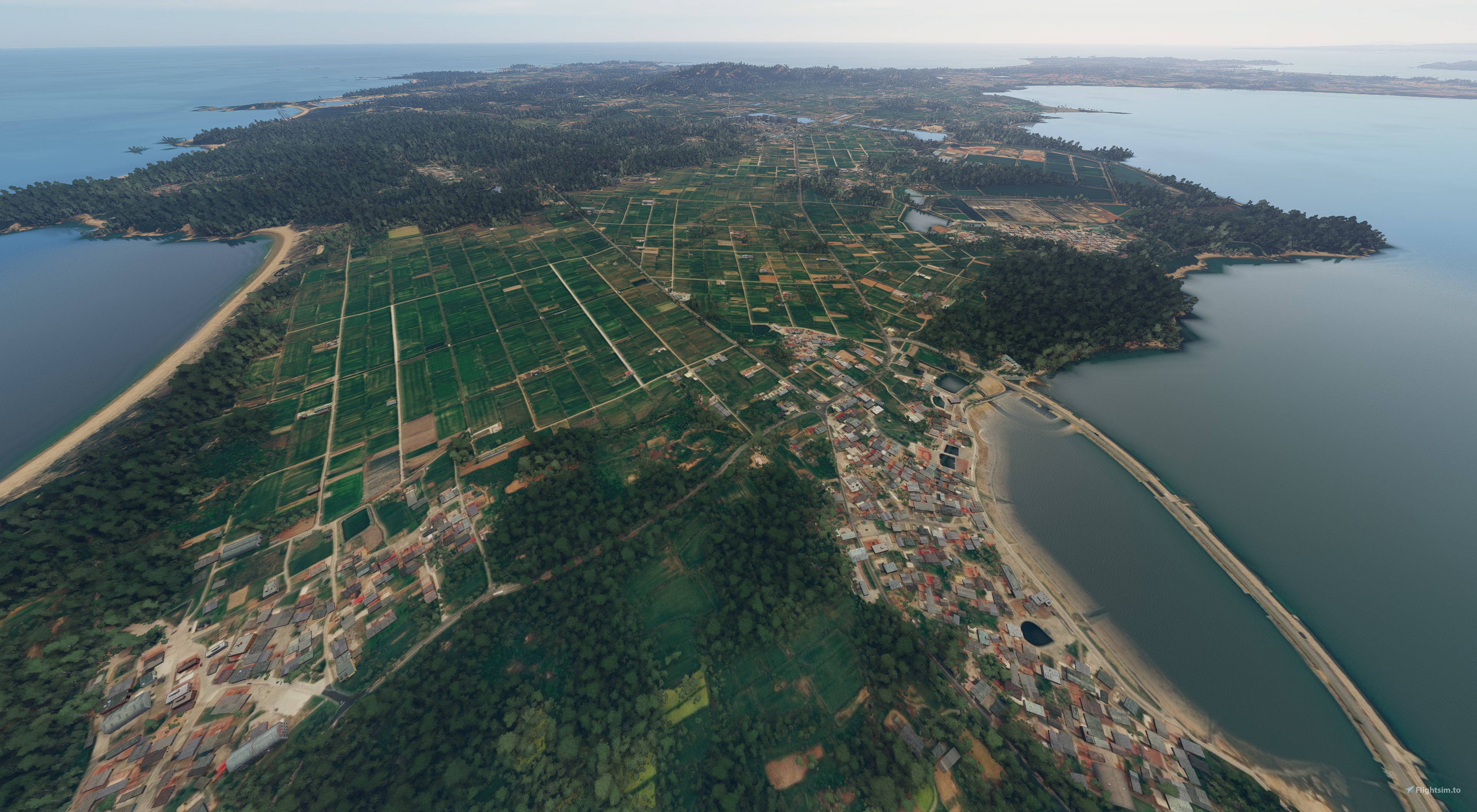
Kinmen Airport (RCBS) is missing in default FS2020. The Bing map data in MSFS is also missing on Kinmen Island. This package provides a whole major Kinmen island aerial enhancement. You can also download “RCBS Kinmen Airport, Taiwan” to have the local airport insight.
Installation: WARNING!! Flightsim.to does not allow file larger than 2GB. You need to download and rename two files from the web in order to extract the package correctly. And I suggest you to disable manual cache for better stability.
1) First download the "Main file" and rename it as "kcai-kinmen-aerial.part1.rar".
2) Then download the second file and rename it as "kcai-kinmen-aerial.part2.rar"
3) Extract the two RAR files and get one folder called "kcai-kinmen-aerial"
4) Drag and drop the “kcai-kinmen-aerial ”folder in your Community folder.
(Remove "kcai-rcbs-aerial-temp" folder if you have previous version installed from “RCBS Kinmen Airport, Taiwan”.)
V2.0
Improve stability.
Add DaDan Islands aerial images.
V1.0 Initial release:
Whole Major Kinmen Island aerial replacement up to Z19 resolution.
Comments(29)
Log in to join the discussion
Log Inabout 2 years ago
over 2 years ago
almost 3 years ago
almost 3 years ago
about 4 years ago
請問這兩個壓縮檔下載完後無法解壓縮要怎麼處理呢?
它一直顯示 [資料含有錯誤:kcai-kinmen-aerial\CGL\132\sai123.cgi]
兩個都是
over 4 years ago
These files are giving data errors when I try to unzip them
over 4 years ago
Remember to rename the second file to comply the rar multiple file rule. Thank you!
over 4 years ago
I followed the instructions above. I get the data error when trying to extract the 2nd file, even after renaming it the same way you describe.
over 4 years ago
this is awesome.
about 5 years ago
Next time to Taiwan I intend to fly to Kinmen, this gives me a chance to visit now 😁
about 5 years ago
about 5 years ago
要喔,還有一個 Kinmen 20m DEM也可以下載。
Kinmen Aerial, Taiwan
Enhance your flying experience with Kinmen Aerial, Taiwan add-on for Microsoft Flight Simulator. This package fills the gap left by the missing Kinmen Airport (RCBS) and Bing map data, offering a comprehensive aerial enhancement of Kinmen Island. Ensure proper installation by following the instructions provided, and enjoy improved stability with version 2.0 update including DaDan Islands aerial images.

User Reviews
4 reviews
More Information
Version History
V2.0 Improve stability. Add DaDan Islands aerial images.
Related

Swiss mountains tree fix (trees on mountains removed)
A comprehensive mod fixing tree placement on Swiss mountains, particularly removing inaccurately placed trees on mountain peaks. The update includes a shift to more realistic conifer trees in the Alps and an expansion to border areas of France, Italy, and Austria. From Alpstein Säntis to Stockhorn, numerous locations across Switzerland have been meticulously corrected for a more authentic flight experience.
by THEOLI4D

Shorter Trees / Tree Height Modification VERSION 4.0 for MFS2020 (shorter, realistic trees)
Experience realistic and shorter trees in Microsoft Flight Simulator with the Shorter Trees / Tree Height Modification VERSION 4.0 add-on. Compatible with the latest version of MSFS, this mod provides adjusted tree heights for a more authentic flying experience. Update includes enhanced tree coloration blending seamlessly with photogrammetry trees. Installation is simple - just copy the folder into your community folder and enjoy a new perspective from the skies.
by ARIF STUDIOS - Adnan Arif

AUSTRIA 10m DEM - High Resolution Terrain Elevation Data from LIDAR Imaging
Explore the stunning terrain of Austria with this mod featuring high-resolution LIDAR data, offering a mesh resolution of 10m for a more realistic flight experience. Flatten lakes, rivers, and eliminate any terrain artifacts as you soar over the Austrian landscape. Divided into regions for convenience and performance optimization, this mod enhances the mountain shapes to mirror reality and provides a smoother flying experience. Experience Austria like never before with enhanced elevation data and realistic terrains.
by Troglodytus

SWITZERLAND 20m DEM - High Resolution Terrain Elevation Data from LIDAR Imaging
Explore the beauty of Switzerland with this mod offering high resolution terrain elevation data using LIDAR imaging. The mesh resolution is 20m, providing exceptional detail with a height resolution of 0.1m. Update includes extreme LIDAR meshes for specific regions. Please note potential performance impacts and report any bugs for further improvements. Fly VFR over Switzerland with enhanced realism and accuracy.
by Troglodytus
almost 2 years ago