Description
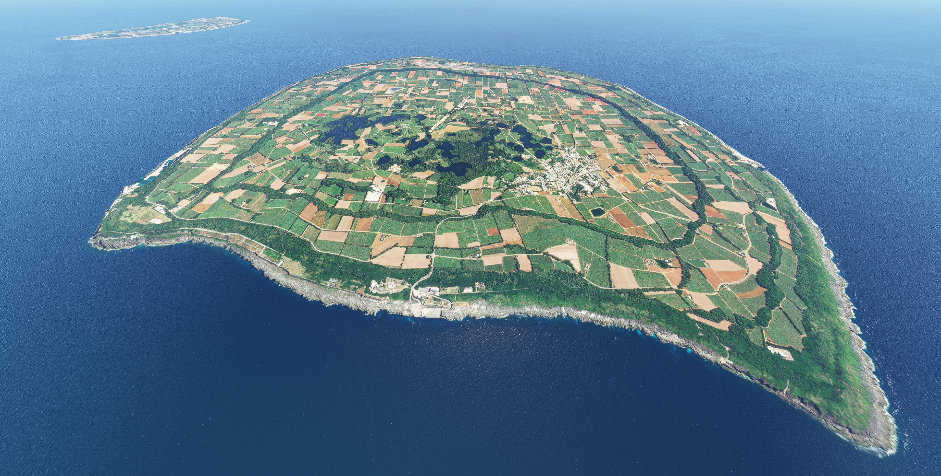
This is an aerial project for both Minamidaito and Kitadaito Islands, Japan. There is no aerial from default Asobo data.
Please refer to OJGKATSU's great airport project for further enhancement.
[ROMD] Minamidaito Airport -Japan https://flightsim.to/file/856/romd-minamidaito-airport-japan
[RORK] Kitadaito Airport - Japan https://flightsim.to/file/852/rork-kitadaito-airport-japan
Installation: drag and drop “kcai-Minamidaito and Kitadaito-aerial” folder into your Community folder.
Comments(4)
Log in to join the discussion
Log InMinamidaito and Kitadaito Aerial, Japan
Explore the stunning Minamidaito and Kitadaito Islands in Japan with this aerial project, providing detailed aerial imagery not available in the default Asobo data. Enhance your experience further with the accompanying airport projects for Minamidaito and Kitadaito by OJGKATSU. Simply drag and drop the files into your Community folder for easy installation.

User Reviews
2 reviews
Location
More Information
Version History
No version history available.
Related

Swiss mountains tree fix (trees on mountains removed)
A comprehensive mod fixing tree placement on Swiss mountains, particularly removing inaccurately placed trees on mountain peaks. The update includes a shift to more realistic conifer trees in the Alps and an expansion to border areas of France, Italy, and Austria. From Alpstein Säntis to Stockhorn, numerous locations across Switzerland have been meticulously corrected for a more authentic flight experience.
by THEOLI4D

Shorter Trees / Tree Height Modification VERSION 4.0 for MFS2020 (shorter, realistic trees)
Experience realistic and shorter trees in Microsoft Flight Simulator with the Shorter Trees / Tree Height Modification VERSION 4.0 add-on. Compatible with the latest version of MSFS, this mod provides adjusted tree heights for a more authentic flying experience. Update includes enhanced tree coloration blending seamlessly with photogrammetry trees. Installation is simple - just copy the folder into your community folder and enjoy a new perspective from the skies.
by ARIF STUDIOS - Adnan Arif

AUSTRIA 10m DEM - High Resolution Terrain Elevation Data from LIDAR Imaging
Explore the stunning terrain of Austria with this mod featuring high-resolution LIDAR data, offering a mesh resolution of 10m for a more realistic flight experience. Flatten lakes, rivers, and eliminate any terrain artifacts as you soar over the Austrian landscape. Divided into regions for convenience and performance optimization, this mod enhances the mountain shapes to mirror reality and provides a smoother flying experience. Experience Austria like never before with enhanced elevation data and realistic terrains.
by Troglodytus

SWITZERLAND 20m DEM - High Resolution Terrain Elevation Data from LIDAR Imaging
Explore the beauty of Switzerland with this mod offering high resolution terrain elevation data using LIDAR imaging. The mesh resolution is 20m, providing exceptional detail with a height resolution of 0.1m. Update includes extreme LIDAR meshes for specific regions. Please note potential performance impacts and report any bugs for further improvements. Fly VFR over Switzerland with enhanced realism and accuracy.
by Troglodytus
about 5 years ago
Trees and buildings arround the islands would be nice to have and like filipo already mentioned the photorealistic doesn't fit exactly.