Description
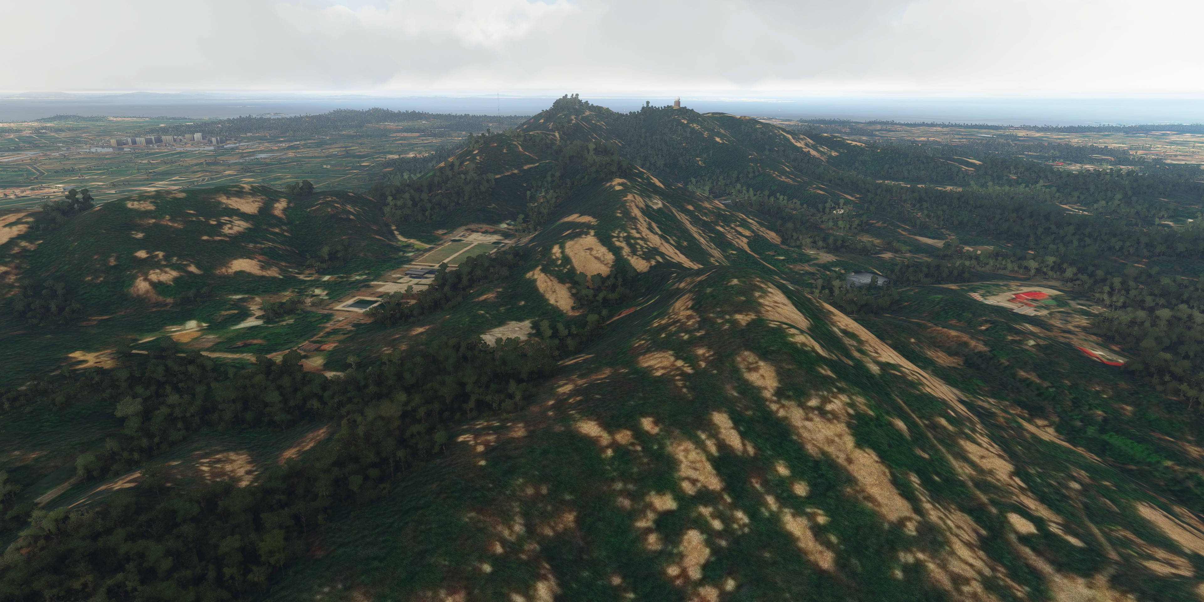
This is a DEM (Digital Elevation Model) work for KinMen Islands, Taiwan. The data source is from a 20m DEM data sampled at 10m spatial distance.The DEM data is created based on heightmap method from SDK system, so far MSFS still has bug for large heightmap files. It has some chance to crash your game. Please use it at your own risk.
In order to enjoy the island flight, please also refer my other projects: “Kinmen Aerial, Taiwan”, and “RCBS Kinmen Airport, Taiwan”. Further update for those projects compatible with the DEM work is coming.
Installation: drag and drop the “kcai-KinMenDEM” folder in your Community folder.
(I have to honor the Nool Aerosystems which is created by Paavo, who made this project possible. His brilliant program made the terrain design easier and faster and deserve your applause.)
Comments
Log in to join the discussion
Log InNo comments yet. Be the first to share your thoughts!
Kinmen 20m DEM, Taiwan
Enhance your flight simulation experience with this Kinmen 20m DEM add-on, featuring detailed Digital Elevation Models of KinMen Islands, Taiwan. Utilizing 20m DEM data sampled at 10m spatial distance, this work offers a unique perspective for island flights. Please note potential game crashes due to large heightmap files and install with caution. Dont miss out on exploring Kinmen Aerial and RCBS Kinmen Airport projects for a complete experience with upcoming compatibility updates.

Location
More Information
Version History
No version history available.
Related

Swiss mountains tree fix (trees on mountains removed)
A comprehensive mod fixing tree placement on Swiss mountains, particularly removing inaccurately placed trees on mountain peaks. The update includes a shift to more realistic conifer trees in the Alps and an expansion to border areas of France, Italy, and Austria. From Alpstein Säntis to Stockhorn, numerous locations across Switzerland have been meticulously corrected for a more authentic flight experience.
by THEOLI4D

Shorter Trees / Tree Height Modification VERSION 4.0 for MFS2020 (shorter, realistic trees)
Experience realistic and shorter trees in Microsoft Flight Simulator with the Shorter Trees / Tree Height Modification VERSION 4.0 add-on. Compatible with the latest version of MSFS, this mod provides adjusted tree heights for a more authentic flying experience. Update includes enhanced tree coloration blending seamlessly with photogrammetry trees. Installation is simple - just copy the folder into your community folder and enjoy a new perspective from the skies.
by ARIF STUDIOS - Adnan Arif

AUSTRIA 10m DEM - High Resolution Terrain Elevation Data from LIDAR Imaging
Explore the stunning terrain of Austria with this mod featuring high-resolution LIDAR data, offering a mesh resolution of 10m for a more realistic flight experience. Flatten lakes, rivers, and eliminate any terrain artifacts as you soar over the Austrian landscape. Divided into regions for convenience and performance optimization, this mod enhances the mountain shapes to mirror reality and provides a smoother flying experience. Experience Austria like never before with enhanced elevation data and realistic terrains.
by Troglodytus

SWITZERLAND 20m DEM - High Resolution Terrain Elevation Data from LIDAR Imaging
Explore the beauty of Switzerland with this mod offering high resolution terrain elevation data using LIDAR imaging. The mesh resolution is 20m, providing exceptional detail with a height resolution of 0.1m. Update includes extreme LIDAR meshes for specific regions. Please note potential performance impacts and report any bugs for further improvements. Fly VFR over Switzerland with enhanced realism and accuracy.
by Troglodytus