Flightsim.to
    Matsu 30m DEM, Taiwan - Image 1

    Description

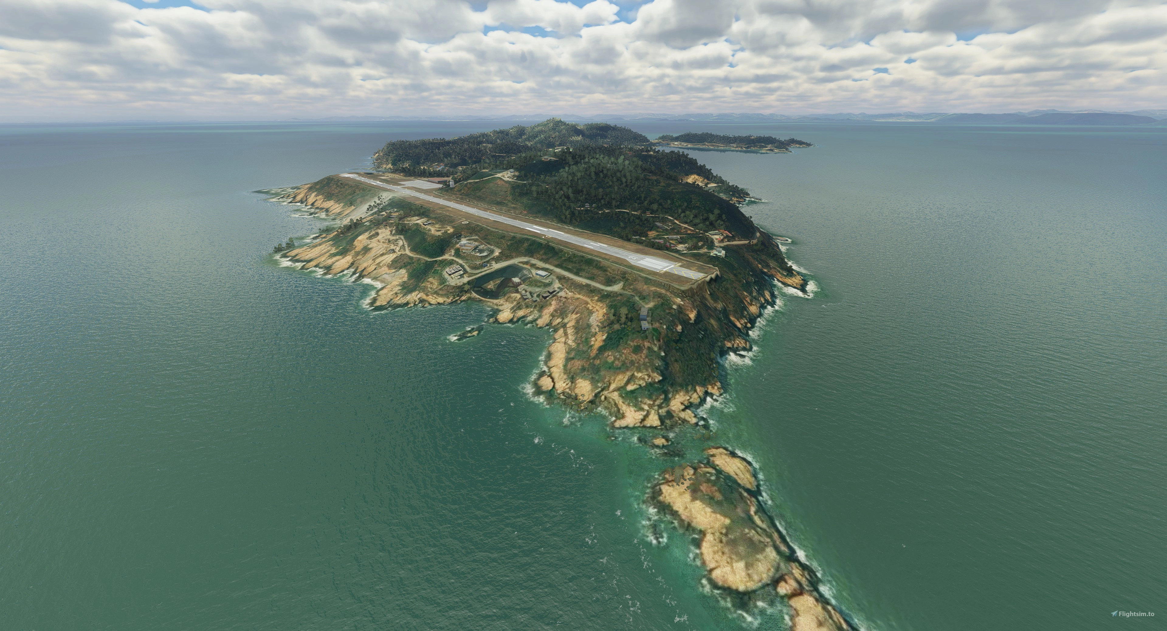
    This is a DEM (Digital Elevation Model) work for Matsu Islands, Taiwan. The data source is from a 30m DEM data sampled at 15m spatial distance. I have to honor the Nool Aerosystems created by Paavo, who made this project possible. His brilliant program made the terrain design easier and faster and deserve your applause.


    The DEM data is created based on heightmap method from SDK system, so far MSFS still has bug for large heightmap files. It has some chance to crash your game. Please use it at your own risk.


    In order to enjoy the island flight, please also refer my other projects: “Matsu Aerial, Taiwan”, “Matsu Heliports, Taiwan”, “RCFG Nangan Airport, Matsu, Taiwan”. Further update for those projects compatible with the DEM work is coming.


    Installation: drag and drop the “kcai-MatsuDEM” folder in your Community folder.

    Comments(3)

    Log in to join the discussion

    Log In
    r

    almost 5 years ago

    nice job, have not been to Matsu yet, but will probably visit in the next 2 years - if Covid allows it … 😊


    a

    about 5 years ago

    30 m ?
    bring back fsx !!
    k
    kcaiAuthor

    about 5 years ago

    you guys are lucky living in a peaceful world without immediate hostility from your neighbor country. You got everything you want. Things like 1 m or 5m DEM is a confidential data away from civilian usage to prevent foreign threats.
    MSFS 2020MSFS 2024

    Matsu 30m DEM, Taiwan

    Matsu 30m DEM is a digital elevation model add-on for Matsu Islands, Taiwan, using 30m DEM data sampled at 15m spatial distance. Created with Nool Aerosystems help, this project enhances terrain design for a more realistic flight experience in Microsoft Flight Simulator. Please note the potential game crash risk due to large heightmap files and enjoy additional related projects for an immersive island flight experience. Installation is simple by placing the provided folder in the Community folder.

    Downloads1K
    Version1.0
    File Size216.61 KB
    Published5 years ago
    Updated5 years ago

    User Reviews

    5.0

    1 reviews

    5
    100%
    4
    0%
    3
    0%
    2
    0%
    1
    0%

    More Information

    Simulator
    MSFS2020
    Sub-CategoryLandscape
    CountryTW
    ICAONULL

    Version History

    No version history available.

    Related

    Swiss mountains tree fix (trees on mountains removed)

    Swiss mountains tree fix (trees on mountains removed)

    A comprehensive mod fixing tree placement on Swiss mountains, particularly removing inaccurately placed trees on mountain peaks. The update includes a shift to more realistic conifer trees in the Alps and an expansion to border areas of France, Italy, and Austria. From Alpstein Säntis to Stockhorn, numerous locations across Switzerland have been meticulously corrected for a more authentic flight experience.

    by THEOLI4D

    5.0
    Shorter Trees / Tree Height Modification VERSION 4.0 for MFS2020 (shorter, realistic trees)

    Shorter Trees / Tree Height Modification VERSION 4.0 for MFS2020 (shorter, realistic trees)

    Experience realistic and shorter trees in Microsoft Flight Simulator with the Shorter Trees / Tree Height Modification VERSION 4.0 add-on. Compatible with the latest version of MSFS, this mod provides adjusted tree heights for a more authentic flying experience. Update includes enhanced tree coloration blending seamlessly with photogrammetry trees. Installation is simple - just copy the folder into your community folder and enjoy a new perspective from the skies.

    by ARIF STUDIOS - Adnan Arif

    5.0
    AUSTRIA 10m DEM - High Resolution Terrain Elevation Data from LIDAR Imaging

    AUSTRIA 10m DEM - High Resolution Terrain Elevation Data from LIDAR Imaging

    Explore the stunning terrain of Austria with this mod featuring high-resolution LIDAR data, offering a mesh resolution of 10m for a more realistic flight experience. Flatten lakes, rivers, and eliminate any terrain artifacts as you soar over the Austrian landscape. Divided into regions for convenience and performance optimization, this mod enhances the mountain shapes to mirror reality and provides a smoother flying experience. Experience Austria like never before with enhanced elevation data and realistic terrains.

    by Troglodytus

    5.0
    SWITZERLAND 20m DEM - High Resolution Terrain Elevation Data from LIDAR Imaging

    SWITZERLAND 20m DEM - High Resolution Terrain Elevation Data from LIDAR Imaging

    Explore the beauty of Switzerland with this mod offering high resolution terrain elevation data using LIDAR imaging. The mesh resolution is 20m, providing exceptional detail with a height resolution of 0.1m. Update includes extreme LIDAR meshes for specific regions. Please note potential performance impacts and report any bugs for further improvements. Fly VFR over Switzerland with enhanced realism and accuracy.

    by Troglodytus

    4.9