Description
Llanbedr Airport (EGOD) in North Wales, UK
v2.0 updated to cover changes by the UK/World update
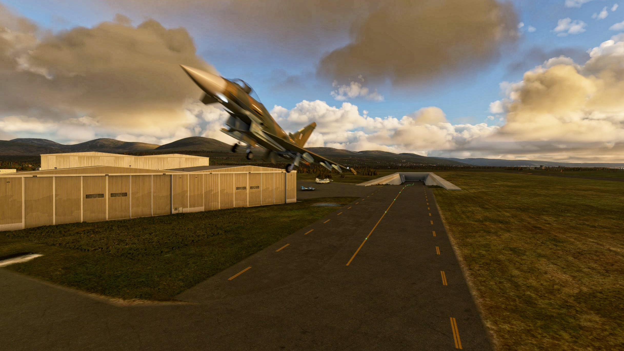
'The Gateway to the Mach Loop' The entrance to the low level military flying zone is only 12 miles from the airport so it is ideal for low level jet training.
Llanbedr airfield is also known as Snowdonia Aerospace Centre, is fast becoming a hive of activity with regular VIP Landings, aerospace testing, training, and events. There is also a flying school on site www.flysnowdonia.com offering lessons as well as aerobatic experiences.
They can also provide float planes for accessing the coast line which has regular visits from pods of dolphins,
With future plans to reopen the airport for military use the underground shelter has been installed to provide a 24/7 fast military response for un-authorised intrusions into UK airspace.
The airport has a FAA identifier of EGOD, with Gate 1 reserved for the military jets and the other parking locations available for GA planes.
NOTAM: under no circumstances should light aircraft loiter in the zone West of the general parking apron. Military fighter jets can, and do, launch with zero warning and cross the hatched area at very low altitudes.
Library assets used are:
https://flightsim.to/file/4696/dave-s-crooked-library
https://flightsim.to/file/5452/dave-s-3d-people-library
https://flightsim.to/file/1923/mikea-at-assetpack
https://www.flightsim.to/file/6072/sdr-scenery-pack-v1-0
https://www.flightsim.to/file/6841/dave-s-3d-animals-library
All the libraries need to be in your community folder and I would recommend the latest versions are downloaded.
v2.0 updated to cover changes by the UK/World update
v1.3 minor update to include all the runway signs to assist with taxing around the airport. One error corrected on the fuel truck routing.
v1.2 release. Final release until the UK update hits our computers in February. ATC issues resolved and all ground services now available.
v1.1 release. Taxiways and runways upgraded as well as a significant update to the underground hanger and local terraforming. ATC services basically work but I need to debug some issues I've seen with them. The Airport is now recognised as being open again after MSFS closed it :)
v1.0 release. Terraforming improved around the airport to improve the visibility of the approach lights on rwy17, control tower added and numerous other little tweaks. Flight plan for the Mach loop also included.
v0.1 1st concept release. With the release of military airplane to the flight simulator, this is a concept idea for an underground shelter for fast response fighter jets. Comments are invited on ideas to improve the concept.
Comments(14)
Log in to join the discussion
Log Inover 2 years ago
Does that mean I can't use this mod?
about 4 years ago
Anyone know why I'm getting pink textures for the aprons with this addon?
over 4 years ago
Interestingly this airfield does not show on SkyVector with either EGOD or the later EGFD ICAO designator.
Must be a secret base lol.
over 4 years ago
I think it was closed but was being re-opened for private use?
over 4 years ago
It seems to have a strange status. It is not listed at all in the United Kingdom NATS AIP's but there is a guide to the airport and its facilities on YouTube dated 24 July 2021. Very weird.
over 4 years ago
For anyone interested in this level of detail I found the answer to my query. Llanbedr is apparently an unlicensed airfield at the moment, but it is listed in the Part 2 - EN-ROUTE (ENR) - ENR 5 - NAVIGATION WARNINGS section of the UK AIPs instead of Part 3 - AERODROMES (AD). Below is an extract from an informative discussion about the the status of such airfields on one of the UK GA web sites, plus a copy of the current AIP data for Llanbedr:
By chevvron - Mon Feb 04, 2019 5:11 am
RESURRECTING AN OLD THREAD!
A list of unlicensed airfields without ICAO location indicators is in the AIP, but is it in the correct place for everyone's 'needs'?
ENR (a section which GA pilots seldom need to consult) contains lists of 'Aerial Sporting and Recreation Activities' including hang glider sites, gliding sites, microlight sites and parachuting sites, plus unlicensed airfields with ICAO Location Indicators where training has been approved by the CAA. Some of these latter eg Bourne, Henlow, Llanbedr, North Weald, Popham can generate intensive and/or high energy traffic, but rather than list them as airfields in the AD section, they are being treated simply as Navigation Warnings with only a phone number and 'type' of activity listed ie no contact frequency, no indication of runway length or QDM.
I would submit that many of these airfields , especially those listed as 'training' should be listed in the AD section of the AIP under a heading of 'Unlicensed aerodromes' with more detailed information than is presently published in ENR 5.5 extracted from the forms submitted to register the site as an 'Unlicensed & Uncertificated Aeronautical Site' such as runway direction, radio callsign and frequency plus type of radio service etc.
The RAF used to portray these airfields (including a recommended 'avoid' radius in the absence of an ATZ) when they published a section in the AIP (Mil) regarding 'Low Flying Areas' but I cannot find this section in the present AIP (Mil).
Source: https://forums.flyer.co.uk/viewtopic.php?f=74&t=86409&sid=32c47282ecf27b9f4dde7c1fe346da3a&start=15
--------------------------------------------------------------------------------------
UK AIP Part 2 - EN-ROUTE (ENR}
ENR 5 NAVIGATION WARNINGS
ENR 5.5 AERIAL SPORTING AND RECREATIONAL ACTIVITIES
LLANBEDR, GWYNEDD (AD)
Static data
Failed to load data!
A circle, 1.5 NM radius, centred at 524817N 0040738W
Upper limit: FL150
Lower limit: SFC
Phone: 07703-532064. RAF Valley 01407-762241 Ext 7404. London Control (Swanwick): 01489-612420.
Activity notified on the day to RAF Valley or London Control (Swanwick) outside hours of Llanbedr.
Alternative contact: 118.930 MHz Llanbedr or 125.225 MHz Valley Radar or 124.750 MHz London Information.
Hours: Normally during daylight hours.
over 4 years ago
thank you
about 5 years ago
whats the little bunker/ take off point about??
about 5 years ago
It's in the description
over 5 years ago
over 5 years ago
over 5 years ago
Llanbedr Airport (EGOD) 'The Gateway to the Mach Loop'
Explore Llanbedr Airport (EGOD), known as The Gateway to the Mach Loop in North Wales, UK. This scenic airfield is a hub for VIP landings, aerospace testing, training, and events, with a flying school offering lessons and aerobatic experiences. It features a unique underground shelter for military response, FAA identifier EGOD, and specific parking for military jets and GA planes. Be cautious of military activity in the area and enjoy access to coastal float planes for dolphin sightings.

User Reviews
3 reviews
Location
More Information
Version History
v2.0 updated to cover changes by the UK/World update
Related
The Gotgravel STOL Academy at Squamish, BC (CYSE)
Explore the back country of British Columbia with the GotGravel Academy at Squamish Airport (CYSE). This add-on offers 40 off-airport landing strips and two dedicated STOL strips for competitive events and practice. Immerse yourself in the art of STOL flying and enjoy custom pylon racing circuits alongside the Squamish river. Join the GotGravel discord for support and make sure to have the recommended libraries installed for the best experience.
by Photosbykev
Cougar Basin (PZ12) Idaho playground
Discover Cougar Basin (PZ12) Idaho, a unique scenery playground for Microsoft Flight Simulator enthusiasts. This regularly updated add-on features a grass/rock runway, custom buildings, and scenery animations. Nestled among popular airstrips in Idaho, this playground offers a picturesque setting for small GA planes and float planes to explore. Stay tuned for new ideas and additions from the developers creative mind.
by Photosbykev

Warm Lake Shoreline airport, Idaho
Explore the backcountry of Idaho with Warm Lake Shoreline airport (PZ10) featuring a 1300 grass/shale runway and seaplane facilities. Enjoy the amenities of a nearby community and the renowned WP8 cafe. Watch out for local wildlife and utilize various library assets for an immersive experience.
by Photosbykev
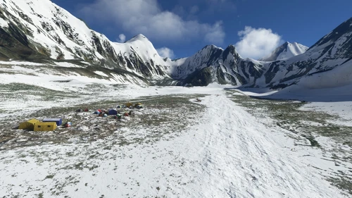
Everest Base Camp (YETI), Nepal side
Explore the stunning mountain scenery at Everest Base Camp (YETI) on the Nepal side with this MSFS add-on. Featuring Google Earth data, a challenging airstrip at 17,000, and a helipad at Gate H-1, this mod offers a realistic experience for adventurous pilots. Dont miss out on the local color and custom models included in this scenery enhancement.
by Photosbykev
over 1 year ago