Description
frisian islands sand banks
----------------------------------
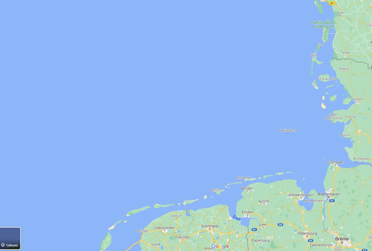
The Frisian Islands, also known as the Wadden Islands or the Wadden Sea Islands, form an archipelago at the eastern edge of the North Sea in northwestern Europe, stretching from the northwest of the Netherlands through Germany to the west of Denmark. The islands shield the mudflat region of the Wadden Sea (large parts of which fall dry during low tide) from the North Sea.
The Frisian Islands, along with the mainland coast in the German Bight, form the region of Frisia (German and Dutch: Friesland), homeland of the Frisian people. Generally, the term Frisian Islands is used for the islands where Frisian is spoken and the population is ethnically Frisian. In contrast, the term Wadden Islands applies to the entire archipelago, including the Dutch-speaking westernmost islands of Texel and Vlieland and Danish-speaking Danish Wadden Sea Islands further north off the west coast of Jutland.
Most of the Frisian Islands are environmentally protected areas, and an international wildlife nature reserve is being coordinated between the Netherlands, Germany and Denmark. Natural gas and oil drilling continue, however, and in the vicinity of the Ems, Weser and Elbe estuaries, and ship traffic causes tension between wildlife protection and economic values.
GPS : 53.547462, 6.269623
v1.0
1..add all major sand banks and sand islands (more than 30) along Frisian islands
v1.1
1..remove all vegetation over sand banks
v1.2
1..fixed polygons edges issues
v1.3
fix water polygon issue from last update
Comments(29)
Log in to join the discussion
Log Inover 3 years ago
Doesnt seem to work anymore :( first thing i noticed is that Noorderhaaks is missing between Den Helder and Texel, but its featured in 2 of your screenshots here, also i do not see any change for Richel and Griend with or with out the mod... Could be V1.2 is missing files.
Sub Folder Scenery only has a poly.bgl file, and the main folder only layout and manifest, is this correct? if not could you upload a fixed version?
over 3 years ago
thanks for reporting
I will check that as soon as possible
over 3 years ago
Thank you in advance, hope its an easy fix.
over 3 years ago
after investigating, I was told that it is a bug from the new update
the issue has been present from the beginning of the beta 12
so all mod using poly are affected
over 3 years ago
Shame that after some after some updates some things no longer work, hope there is still a way to fix things
about 3 years ago
Thank you for fixing it! "Noorderhaaks" is back :)
over 4 years ago
Thanks for this mod, love the Waddenzee! One small remark: mostly south of Ameland there are some artificial looking ground textures in roughly rectangular-ish shapes. Are they a bug?
over 4 years ago
Is there a conflict between this mod and this mod: https://flightsim.to/file/25954/east-frisian-islands-sandbanks
?
over 4 years ago
I figured I'd rate this mod too, as I think it deserves more than the three stars that someone else gave it so far. Five stars might be a bit excessive, compared to some huge and really excellent add-ons that can be found here on flightsim.to as well, but it sure is a valuable addition to bring the Wadden Sea to life.
over 4 years ago
Great addition, thanks! I am a sailor myself and lived on Texel for a while, so I have sailed the (Dutch) Wadden Sea a lot. Hence I found it a bit of a pity that most sand banks were missing. Griend was there, and the Bornrif, but Richel, which is so consipuous opposite the entrance of Vlieland harbour IRL, was missing, as well as "De Razende Bol"/Noorderhaaks, which I visited several times with my boat. So I really appreciate that you added these!
Do you think it would be possible to smoothen Richel a bit though: right now it has rather sharp corners and straight line, which makes it pretty obviously fake. If you could give it a bit more rounded corners, it would look significantly better.
over 4 years ago
hello
Richel sharp corners and straight line are not because of my scenery
they were already there with the default scenery
just remove my scenery from community folder, and check it
I think it is a water issue from bing data
maybe you can send me a screenshot to show me what you think is wrong
best regards
over 4 years ago
Actually, Richel is not there in the default scenery; at least, not really: recently, Microsoft/Asobo added shoals to the Wadden Sea to some extent in the form of water masks: you can see the shapes and textures of channels and shoals shining through the water, but the simulator still considers it as water (so it does not show up on the map and you crash if you try to land on it). I'll send you a couple of screenshots in a private message shortly.
over 4 years ago
thanks to your screenshot I could visualized the issue on richel
mea culpa, you were right
It is now fixed
tell me what you think about it
best regards
over 4 years ago
Thanks, Richel looks much better now; not like a rough polygonal approximation. It looks like you carefully tried to trace the contours of the satellite map. As I said, I am really happy with the improvement, but I think it might be more realistic if you'd do it less accurately, ironically: I have to admit I never saw the sandbanks from the air, so it might look less smooth from a distance, but I believe the shapes that occur due to endless eroding by the tidal currents are very smooth indeed. By tracing every single detail, the shape seems to have become more rugged, wiggling inwards and outwards. It might be more accurate if you'd just follow the general shape where it has a gentle curve (so the shape remains generally convex) and only add more vertices to round off sharp corners.
over 4 years ago
Of course, the exact shape of these sandbanks is rather arbitrary anyway as the rising and falling of the tide causes large tidal flats to become "dry" (mud) at low tide, so the choice which shape to represent would actually depend on the water level. The situation in the simulator would correspond with high tide, when most of the Wadden Sea is filled with water. At low tide, only the deeper channels would remain. But I don't think that is possible to model in the simulator...
over 4 years ago
Thank's. Great work!
over 4 years ago
Thanks for V 1.1 Without the trees!
frisian islands sandbanks and water fix
Experience the beauty and unique landscape of the Frisian Islands with this add-on focusing on sand banks and water fixes. Explore over 30 detailed sand islands and immerse yourself in the environmentally protected areas of this North Sea archipelago. Perfect for nature lovers and aviation enthusiasts alike.

User Reviews
4 reviews
More Information
Version History
Related
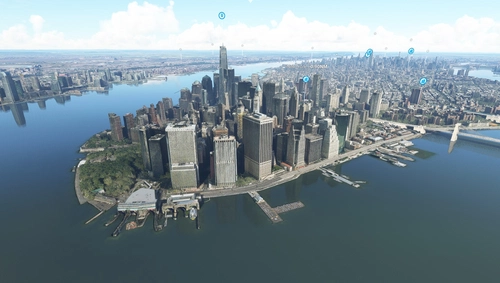
Water fix - New York City, New York, USA
Enhance the default scenery of New York City, USA with this mod that fixes water areas and removes misplaced trees near Kennedy and LaGuardia airports. Stay up to date with the modular installation feature and the latest bug fixes and improvements included in each update.
by mistercoffee1
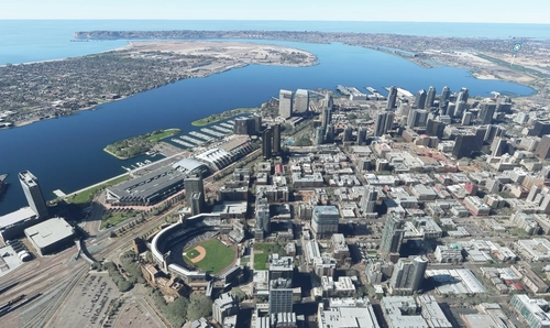
Water fix - San Diego County, California, USA
Enhance water visuals in San Diego County, California, USA with this mod. Corrects underwater roads, restores boat visibility, eliminates excess trees, and more. Please check out other water fix mods available for various locations across the USA.
by mistercoffee1
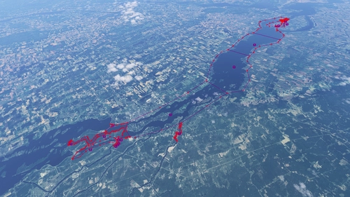
Worldwide Water Fix (WIP)
This add-on is a work-in-progress project for MSFS 2024 focusing on correcting water elevation issues encountered globally. The developer addresses problems as they are discovered during flights rather than systematically reviewing every location. Users can expect ongoing updates to enhance water accuracy throughout the simulators lifespan.
by AVCORP
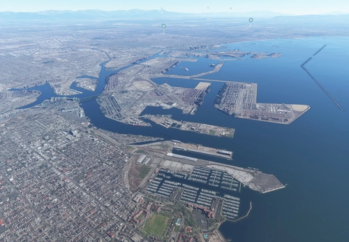
Water fix - Los Angeles County, California, USA
Enhance default scenery of Los Angeles County, California, USA with this mod fixing issues related to water and trees. Stay updated with V1.4 for World Update XIII compatibility and experience restored visibility of piers, jetties, and more. Install effortlessly by placing the "lawaterfix" folder in your community folder.
by mistercoffee1
almost 3 years ago