

Description
Radio Range Navigation
Description
This add-on for MSFS simulates the basic function of an the 1940's and 1950's radio range navigation.
Including a historically correct database of 400 stations from 1944 in the lower US 48 states. More stations can be added by the user.
An illustrated tutorial is included.
Installation & use
Unzip the file to a folder of your choice
This add-on runs outside of MSFS. It requires some alt-TAB.
Run the application after running MSFS.
This add-on may be use with any aircraft, ship, or car in MSFS.
Discord support
No support is offered beyond a discord channel “MSFS Astro Navigators Lounge”: DISCORD
Acknowledgement
A big and special thanks to Doug Davis, for his excellent site at https://flyingthebeams.com/
Donate
Developing this add-on, and creating the guide have cost me heaps of time.
I enjoyed it.
Still, feel free to help me pay for my graphics card upgrade for MSFS via the Donate button in flightsim.to.
September 2021, Eric van der Veen.
52°04’N, 4°14’E (Approximately)
Radio Range Navigation
Explore the functionality of 1940s and 1950s radio range navigation with this MSFS add-on. Features a database of 400 historically accurate stations from 1944 in the US 48 states, with the ability for users to add more. Includes an illustrated tutorial for easy integration into your flight simulation experience. Join the MSFS Astro Navigators Lounge on Discord for additional support.


Supporters

User Reviews
4 reviews
Version History
Fixed a bug that the aircraft position would not update correctly
Featured in Collections(1)





Related
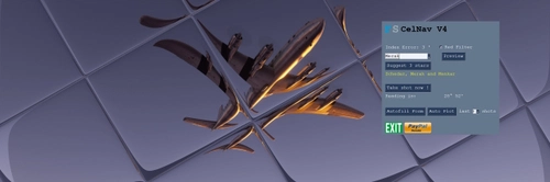
CelNav for MSFS
Experience realistic airborne navigation with CelNav for MSFS add-on. Practice Astro navigating using the Sun, Moon, planets, and stars. This tool simulates the function of a sextant, offering a unique way to navigate in the skies. Detailed guide included for those ready for an advanced flight experience.
by ElectronVolt

Terrain Following Radar Autopilot TFR-AP
The Terrain Following Radar Autopilot (TFR-AP) is an add-on for Microsoft Flight Simulator 2020 and 2024, designed to enhance low-altitude flying by using a standalone terrain database to scan ahead and adjust the aircraft’s elevation accordingly. Configurable for most aircraft, it can operate down to 200 feet. The add-on features user-friendly settings and maintains compatibility with the default autopilot for navigation and speed control. A manual is included to assist users.
by ElectronVolt
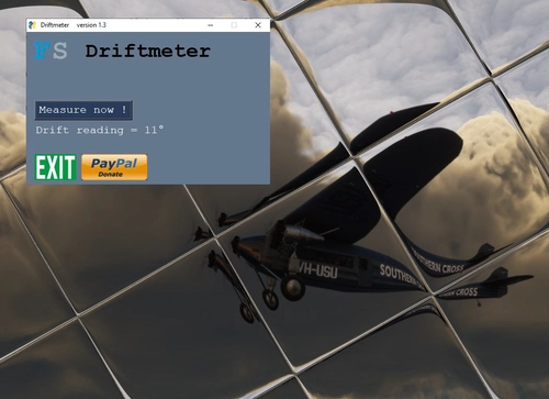
Driftmeter for MSFS
Add driftmeter functionality to your MSFS experience with this add-on. Measure wind-induced drift with a single click and enhance your Dead-Reckoning navigation, especially over water. Includes random error simulation and additional resources for improved accuracy. A valuable tool for precision flying enthusiasts.
by ElectronVolt

RealGyro for MSFS
RealGyro offers realistic drift on the Direction Gyro in MSFS, enhancing grid navigation and polar flights without GPS. This add-on features realistic drift, pause detection, and background running for (almost) all aircraft. Developed by CelestialNavigator, RealGyro is designed to provide an authentic flying experience with accurate gyroscopic behavior.
by ElectronVolt
Log in to join the discussion
Log InComments(33)
10 months ago
10 months ago
10 months ago
over 3 years ago
Truly, an astonishing accomplishment! Some beers on the way shortly.
A very minor correction on the location of one of the ranges, the Whitmore, California, range (AWH). The .csv file provided to plot the locations in LittleNavMap is a superb source and makes plotting cross country flights much easier. Having used it a bit (and LOVING it), I decided to try finding any traces of some of the old sites. Most of course have vanished, but the Whitmore site appears to still be there. It's on page 35 and 49 of the included facilities listing. By reference to the plotted location in LNM, it's just south of Whitmore road. Looking at the same location in Google Earth, just to the north of the road from where it's plotted in LNM you can still see the entire site (5 poles for the range antennas and two more for comm, plus the blockhouse), just like one of the pictures here: https://flyingthebeams.com (about halfway down the "What it Was" page).
over 4 years ago
Hi ElectronVolt, the description of Radio Range Navigation says that this add-on may be used with any aircraft, ship, or car in MSFS. However when I want to use it for instance in a Cessna 172, this aircraft (and most aircraft!) has no radio equipment to tune in a radio beam station nor can you hear the N of A. You need a historical 1930s radio, so how can you say that is may be used with any aircraft?
over 4 years ago
Because this download version is stand-alone, it runs outside of MSFS. It does not even know what aircraft you have. So, you can run the .exe, it will connect to MSFS and retrieve aircraft position, and then play the sounds accordingly. You operate it from the GUI, not a radio unit. I used it with the DC-6B, the MB-339, and more. Only the version that comes with the B247 which has the radio unit remains restricted to the B247.
over 4 years ago
I do not understand what you mean by "you operate it from the GUI”. GUI is an abstract word for me, what GUI precisely? Please be more specific.
over 3 years ago
GUI is Graphical User Interface. I suggest you take the time to go through the entire included step-by-step guide in the Documents folder as it explains how to use the GUI. Read first to understand how it works and then try it any MSFS aircraft. It's a .pdf called "Radio Range Navigation PMDG DC6 step by step guide version 0.2.pdf
over 4 years ago
Hi Eric, where can I find the add-on GUI to use? I've looked into the files of the folder "MSFS FlyingTheBeam v1.002" but no file that looks like this add-on?
over 4 years ago
Not sure I understand correctly. In the install folder for 1.002 just click the FlyingTheBeam v1.002.exe and it should work with the GUI.
over 4 years ago
It works now, thank you.
I've another question. I was busy planning the flightroute KSNA-KNYL page 9 from your Step-by-step Guide. When I dial in the frequency of 388 in the screen called "Python Turtle Graphics" and press 'pilot', the station ZQ (Presque Isle) appears in stead of RV (Riverdale). Apparently in the stationlist.csv there are many radio stations with frequency 388. So how can you select the right radio station other than dial in the frequency of 388 in that screen?
over 4 years ago
Perhaps your aircraft was still parked elsewhere while planning, or still in the menu or map mode? The plotter takes the nearest station. So ZQ may have been nearer at that point in time.
over 4 years ago
Indeed, that was the reason; now I understand how to plot the right station; thank you.
over 4 years ago
Hi Eric,
I love to use your beautifull work. I do think you did an outstanding job!
I'm using your work in the new B247 from Wing42.
You extended the beacon database there to Alaska, Europe, Hawai, etc.
I understand you must have been very busy for the B247 but is there a way to use these in this addon so I can use them with other aircraft too?
Thanks anyway for your wonderfull addon.
over 4 years ago
Hi ElectronVolt and thank you for your work on the radio range navigation.
I am a 100% VR simmer and just would like to ask whether there is a way how to make this tool natively available in VR in MSFS?
Thanks.
over 4 years ago
The tool is improved and avail in MSFS in the recently published Boeing 247D bij Wing42.com. That should also work in VR. There are several youtube videos with reviews already.
over 4 years ago
Thanks for a quick reply. I got the Boeing 247D and I plan to fly radio range nav with it :-)
I hoped to do the same with the Electra and therefore my question.
over 4 years ago
What a beautifull work have you done.
I've used the system in fs2004 too. There where some realy nice gauges too that you could build in your panels. Maybe you could use those too.
Thanks very much anyway.
over 4 years ago
Thank you! Unfortunately, MSFS does not feature 2D panels like FSX did.
Fortunately....something is coming. Stay tuned for the Wing42 Boeing 247....
over 4 years ago
Looking forward to the 247. Thank you.