
Description
Säntis (Mountain) is located in the northeast of Switzerland and the highest Peak in the Alpstein massiv with an observation deck on its top. The mountain has an elevation of "only" 2,502m (8,209 ft), but the massiv is very exposed only surrounded by hills, what causes a very rough weather. From the top, six countries can be seen: Switzerland, Germany, Austria, Liechtenstein, France and Italy. The edged ridge and the green hills are a paradise for hiking and paragliding. Once the mountain range was in a preselection for Swiss Airforce as a practice area, but we are happy the title went on Axalp nearby Interlaken. Now its a playground for us in the Sim! The next Airports are Flughafen St. Gallen Altenrhein LSZR, Flugplatz Mollis LSZM (Swiss Airforce) and Flugplatz Bad Ragaz LSZE. Other landmars nearby are Churfirsten (mountain range in the south) and St. Gall (City in the north). Both can be downloaded here.
GPS: 47°14′57.73″N 9°20′35.92″ECoordinates: 47°14′57.73″N 9°20′35.92″E Coordinates: 47°9′7″N 9°17′53″E
File:
After World Update 6 (DACH) this area looks great in the sim and works much more stable without adding this file. There is no need anymore to download it.
The Scenery is a mix of two seasons. The Google Data are shot in Winter, the MSFS Data look like Summer. For the moment the observation deck and antennas on top of Säntis and Hoher Kasten are missing. I know, it is very large (a span of nearly 20km), so i had to split it in four areas. You can use only Scenery_Alpstein_Saentis with the highest peaks, or you combine it with the whole mountain range.
Credits:
This scenery has been extracted from Google Maps, hence all 3D credits goes to Google.
This scenery has been generated with the Google Earth Decoder tool (credits to /u/Jonahex111):
https://www.reddit.com/r/FS2020Creation/comments/j3faaj/google_earth_decoder_now_userfriendly/
Thanks to Kelarius for his Youtube-Video!
Installation:
Extract Scenery_Alpstein_Saentis and move the four files (Scenery_alpstein_saentis, _ebenalp, _hoherkasten and _luetispitz) into the Community folder. Don't forget to restart the Microsoft Flight Simulaor after that. Thats it!
Mt. Säntis and Alpstein (Mountain Range) Switzerland
Discover the beauty of Mt. Säntis and Alpstein Mountain Range in Switzerland, showcasing rough weather, an observation deck, and stunning scenery for hiking and paragliding. This add-on covers an area of nearly 20km split into four sections, allowing customization from peaks only to the whole range. Extract and move the files to your Community folder for easy installation and enjoy exploring this picturesque Swiss landscape in Microsoft Flight Simulator.

User Reviews
3 reviews
Location
More Information
Version History
No version history available.
Related
Matterhorn Mountain
Explore the stunning beauty of Matterhorn mountain with this add-on, featuring a fully photogrammetry-based model and terraformed edges for a more realistic experience. Version 2.0 includes new additions such as improved LOD levels, color-corrected textures, cable car pylons, and populated forests. Install by dragging the folder into your "Community" folder and enjoy the enhanced scenery around this iconic peak.
by NikPrist
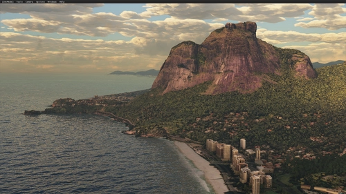
Rio de Janeiro Megapack Montanhas
Explore the detailed mountainous landscape of Rio de Janeiro in this updated megapack. Precisely positioned mountains like Pedra da Gávea and Pão de Açúcar using Google Maps models. Create your mod via Earth2MSFS for an effective import process. Stay tuned for further updates with optimized textures and added landmarks. Individualize your experience by adding specific mountain ranges to enhance your simulation.
by RodrigoMoraes94
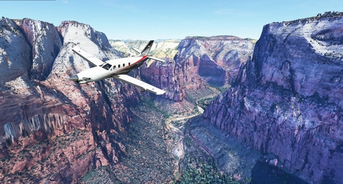
Zion Canyon National Park, Utah
Explore the breathtaking beauty of Zion Canyon National Park in Utah with this V1.0 scenery add-on. Discover well-known locations like the Zion Canyon Overlook, Angels Landing, and more. Experience corrected terrain heights and improved color blending for a more immersive flight simulation. Simply extract the file to your Community Folder and start your aerial adventure in this stunning national park.
by Jeppeson2001
Chamonix-Mont-Blanc, Rhône-Alpes, France - Valley
Explore the stunning Chamonix-Mont-Blanc valley in Rhône-Alpes, France with this addon, including a semi-fictional DZ at Argentière. Enhance your experience by combining it with the Mountains addon. Download, extract into community folder, and enjoy photogrammetry and object data. This addon requires a minimum configuration for optimal performance.
by AdrianL
Comments(14)
Log in to join the discussion
Log Inalmost 5 years ago
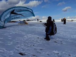
My hiking region in the flight simulator, how nice! As already mentioned here, I also hope for the Säntis mountain station. In advance, I have already started an exploratory tour through the valleys of the Alpstein with the MB339:
https://www.youtube.com/watch?v=WVCJnw-FikQ&t=378s
Meine Wander-Region im Flugsimulator, wie schön! Wie schon hier erwähnt, hoffe ich auch auf die Säntis-Bergstation. Vorab habe ich mit der MB339 schon mal eine Erkundungstour durch die Täler des Alpsteins gestartet:
https://www.youtube.com/watch?v=WVCJnw-FikQ&t=378s
over 4 years ago
Thanks for your comment. I added your Youtube-Movie to my screenshots. But after World Update 6 there is no need anymore to add my file to the sim. Enjoy flying!
about 5 years ago
Hab dich eben in Konstanz am Flughafen getroffen.....
Wie überzeuge ich dich Radolfzell meine alte Heimat zu bauen?
about 5 years ago
over 5 years ago
I have to say though, on my midrange computer, I can't really use it in VR. The performance is way to low, framerates drop like a stone when I get close to the area.
Let's hope Asobo will work on the alps soon. They really have to. The whole Swiss, Austrian and Italian Alps definitelly need to be improved massivly.
The data exists... let's hope they will use it.
over 5 years ago
over 5 years ago
over 5 years ago
over 5 years ago
aber auf jedenfall ein riesenspass, die seen im alpstein abzuklappern :-)
over 5 years ago
over 5 years ago
over 5 years ago
Vielen Dank für Deine Arbeit
about 5 years ago
about 5 years ago