Description
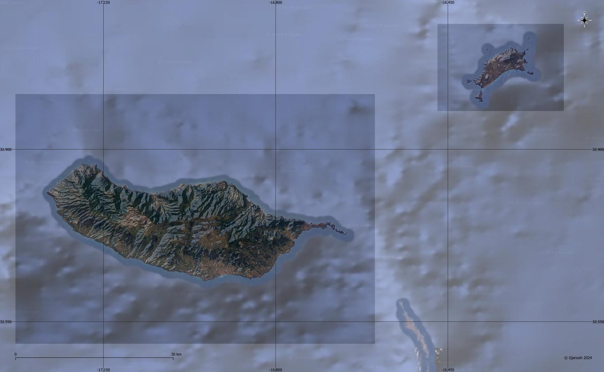
DEM / ETM10 - Enhanced Terrain Mesh 10m for Madeira and Porto Santo Islands
This is an Enhanced Terrain Mesh derived from Sentinel-1A mission of the European Radar Observatory for the Copernicus joint initiative of the European Commission (EC) and the European Space Agency (ESA), 10 meters (1/3 arc sec). Mainly the area covered by this terrain mesh is related to the region of ... see coverage map.
Affected Sceneries
Any large Payware and Freeware Airport I could think of, has been excluded from the mesh. So hopefully the glitches will be minimal.
Please report any bugs with sceneries or airports and I will see what I can do!
Created using MSFS Toolkit by Nool Aerosystems (MSFS Toolkit).
On Discord: ItalianCharter Team // Gjanosh61#9850
Please don’t feel as though you have to, but if you wanted to buy us and the team a coffee to support the work. Thank you very much.
Buy Gjanosh61 a coffee
Scenario Release Temporarily Suspended
Dear Virtual Pilots,
After over 20,136 downloads and only 465 likes (2.31%), I have decided to temporarily suspend the release of new scenarios, both in freeware and donation formats.
This is not a controversial decision, but rather a pause for reflection.
The ETM10m project was born from a deep passion for VFR flight and the desire to offer realistic and curated content to the community. However, the low response leads me to question the real interest in this type of work, which requires time, study, and dedication.
I sincerely thank everyone who appreciated, commented, or supported the project. For those who would like to learn more or receive the full version, I remain available privately.
📬 Contacts
Discord: ItalianCharter Team (Gjanosh61)
Facebook: ItalianCharter Team
Flightsim.to: Gjanosh61
Thank you for your understanding. Happy flying everyone.
Comments(8)
Log in to join the discussion
Log Inabout 2 years ago
about 2 years ago
about 2 years ago
over 2 years ago
over 2 years ago
Qualquer grande aeroporto de Payware e Freeware que eu possa imaginar foi excluído da malha. Então, espero que as falhas sejam mínimas."
Contudo, se até agora não recebi quaisquer outros relatórios a este respeito, deduzo que são plenamente compatíveis.
Saudações e bom voo
over 2 years ago
over 2 years ago
DEM / ETM10 - Enhanced Terrain Mesh 10m for Madeira and Porto Santo Islands
Enhanced terrain mesh at 10m resolution for Madeira and Porto Santo Islands, derived from Sentinel-1A mission data. Excludes major payware and freeware airports for minimal glitches. Created with MSFS Toolkit by Nool Aerosystems. Contact on Discord: ItalianCharter Team // Gjanosh61#9850.
Downloads Stopped
The creator has temporarily stopped downloads for this addon. Please check back later.
Location
More Information
Version History
No version history available.
about 2 years ago
I would like an update, thanks!
Best regards Esa Sairio, Finland