Description
Important! To better enjoy this scenery, download also Gibraltar scenery here: https://flightsim.to/file/65681/gibraltar
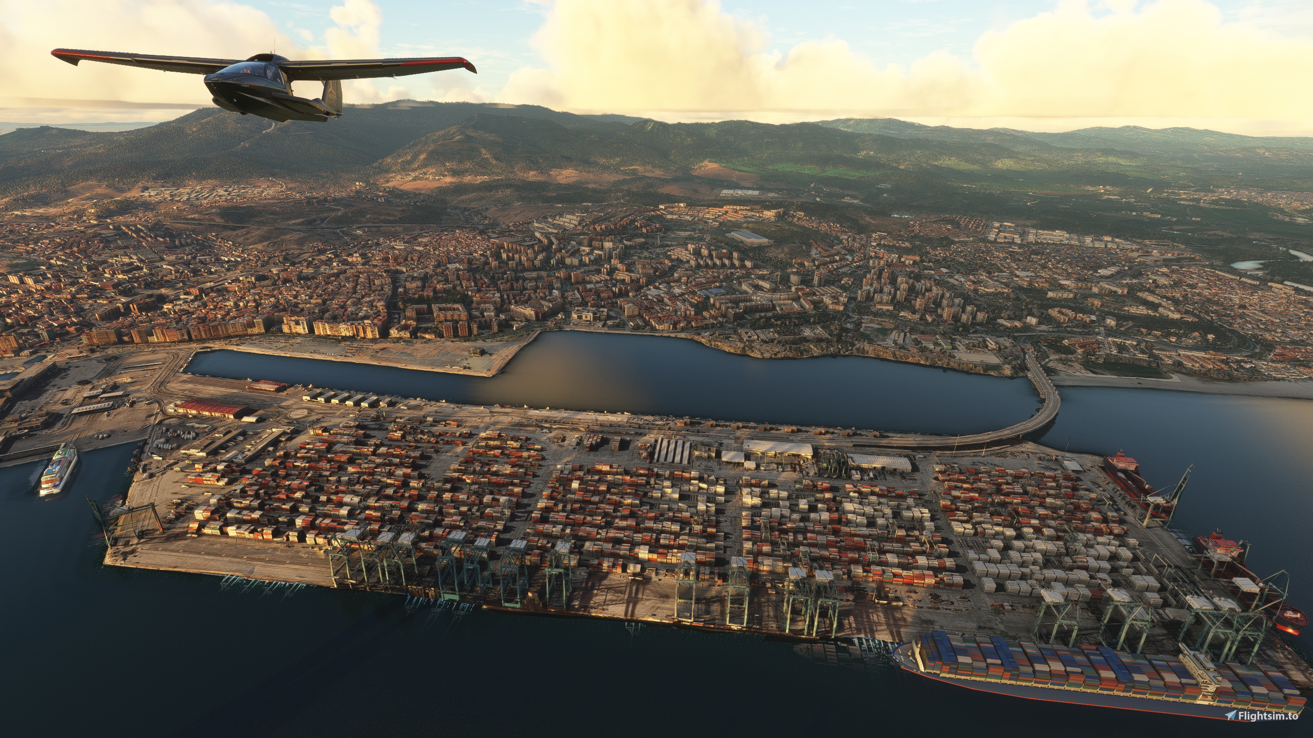
Algeciras is a municipality of Spain belonging to the province of Cádiz, Andalusia. Located in the southern end of the Iberian Peninsula, near the Strait of Gibraltar, it is the largest city on the Bay of Gibraltar (Spanish: Bahía de Algeciras).
The Port of Algeciras is one of the largest ports in Europe and the world in three categories: container, cargo and transshipment. The urban area straddles the small Río de la Miel, which is the southernmost river of continental Europe. As of 1 January 2020, the municipality had a registered population of 123,078, second in its province after Jerez de la Frontera and greater than Cádiz city population.[2] It forms part of the comarca of Campo de Gibraltar.
The surrounding metro area also includes the municipalities of Los Barrios, La Línea de la Concepción, Castellar de la Frontera, Jimena de la Frontera, San Roque and Tarifa, with a population of 263,739.
GPS: 36° 7′ 39″ N, 5° 27′ 14″ W
Credits:
Microsoft and Asobo for this fantastic MSFS software.
This scenery has been extracted from Google Maps, hence all 3D credits goes to Google.
This scenery has been generated with the Google Earth Decoder tool (credits to /u/Jonahex111):
https://www.reddit.com/r/FS2020Creation/comments/j3faaj/google_earth_decoder_now_userfriendly/
Addon history:
v1.0: initial release
v1.1: fix elevation to better blend with Gibraltar scenery
Installation:
Download the main file. Extract the content of the archive into the Community folder.
If you want to donate, you will always be welcome to help me continue with more projects and update the existing ones https://paypal.me/Thalixte.
Comments(7)
Log in to join the discussion
Log Inalmost 2 years ago
This wonderful addons now conflicts with the new photogrammetry.
I would say just a small part conflicts with Thalixte-algeciras because the new photogrammetry just covers Gibraltar and la linea de la concepcion as you mentioned.
So it makes this addon still essential, important.
Besides, the new photogrammetry
conflicts with the default airport scenery. It seems that Asobo forgot to update it. They didn't remove some autogen buildings and the rock remains the same ugly artificial one.
over 1 year ago
https://flightsim.to/file/78639/gibraltar-terrain-fix-for-default-asobo-lxgb
over 1 year ago
over 2 years ago
Muchas gracias por tu trabajo.
Saludos.
over 2 years ago
over 2 years ago
Algeciras
Experience the beauty of Algeciras, Spain in Microsoft Flight Simulator with this detailed scenery add-on. Explore the largest city on the Bay of Gibraltar, known for its bustling port and stunning views. Enhance your virtual flying experience with this accurate representation of the municipality and surrounding metro area. Install the scenery and take to the skies to discover the charm of Algeciras from above.
User Reviews
2 reviews
Location
More Information
Version History
Fix elevation to better blend with Gibraltar scenery
Related
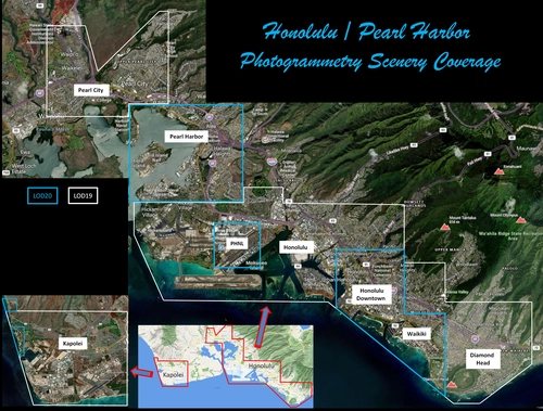
Honolulu
Explore the photogrammetry scenery of Honolulu, including the iconic Pearl Harbor area with optimized performance for better FPS. Discover Waikiki, Honolulu downtown, and more with this detailed addon. Enhance your experience by adding free mods for carriers, battleships, and military airplanes in Pearl Harbor and surrounding bases. Support the creator for future updates if you enjoy this mod.
by steveli
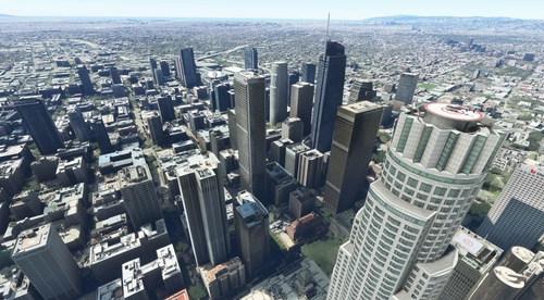
Downtown Los Angeles
Various buildings and monuments that are missing from Los Angeles in the game that shoudn't be. Wilshire Grand Center, SoFi Stadium, 801 S Grand, 825 S Hill, 888 S Hope, 1000 Grand, Apex the One, Atelier, Aven Apartments, Metropolis Towers, Level Los Angeles
by senecadriver
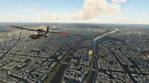
Paris
Explore the iconic cityscape of Paris in Microsoft Flight Simulator. This detailed add-on captures the essence of the French capital, featuring famous landmarks and architectural marvels. With accurate GPS coordinates, immerse yourself in the beauty of Paris, known for its historical significance and vibrant culture. Download now and experience the City of Light from a whole new perspective.
by Thalixte
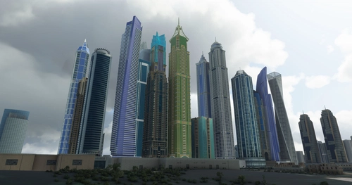
Dubai City Pack
Explore a detailed rendition of Dubai City and Jebbel Ali Port featuring over 250 custom buildings and various landmarks like the iconic hotels and tourist attractions. While focusing on enhancing the daytime visuals, this pack offers improved textures for select buildings, promising a refreshing experience for simmers. Additionally, adjustments have been made to SkyDive Dubai Airport to address previous elevation issues, ensuring a more immersive flight into this dynamic cityscape.
by risuali
almost 2 years ago
Now we have a good TIN scenery for Gibraltar (WU 17) that includes a part of "La Linea de la Concepcion" (north of the airport), it would be awesome if you could update your Algeciras photogrammetry to avoid any conflict and take advantage of the better photogrammetry provided by Microsoft.
Thanks for ur work anyway !