
Description
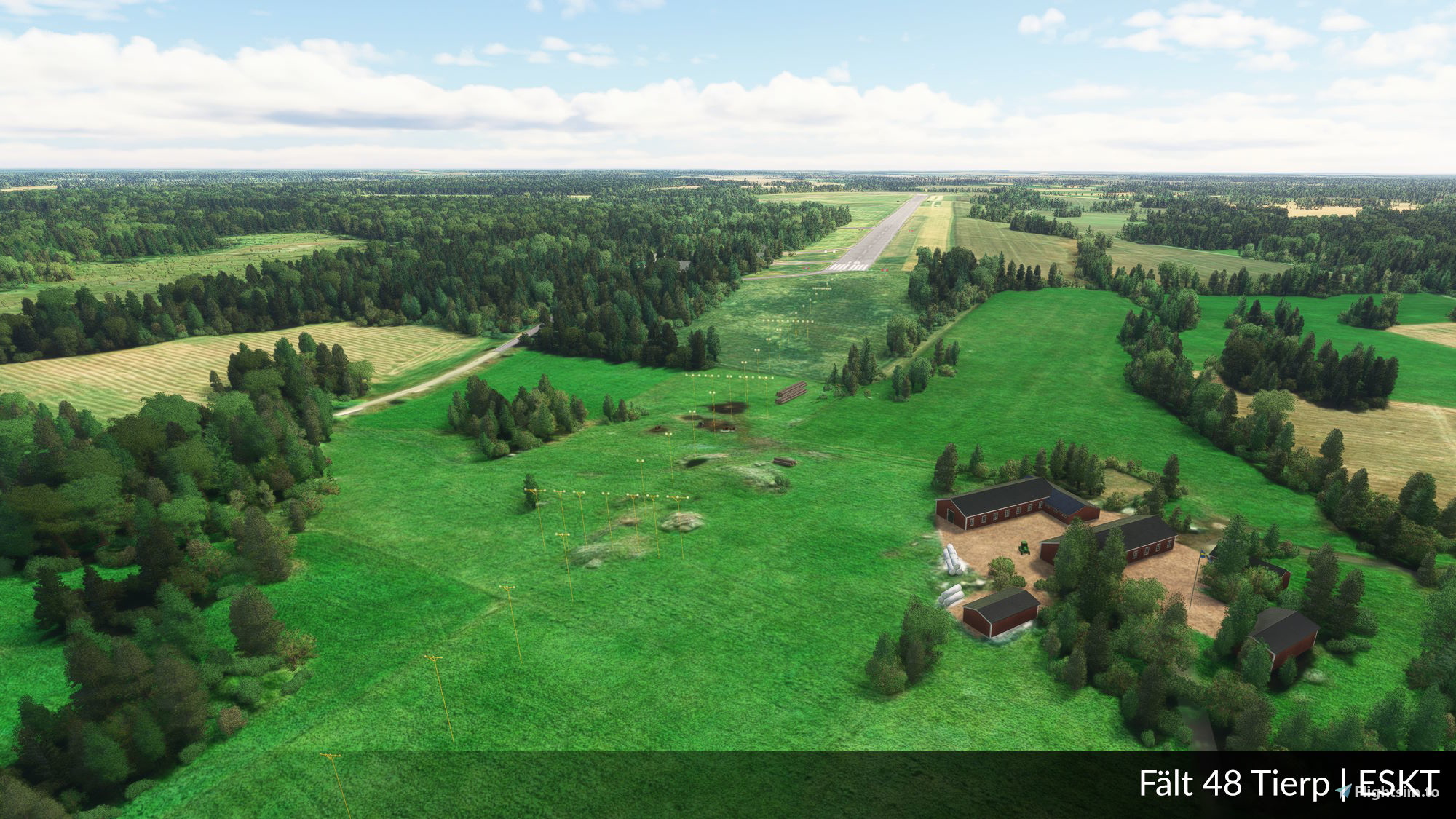
This is a scenery of Fält 48 Tierp and it is made to reflect how the airbase looked when being in use as a Bas 60 airbase. The was closed by the Swedish Air Force in 1999 and the northernmost part has been used as a airport for the local flying club since then. The sothernmost end is nowadays converted into a motor-track and has hosted multiple car races.
Dependencies
Location
Fält 48 Tierp | ESKT
Explore the virtual rendition of Fält 48 Tierp (ESKT), a former airbase turned flying club and motor track. This add-on faithfully recreates the Bas 60 airbase as it appeared before its closure in 1999, providing a glimpse into its aviation history and present-day transformations.


User Reviews
2 reviews
Version History
- Added orto and removed polygons to cover the racing track - Removed apron with SK50 due to non existing at the time - Added new signage - Corrected taxiways - Corrected approach light - Added ILS RWY 16 - Added comms - New buildings in area from SWABOL 2.0 - Added details at farm close to RWY16
Related

Swedish Airbase Object Library (SWABOL)
A comprehensive object library essential for Swedish Airbase scenery creations, continually expanding with new aircraft types and upgrades. Ideal for developers looking to enhance their virtual aviation environments. Check out the library documentation for developers at the provided link.
by joakimhz

Fält 50 Strängnäs | ESKZ
Experience a detailed recreation of the Strängnäs-Malmby Airbase, former Swedish Air Force Base 60, now closed since 2005. Explore this historical airbase not included in the default MSFS database, with dependencies on the Swedish Airbase Object Library and Terrainfix for Sörmland and Östergötland.
by joakimhz

Fält 42 Björkvik | ESKX
Explore the detailed recreation of the former Swedish Air Force base, Björkvik Airbase, in this addon. Experience the Bas 60 airbase as it appeared before its closure in 2000. Dependencies: Swedish Airbase Object Library and Terrainfix for Sörmland and Östergötland. Please remove previous versions before installing.
by joakimhz

Fält 66 Fällfors | ESUF
Experience the historical Fält 66 airbase in Fällfors with this detailed scenery depicting its Bas 90 era. Explore the short runways A, B, and C, while imagining the activities that once took place on Runway D. Witness the transformation of the airbase post-military use, now hosting Swedens longest car race track. Dont miss out on this realistic recreation of a significant part of Swedish aviation history.
by joakimhz
Log in to join the discussion
Log InComments5
Jättesnyggt gjort! Roligt att du gjort så många Bas 60/90, dom är verkligen jättefina! Har du funderat på att göra flottiljer som typ Malmen (ESCF), Uppsala (ESCM) eller Såtenäs (ESIB)? Skulle vara jättekul att flyga till dom flygplatserna då det inte finns något bra scenery till dom i nuläget. :)
Hej Isak! Jag vill tyvärr inte göra något som är aktivt, i synnerhet inte i dessa tider då jag tycker lagstiftningen är något luddig kring vad som får eller inte får avbildas.
Hej, ja det är helt förståeligt i dessa tider. Jag tänkte inte på det. Men har du funderat på att göra exempelvis reservbanor (vägrakor och uppställningsplatser) ur Bas 90 eller Bas 60 systemet? Kanske vägrakan vid Riksväg 44 eller något annat lämpligt ställe där man hade Bas 60/90. Tror du att det är möjligt att skapa vägbaser till MSFS? Skulle nog faktiskt vara rätt så coolt.