
Description
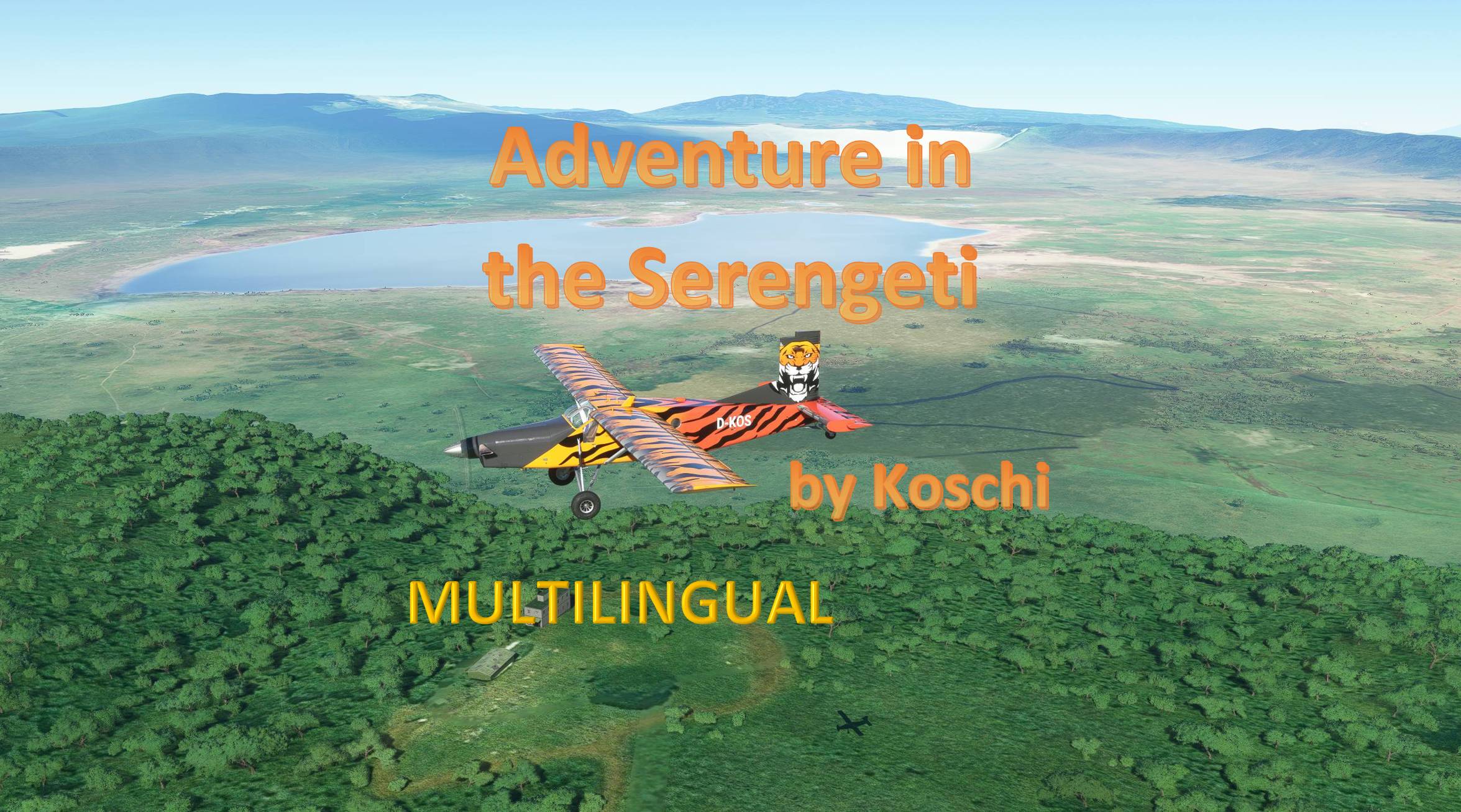
Adventure in the Serengeti - Charter Pilot in Serengeti National Park
Here is a trip with challenges for real bush pilots, i.e. increased level of difficulty. Land on runways somewhere in the terrain, rescue a climber on the glacier of Kilimanjaro and cope with system failures. Watch herds of elephants on their way through the wilderness, track down poachers and more. The plane will be loaded differently at the airfields, which will affect how it flies.
As perhaps in real life, you are an amateur pilot who takes on all sorts of assignments for the Serengeti National Park Authority while on vacation so that some money comes into the vacation coffers on the side. The journey starts at Seronera Airstrip, the primary airfield of the Serengeti National Park and will bring you back here in the end.
Specification:
- You are flying the Pilatus PC 6 from MS, which can be exchanged for the pay ware version with little effort. You can find instructions in the exchange file. Alternatively, the MissinChanger from BuffyGC can be used. Because of the loading points I would not recommend any other aircraft.
- The flight distance is 617 nm, with 13 legs.
- MULTILINGUAL: The trip is machine translated into all MSFS languages except Chinese and Japanese. Therefore, there may be errors in the translation. If anyone knows a better translation, please send it to me. The basic language is German.
- There is no GPS heading. Use the ICAO identifiers of the airfields in the G 1000 to navigate.
- Weather is user selectable. Live weather is preset.
- The button "Load and refuel" is only available at airports with refueling station.
- Turn off engine and battery and apply the handbrake to finish the flight.
- Use ATC if you like.
- The empty airfields have been upgraded a bit with buildings and other things. Many thanks to the creator, who does not want to be named here.
Have fun flying and always safe landings,
Koschi
Helpful tips:
- Sometimes the trip does not end. This can be due to the following reasons:
On grass runways, the airfield often has no additional area to register the landing. In this case, stay on the grass runway and finish the flight there.
Go to the main menu after each finished leg and then start the next leg. There is one exception, after landing on Kilimanjaro: do not go back to the main menu here, but continue the next flight by clicking 2x on "Continue". - Since SU11, the simulator does not save the progress in time intervals anymore, but only after a waypoint has been flown over. To avoid having to start over after a crash landing, empty waypoints are inserted - about 10 NM before the next destination.
Recommended addons:
Seronera Airstrip, Serengeti, Tanzania by benshares
Created with BushTripInjector by BuffyGC.
Abenteuer in der Serengeti – Charterpilot im Serengeti-Nationalpark
Hier ein Trip mit Herausforderungen für echte Bush-Piloten, also erhöhtem Schwierigkeitsgrad. Lande auf Pisten irgendwo im Gelände, rette einen Bergsteiger auf dem Gletscher des Kilimandscharo und werde dabei auch noch mit Systemausfällen fertig. Beobachte Elefantenherden auf ihrem Weg durch die Wildnis, komme Wilderern auf die Spur und einiges mehr. Das Flugzeug wird an den Flugplätzen unterschiedlich beladen sein, was sich auf das Flugverhalten auswirken wird.
Wie vielleicht auch im richtigen Leben, bist du ein Hobbypilot, der in seinem Urlaub alle möglichen Aufträge für die Serengeti-National-Park-Behörde annimmt, damit nebenbei noch etwas Geld in die Urlaubskasse kommt. Die Reise beginnt am Seronera Airstrip, dem primären Flugplatz des Serengeti National Parks und wird dich am Ende auch wieder hierher zurückführen.
Spezifikation:
- Du fliegst mit der Pilatus PC 6 von MS, die mit geringem Aufwand gegen die Payware-Version ausgetauscht werden kann. Eine Anleitung dazu findest du in der Exchange-Datei. Alternativ kann der MissinChanger von BuffyGC verwendet werden. Wegen der Beladungspunkte würde ich kein anderes Flugzeug empfehlen.
- MULTILINGUAL: Der Trip ist in alle Sprachen des MSFS maschinell übersetzt, außer chinesisch und japanisch. Daher können in der Übersetzung Fehler auftreten. Wer eine bessere Übersetzung weiß, kann sie mir bitte schicken. Die grundlegende Sprache ist Deutsch.
- Die Flugdistanz beträgt 617 nm, mit 13 Etappen.
- Es gibt keinen GPS-Kurs. Nutze die ICAO-Kennungen der Flugplätze im G 1000 zum Navigieren.
- Das Wetter ist frei wählbar. Live-Wetter ist voreingestellt.
- Der Button „Beladen und Tanken“ ist nur auf Flughäfen mit Tankstelle verfügbar.
- Stelle Motor und Batterie ab und ziehe die Handbremse an, um den Flug beenden zu können.
- Nutze ATC, wenn du magst.
- Die leeren Flugplätze wurden durch Gebäude und andere Dinge etwas aufgewertet. Vielen Dank an den Kreator, der hier nicht genannt werden möchte.
Viel Freude beim Fliegen und immer sichere Landungen,
Koschi
Hilfreiche Tipps:
- Manchmal beendet sich der Trip nicht. Das kann folgende Ursachen haben:
Auf Grasbahnen hat der Flugplatz oft keine zusätzliche Fläche, um die Landung zu registrieren. Bleibe dann auf der Grasbahn stehen und beende dort den Flug.
Gehe nach jedem beendeten Leg ins Hauptmenü und starte dann das nächste Leg. Es gibt eine Ausnahme, nach der Landung auf dem Kilimandscharo: Gehe hier nicht ins Hauptmenü zurück, sondern setze den nächsten Flug fort, indem du 2x auf "Weiter" klickst. - Der Simulator speichert den Fortschritt seit SU11 nicht mehr in Zeitabständen, sondern nur noch, nachdem ein Wegpunkt überflogen wurde. Um nach einer Bruchlandung nicht von vorne beginnen zu müssen, sind - etwa 10 NM vor dem nächsten Ziel - leere Wegpunkte eingefügt.
Adventure in the Serengeti
Embark on an exciting adventure as a charter pilot in Serengeti National Park. Face challenges such as landing on remote terrains, rescuing climbers, and managing system failures while observing wildlife. Fly the Pilatus PC 6 on a 617 nm journey with 13 legs, all within a beautifully designed setting. Enjoy this unique experience and safe landings in the Serengeti skies.
Supporters

User Reviews
3 reviews
Version History
Since SU11, the simulator does not save the progress in time intervals anymore, but only after a waypoint has been flown over. To avoid having to start over after a crash landing, empty waypoints are inserted - about 10 NM before the next destination. # # # # # # # # Der Simulator speichert den Fortschritt seit SU11 nicht mehr in Zeitabständen, sondern nur noch, nachdem ein Wegpunkt überflogen wurde. Um nach einer Bruchlandung nicht von vorne beginnen zu müssen, sind - etwa 10 NM vor dem nächsten Ziel - leere Wegpunkte eingefügt.
Related

Discover Germany - Part 1
Explore Germanys rich history and diverse landscapes with this Bush-Trip add-on. Discover iconic destinations such as Berlin, the Baltic Sea, North Sea, and Elbe River, covering 938 NM with 20 legs. Enjoy flying with a Cessna Skyhawk G1000 and multilingual support for a truly immersive experience. Install, start your engine, and embark on an unforgettable adventure in the skies.
by Koschi

Discover Germany - Part 2
Explore Germany from the Elbe to the Rhine in this flight simulation add-on. Follow a 863 NM route with 15 legs, flying a Cessna Skyhawk G1000. Available in multiple languages, with detailed landmarks and customizable weather settings. Installation is easy - just unpack and enjoy discovering Germany for yourself.
by Koschi

Discover Germany - Part 3
Embark on a journey through historical sites along the Rhine River in "Discover Germany - Part 3," covering 531 NM from Emmerich airfield to Lake Constance. Explore areas settled by the Romans and experience all the sights of World Update 6. Fly in a Cessna Skyhawk G1000 with multilingual support and customizable weather options. Join the adventure and discover Germany for yourself.
by Koschi
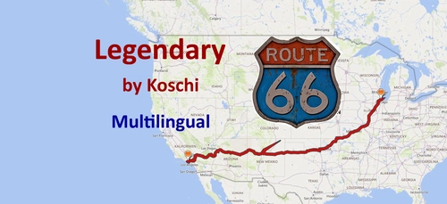
Legendary Route 66
Embark on the legendary Route 66, spanning 2,448 US miles from Chicago to LA/Santa Monica. Experience historical events and landmarks along the way in this immersive journey. Fly with a Cessna Grand Caravan EX and follow waypoints for a smooth simulator experience. Installation is easy - just extract the folder into your MSFS community folder.
by Koschi
Log in to join the discussion
Log InComments(37)
11 months ago
I like this nice adventure, but I stick in Mosha. They have a real bad mechanical service over there. It needed just a small reparation and they don't get it. The engine doesn't start after repairing. After new start it looks like at the Picture and I haven't any chance to start. But the engine is working ...
What is to do?
almost 4 years ago
Hi Koschi,
My journey ended at HTWK as when trying to set up the next leg the plane was parked way off the runway, surrounded from bush and trees. The was no way getting out there without crashing sooner or later. I've tried compiling the airport, having it's ARP just centered on the runway - without avail. Likely I can help myself when looking into your project files, but I think it would be better updating your package.
BTW, I love specifically this Bush Trip as I can remember this area quite well, of course not all destinations. Well, we took public buses and and some guided tours. Actually, I would have included the Ngorongoro Crater and Lake Manyara as both places where most impressive (despite the double peaks of Uhuru and Mawensi, of course).
EDIT: It works this way (changed it in your .FLT-file twice, at line 116 and 176):
Waypoint.8=AG, HTWK, , West-Kilimandscharo, A, S3° 03' 20.33", E36° 59' 56.29", +008500.00,
ADE told me those coordinates for the middle of the runway:
LAT: -3.05564727634192, LON: 36.9989682734013 (E)
Hope it helps.
almost 4 years ago
Hello FlyingAxx,
you have caused double joy with me.
1. because you like the trip so much,
2. because you could help yourself.
Before SU 11, it was the case that the aircraft took off from where you left it. Now, when you return to the main menu after a leg, the plane is in front of the runway and sometimes in a bush or tree. This bug is known and should perhaps be fixed with the next update.
https://devsupport.flightsimulator.com/questions/12357/bug-spanwing-position-bushtrips-leg-2.html
Many greetings from the German east coast,
Koschi
almost 4 years ago
Hi Koschi,
As it seems SU11 is causing even other bugs, too. I observed flying elephants and a giraffe until being very close to Loomalisin Peak. Actually, I saw before trees causing strange effects while hovering over the landscape before the mesh popped up - way too close for my taste. Little islands where flat while approaching and then popping up as if somebody underneath blows the bellows. The same happens with other detailed mesh as well, as it surely particularizes too late.
almost 4 years ago
Thanks for the description. However, bush trips have no influence on how the mesh is displayed or in which order and speed it is built up. That has rather something to do with the load of the servers and with the speed of your Internet connection.
Greetings, Koschi.
almost 4 years ago
Well, it's rather the server speed. I'm connected via fibreglass and never saw any download speed going even close to the maximum. The popping mesh seems to be a new phenomena as I didn't see it before SU10 (or even later). It even happens while seeing the frame rates beeing limited by my settings.
almost 4 years ago
Hi Koschi,
BTW, in Moshi the restart happens while sticking with the left wing in a house - no chance to move in any direction.
The coordinates to correct this are: S3° 21' 43.74", E37° 19' 42.67" (for others: description where to do it can be seen above).
After Arusha your hint only works in conjunction with Google. Regarding other sources (Openstreetmap and Wikipedia) this road name doesn't exist in Tanzania any more. There are some rudiments left, but officially you can only find it beginning at Kenya's border towards Nairobi. The most recent name seems to be "T5". You may consider updating this in form of an additional information (which one ever).
BTW, I'm wondering why ever ASOBO and MS are not using coordinates in Decimal format.
almost 4 years ago
Yes, you are right. I did not compare this with other maps and was not prepared for the fact that there could be different names for it. I made a note and will change it in the next update. Thanks for the hint.
almost 4 years ago
Hi again, its the same with the road number at the last leg (T17 now). What I really missed while flying towards Naabi Hill was the trail of dust of the cars below me. When seeing this road almost forgotten memories came back, having to do with dust and gnashing of tees because of the sand. As you can see, I'm ready now and enjoyed the trip, despite the mentioned hurdles.
As I think that both of us are covered with almost the same clouds at the moment, I'm going to stay virtually in the southern hemisphere until Spring.
almost 4 years ago
Do what you want. I wish you the best and thank you very much for the tips.
Many greetings from the German Baltic coast.
over 4 years ago
Hi Koschi,
Just wanted to let you know I successfully competed all of the legs! Your tips for the Moshi leg worked. That was a real challenge, and it gave me the opportunity to learn how to handle that situation.
I really liked this bush trip. The story and added twists made it very enjoyable.
Looking forward to the Mississippi River bush trip. That's in my part of the world!
Thanks again.
RK
over 4 years ago
Hi,
Is there something special to do to use a language different than "german"? I tried several things but nothing changes, always german...
Thank you very much.
Best regards,
Kebra67
over 4 years ago
Many thanks for the tip Kebra67. I would not have noticed that otherwise. The translations were not included during compilation. Now it should work. Download the package again, unpack it and overwrite the previously unpacked files with it. Flights already started can be continued with it.
over 4 years ago
Hi Koschi,
It works! Thank you very much for your reactivity ( and for the bushtrip, of course )
over 4 years ago
Hi Koschi,
I'm really enjoying this bush flight. Having a story to along with the flights adds a nice touch. As do the "surprises"!
But I'm stuck right now on leg 9 to Moshi. I've landed several times onto the runway but can't trigger the trip end. And once there I can't move around to try and find the right spot. Do you have any suggestions on how to trigger the completion? Is there any way to bypass or modify this leg so that I can continue?
Thanks for any help you can offer.
RK
over 4 years ago
The problem is well known. It is a bug in MSFS. It occurs on different types of aircraft, on different airfields, and unfortunately there is no effective solution for it yet. Have you tried the things under the heading "That might be helpful" on this page?
edit########
I have just updated the notes on the page.
One more tip: repeat the flight from the West Kilimanjaro airfield. Do not go back to the main menu after landing on the summit.
over 4 years ago
If you've gotten stuck after a bad ending of a leg, try starting the previous flight but then exiting. That has worked for me to reset the start of the next trip. that way you don't have to fly the entire trip.