Description
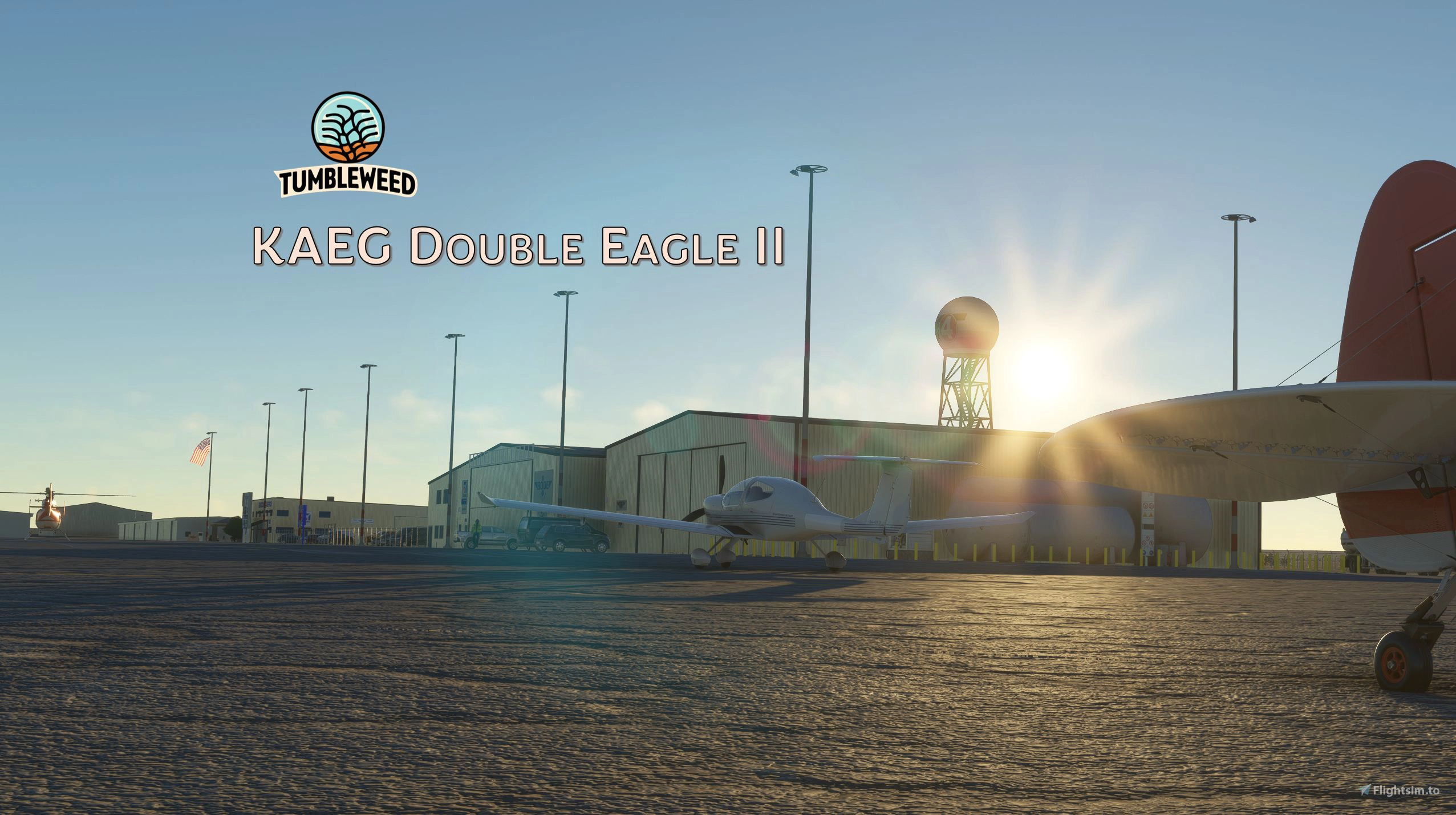
Welcome to KAEG Double Eagle II Airport! As Albuquerque’s second-largest airport, it stands as a vital hub for the general aviation community in central New Mexico. Located just 7 miles northwest of downtown Albuquerque, KAEG offers everything a GA field enthusiast could desire, including an ILS approach on one of its two runways.
Despite its significance, KAEG has never seen any highly detailed scenery in any simulator—until now. Creating this scenery has always been one of my goals, and it was my strong wish to see this airport brought to life in a simulator. I hope you enjoy it.
Installation Instructions:
- Unzip the contents of the package.
- Place the folder named “tumbleweed-airport-kaeg-albuquerque” into your Community folder.
Scenery Highlights:
- Custom-built hangars, buildings, and objects to accurately capture the airport’s unique vibe.
- LODs on some buildings.
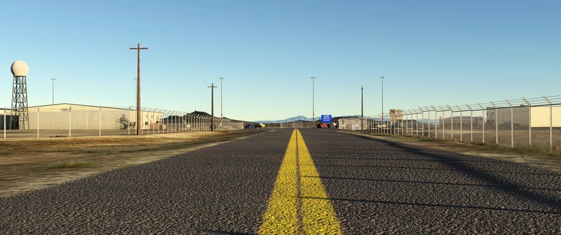
- Fully rebuilt runway, taxiway, taxiway signs, and aprons.
- Some custom ground markings.
- Additional parking spots, fuel station and helipad (alas a hot start)
- Airport fence
- Standard assets thoughtfully placed around the airport.
- Refined terrain based on DEM (digital elevation) data with 1m resolution, e.g. trenches and overflow basins are resolved. (note: resampled to 8m with update 1.1, to reduce bumpiness)
No external libraries are required.
Known issues:
The elevation data is a bit noisy, causing some bumpiness in the terrain - maybe more than in reality. I still believe the benefit of having proper elevation data is outweighing this inconvenience, but with update 1.1, I have tried to improve this aspect using a more coarse resolution and some manual editing of some taxiways.
Taxiway edge lights and night lighting are not perfect.
Credits:
Textures sourced from 3Dtextures.me, texturecan.com, and ambientCG.com, licensed under the Creative Commons CC0 1.0 Universal License.
Digital elevation data provided by USGS (United States Geological Survey) and converted to MSFS using FoxtrotScenery’s Elevation Editor, an excellent tool that was instrumental in recreating the scenic landscape around the airport.
Disclaimer:
All trademarks, logos, and brand names used in this scenery belong to their respective owners and are utilized solely for recreating an authentic depiction of the airport.
Happy flying in scenic New Mexico! 🌶️
Comments(11)
Log in to join the discussion
Log Inover 1 year ago
The bumps ARE quite much so I’ll keep an eye out for a smoothed update. In VR last night thought I was going to get motion sickness from bouncing . Lol
Again, stellar job!
over 1 year ago
I just released an update, mainly to address the bumpy terrain. Taxiways are still not 100% flat, but should be an improvement compared to the initial version.
over 1 year ago
over 1 year ago
almost 2 years ago
almost 2 years ago
I am considering reducing the resolution to something like 4m, hoping to smooth out the terrain, but still keeping features such as the drainage ditches recognizable. Will work on this further.
almost 2 years ago
almost 2 years ago
almost 2 years ago
almost 2 years ago
KAEG Double Eagle II Airport, Albuquerque
KAEG Double Eagle II Airport is a detailed add-on for Microsoft Flight Simulator, featuring Albuquerque’s second-largest airport, located just northwest of the city center. This custom-built scenery includes accurately modeled hangars, buildings, and an upgraded runway and taxiway layout, enhancing the airports unique characteristics. Additional features include extra parking spots, a fuel station, and refined terrain based on high-resolution elevation data, providing a realistic environment for general aviation enthusiasts. No external libraries are needed for installation.
Supporters
User Reviews
4 reviews
Location
More Information
Version History
- DEM (elevation) data was resampled at 8m resolution, to reduce terrain bumpiness while keeping trenches/arroyos - in addition, some taxiways have been flattened - minor corrections of taxiway surfaces - texture housekeeping: got rid of some unused textures, making the dowload and scenery size smaller.
Related
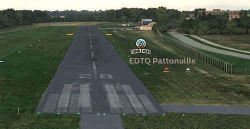
EDTQ Pattonville + Christoph 51 medical helicopter base
Welcome to EDTQ Pattonville, a small general aviation airport in the north of Stuttgart, Germany. It is home to eight flying clubs operating mostly gliders and single-engine planes. This scenery features an improved ground layout and a blend of custom-built and library objects.
by Tumbleweed
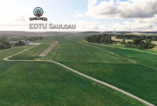
EDTU Saulgau
Explore EDTU Saulgau, a welcoming airfield in southwest Germany known for its vibrant skydiving scene. Developed with attention to detail, this add-on features custom-built objects, accurate markings, and enhanced night lighting. Immerse yourself in this scenic destination located just 20 nautical miles north of Lake Constance.
by Tumbleweed
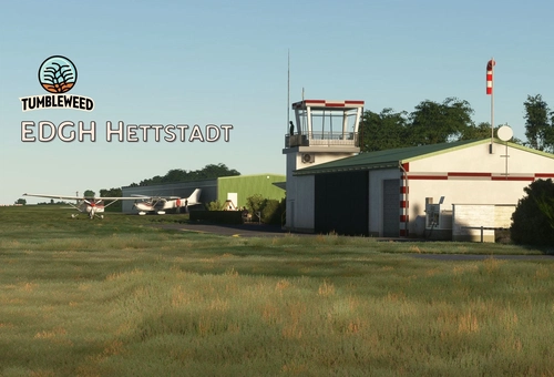
EDGH Hettstadt
Explore the charm of EDGH Hettstadt, a small airport in northern Bavaria, Germany, featuring a grass runway, parking locations, and custom-built objects like a tower and hangars. This scenic add-on offers a realistic rendition of the airport with runway markings and library objects, providing an immersive flying experience. Installation is simple, just drop the contents into your Community folder and enjoy your flights to this unique destination.
by Tumbleweed
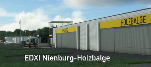
EDXI Nienburg-Holzbalge
Discover the charm of <strong>EDXI Nienburg-Holzbalge</strong>, a quaint airport nestled in northern Germany between Bremen and Hannover. This add-on features a reworked runway layout, custom-built structures, and visual landmarks like a marina and bridges. Immerse yourself in this detailed recreation for a unique flying experience at LSC Nienburg/Weser e.V.
by Tumbleweed
over 1 year ago