
Description
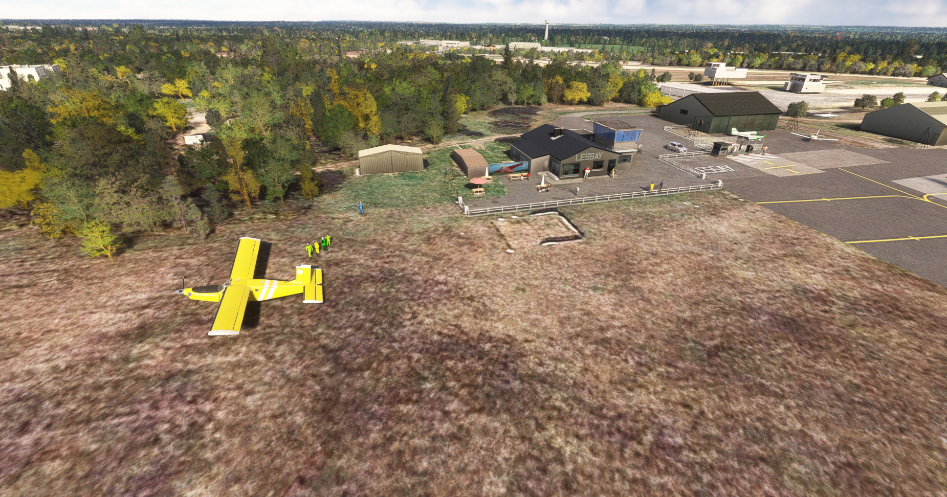
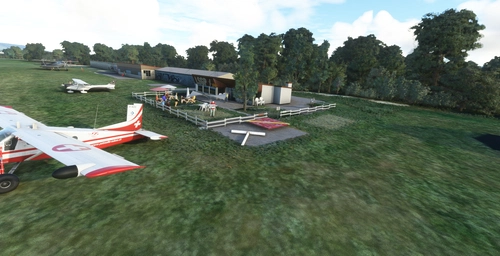
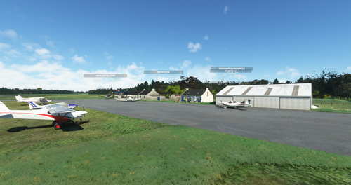
Lessay "Charles Lindbergh" LFOM is a civil airfield open to public air traffic, located 2.5km south-east of Lessay in the Manche region of Normandy, France. It has a 1250x80m grass runway.It is used for leisure activities, tourism and parachuting.
This scene features photorealistic buildings and a high-resolution photo tile. This scene is not finalized and will be regularly updated.A big thank you to the Lessay flying club for its participation in the photo report, which enabled me to bring the buildings out of the ground.
This scene is ideally placed for visiting the Cotentin peninsula, the Channel Islands and Mont Saint-Michel. You can also use it to complement my Granville LFRF scene, which is already available.
L’aérodrome de Lessay "Charles-Lindbergh" LFOM est un aérodrome civil, ouvert à la circulation aérienne publique, situé à 2,5 km au sud-est de Lessay dans la Manche en région Normandie, France. Il dispose d'une piste en herbe de 1250x80m.
Il est utilisé pour la pratique d’activités de loisirs,de tourisme ainsi que le parachutisme.
Cette scène possède les bâtiments photoréalistes et une dalle photo haute résolution. Cette scène n'est pas finalisée et sera régulièrement mise à jour.
Un grand merci à l'aéroclub de Lessay pour sa participation au reportage photo qui m'a permis de faire sortir les bâtiments de terre.
Cette scène est idéalement placée pour visiter le Cotentin, les Iles Anglo-normande ainsi que le Mont Saint-Michel. Vous pouvez également l'utilisée en complément de ma scène de Granville LFRF déjà disponible.
Location
LFOM - Lessay
Experience the picturesque Lessay "Charles Lindbergh" LFOM civil airfield in Normandy, France with a photorealistic depiction featuring high-resolution textures. Perfect for leisure activities, tourism, and parachuting, this scenery is ideal for exploring the Cotentin peninsula, Channel Islands, and Mont Saint-Michel. Stay tuned for regular updates to enhance your flight simulation experience.

User Reviews
1 reviews
Version History
- 4 new hangars added and 2 containor; - start working on race track; - add some statics and dynamic people; - To see animation see ReadMe File.
Related
LSGL Lausanne La blécherette
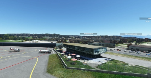
Enhance your virtual aviation experience with the LSGL Lausanne La Blécherette add-on. This scenery revamps the Lausanne LSGL aerodrome in Switzerland, featuring photorealistic representations of key buildings such as the restaurant, operations office, and rescue base. Explore this detailed recreation, including official altitude data for the track and additional landmarks like the Tuillerie stadium extracted from Google Maps. Get ready to take off and enjoy your flight over this newly improved airfield!
by MaxGG60
LFDP Saint-Pierre d'Oléron
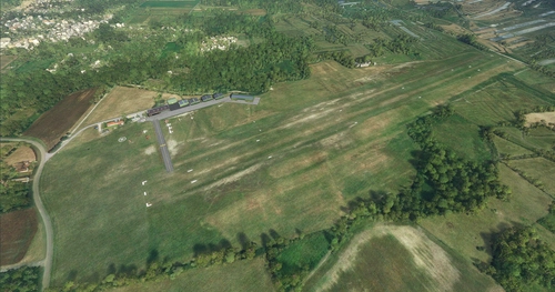
Explore the Saint-Pierre-dOléron aerodrome on the beautiful Oléron Island in Charente Maritime. This add-on features two runways, fueling station, and detailed modeling of all airport buildings. Perfect for a scenic flight or practicing your take-offs and landings.
by MaxGG60
LSGP La Côte
Explore the picturesque LSGP La Côte aerodrome nestled in Prangins, Switzerland, boasting a charming grass runway, 100LL station, and artistically adorned hangars. Embark on your flights in this tranquil setting between Geneva and Lausanne, with ongoing updates to enhance your virtual aviation experience.
by MaxGG60
LFEA Belle-Ile en Mer
Explore the picturesque island of Belle-Ile en Mer with this detailed scenery add-on, featuring key points of interest such as the aerodrome, lighthouses, and the Palace with its citadel. Enjoy an enhanced coastline with removed unsightly trees, and anticipate more POIs to be added in the future. This add-on is compatible with FranceVFR and Orbx seafront vessel library for a seamless flying experience.
by MaxGG60
Log in to join the discussion
Log InComments(14)
12 months ago
12 months ago
about 1 year ago
about 1 year ago
Have you tried checking the compatibility of the scene?
If you notice any problems, please let me know as I am working on something else at the moment.
Thank you in advance!
Max.
almost 3 years ago
Régis et Claire.
www.aair-parachutisme.fr.
almost 3 years ago
about 3 years ago
about 3 years ago
Pour la couleur de la dalle vous pouvez essayez MSFS2020 MapEnhancer vous aurez une parfaite intégration.
Je prend note pour le reportage photo même si je suis en lien avec l'aéroclub. Si vous avez l'occasion de faire des photos des bâtiments environnants et de me les transmettre ça sera avec plaisir.
Merci d'avance.
about 3 years ago
Marc
about 3 years ago
about 3 years ago
about 3 years ago
about 3 years ago
about 3 years ago