Description
*** Compatible with FS2024. However, some gournd textures will have to be adjusted in the following weeks. Worth using without a doubt.
Uapishka Station and Mounts Uapishka (Groulx) scenery
Quebec, Canada
ICAO code (fictitious): CMN7
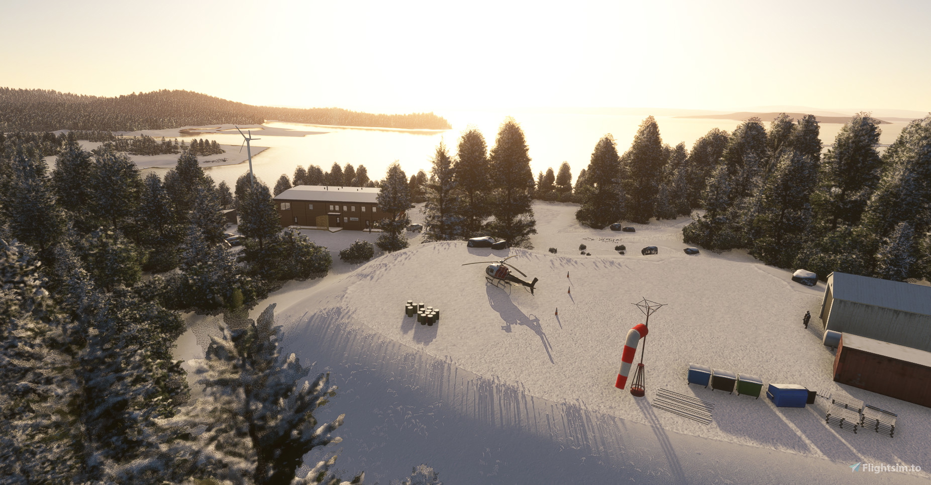
This scene represents the Uapishka station, a station dedicated to northern and aboriginal tourism as well as research, located on the edge of the Manicouagan crater lake. The station is co-managed with the Innu Council of Pessamit and the Manicouagan-Uapishka World Biosphere Reserve (UNESCO). The station shares the Innu culture and values so that visitors leave with a better understanding of this cultural heritage. The joint venture is also involved in the management of the Uapishka Biodiversity Reserve, a protected area located on Uapishka mountains, managed in consultation with the community by the Government of Quebec.
For more information: https://www.stationuapishka.com/about-us
The scene includes most of the infrastructures present on the station map: https://www.stationuapishka.com/our-maps
- The main building
- Related buildings and chalets for rent
- Camping and campers
- The helipad for transporting tourists to the moutains (ski, treck) or emergency operations
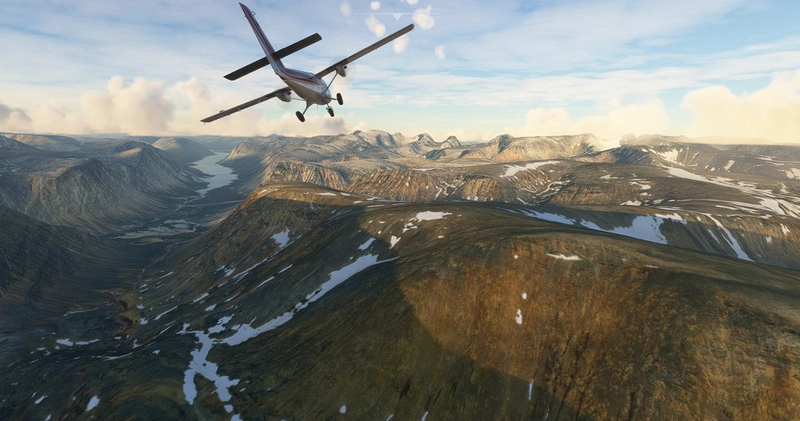
- The emergency shelter located on the Monts Uapishka to the east of Mont Veyrier
- The Mont Veyrier antenna and the weather station near the emergency shelter
- The Quintin lake refuge
- Walkers and caribou on Mont Provencher, Jauffret and Harfand
- The removal of trees from the summits of Monts Uapishka and Mont de Babel (Île René-Levasseur)*
- Vehicles in the various remote parking lots at the start of the trails
- The station's two wind turbines have not been integrated
A water runway has been added to get access to the scenery with a floatplane.
Starting with an helicopter, choose the Parking 0 to start on the helipad.
The following libraries will allow you to see people, animals and campers. Many thanks to these authors.
- daves3danimals: https://flightsim.to/file/6841/dave-s-3d-animals-library
- library daves3dpeople: https://flightsim.to/file/5452/dave-s-3d-people-library
- Library-deltatango-camper: https://flightsim.to/file/12386/camper-library
- Moving people and Caribous : Animated Human 3D Models Library : https://flightsim.to/file/33166/animated-humans-library
* More trees should be removed to better represent the state of Monts Groulx. However, this would make the demarcation between treeless areas more evident. The approach used was to widen the default treeless areas to take advantage of the simulator's more natural transition.
Installation: put the folder «gplamondon-airport-cmn7-station-uapishka» in your Community folder.
________________________________________________________________________
Scène de la Station Uapishka et des monts Uapishka (Groulx)
Québec, Canada
ICAO code (fictif): CMN7
Cette scène représente la station Uapishka, un lieu dévoué au tourisme nordique et autochtone ainsi qu'à la recherche, situé au bord du lac du cratère Manicouagan. La station est en cogestion avec le Conseil des Innus de Pessamit et la Réserve mondiale de biosphère Manicouagan-Uapishka (UNESCO). On y partage la culture Innue afin que les visiteurs repartent avec une meilleure compréhension de cet héritage culturel. La coentreprise est aussi impliquées dans la gestion de la Réserve de biodiversité Uapishka, une aire protégée gérée située sur les monts Uapishka, gérée en concertation avec le milieu par le gouvernement du Québec.
Pour plus d'information : https://www.stationuapishka.com/a-propos
La scène inclue l'essentiel des infrastructures présentes sur la carte de la station: https://www.stationuapishka.com/cartes
- Le bâtiment principal et ses annexes
- Les bâtiments connexes et chalets en location
- Le camping et des roulottes
- Le hélipad
- L'abri d'urgence situé sur les monts Uapishka à l'Est du mont Veyrier
- L'antenne du mont Veyrier et la station météo près de l'abri d'urgence
- Le refuge du lac Quintin
- Des marcheurs et caribous sur le mont Provencher, Jauffret et Harfand
- Le retrait d'arbres sur les sommets des monts Uapishka et du mont de Babel (Île René-Levasseur)*
- Des véhicules dans les différents stationnements éloignés au départ des sentiers
- Les deux éoliennes de la station n'ont pas été intégrées
Une piste sur l'eau a été représentée pour permettre l'accès à la scène avec un hydravion. Pour décoler avec un hélicopter sur le helipad, utilisez le Parking 0.
Les librairies suivantes vous permettront de voir des personnes, animaux et roulottes. Merci à ces auteurs.
- daves3danimals : https://flightsim.to/file/6841/dave-s-3d-animals-library
- library daves3dpeople : https://flightsim.to/file/5452/dave-s-3d-people-library
- Library-deltatango-camper : https://flightsim.to/file/12386/camper-library
- Personnages dynamiques et caribous : Animated Human 3D Models Library : https://flightsim.to/file/33166/animated-humans-library
* Plus d'arbres devraient être retirés pour mieux représenter l'état des monts Uapishka. Cependant, ceci rendrait plus évidente la démarcation entre les zones sans arbres. L'apporche utilisée a été d'élargir les zones sans arbres par défaut afin de profiter de la transition plus naturelle produite par le simulateur.
Comments(9)
Log in to join the discussion
Log Inover 4 years ago
Merci ! Je travaille à ajouter la piste sur l'eau pour un départ en avion plus convivial en été ou hiver. À venir sous peu.
almost 4 years ago
A water runway has been added to get access to the scenery with a floatplane.
almost 4 years ago
Génial! Merci! Je fais la mise èa jour tout de suite!
over 3 years ago
Une piste sur le réservoir a été ajouté dans la dernière version afin de décoller en hydravion
over 4 years ago
Génial! J'y étais l'été dernier. Bien hâte de voir ça dans la sim. Merci!
over 4 years ago
Great to have a such scenery in this remote place - many thanks !
PS : About this area, for anyone who would like to a have round trip, some views in the following post I made for Orbx forum a few years ago ...
over 4 years ago
Interesting post indeed! I like to fly in this region too and have some landing strip made to land here and there inspired from real life (pic Pyramide and head of Koroc river where DHC6 land for mount Iberville climbers). Hoping MSFS will improve photo coverage in these lands since a lot is FSX style coverage.
over 4 years ago
Glad you had a view on the post - rich story and native people culture to discover !
Great if you plan to continue your project with other strips or details in this area -Maybe working in better msfs landscape definition in the future thanks to upgrade ?
Uapishka Station and Mounts Uapishka (Groulx), Quebec
This scene represents the Uapishka station, a station dedicated to northern and aboriginal tourism as well as research, located on the edge of the Manicouagan crater lake. The station is co-managed with the Innu Council of Pessamit and the Manicouagan-Uapishka World Biosphere Reserve (UNESCO) and offers an helipad..
User Reviews
2 reviews
Location
More Information
Version History
After a visit on site, changes applied: - Improvement and more details to the main station and infrastructures around - Added stones, death trees and a barge on shore - People, markers and caribous on mount Jauffret, Hardand and Veyrier - Trees removed from many lake east of the Uapishka mountains and on Brooch lake (far south) - Rivers corrections (level and trees) - Emergency shelter should be seen from farther away
Related
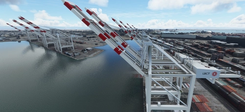
San Pedro Bay Port Facilities, Los Angeles & Long Beach CA USA (V3.0 MSFS2020) / (V1.3 MSFS2024)
This add-on provides detailed scenery enhancements for the San Pedro Bay port facilities in Los Angeles and Long Beach, California, specifically optimized for both MSFS2020 and MSFS2024. Version 3.0 for MSFS2020 features improved models, with significant updates including new cargo crane designs and streamlined asset management. The MSFS2024 version introduces additional upgrades and new details while ensuring compatibility with the latest simulator features.
by FreakyD
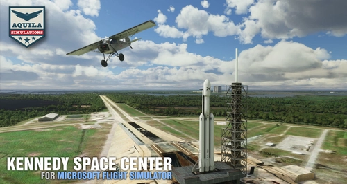
Kennedy Space Center
Explore the iconic Kennedy Space Center in Microsoft Flight Simulator with this detailed add-on, featuring key landmarks such as the VAB Building, Launch Control Building, and Launch Complexes 39A & 39B. Witness the impressive Falcon Heavy Rocket and SpaceX Rocket Assembly building as you embark on virtual space missions. Additional updates promise more buildings and assets to enhance your experience.
by Acktu
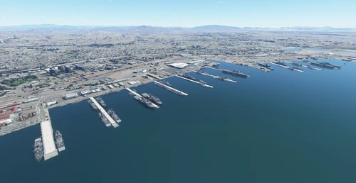
US Navy - San Diego V3.0.1
The US Navy - San Diego V3.0.1 add-on enhances the naval scenery around San Diego in Microsoft Flight Simulator. It includes a variety of updated ship models and improved textures, ensuring compatibility with both MSFS2020 and MSFS2024. Key features include detailed representations of the Rosecrans Submarine Base, multiple naval shipyards, and various classes of ships, including attack submarines and aircraft carriers. Recent updates have focused on model clean-up and the addition of interactive landing pads for helicopters.
by FreakyD
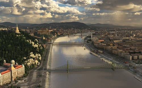
HungaryVFR FS2020
HungaryVFR is a package covering Hungary with airports and landmark sceneries, with its own library. The main goal is to bring as many airports and landmarks to Hungary as many we can, to have an authentic library for the are. The library can be used by other 3rd party scenery developers!
by ekre
over 4 years ago
Scène très réussie. Les modèles des bâtiments sont fidèles. J'ignorais qu'il y avait un heliport! Dans une prochaine version, j'apprècierais beaucoup l'ajout d'un marqueur d'hydrobase dans la baie (autour de 51° 28' 7,13" N 68° 14' 18,94" W) pour qu'on puisse y décoller. Un cub y a attéri quand j'y faisais du kayak avec la famille. Aussi, si possible, des textures un peu plus nuancées pour les bâtiments et les chemins seraient de belles améliorations car on a tendance à voler bas dans cette région... :)