Description
Jomsom Airport VNJS v1.4
by Sergio Del Rosso
sdr.cell@gmail.com
Thanks so much to everyone who appreciates me and supports my passion for making these scenarios. If you liked it, just a comment, if you want to donate something like a coffee I'm happy anyway and can help me to improve this scenery.
Make a DONATION
paypal account: sdr.cell@gmail.com
WHAT'S NEWS in 1.4
+after SU5 i just open the scenery and save with the SU5 update
+add some rocks
WHAT'S NEW IN V.1.3
+model and add main apron
+model and add 9 different type of nepal building
WHAT'S NEW IN V.1.2
+fixed snow layer on runway
+remove any lights from taxiway and runway
+fixed some height layer bug
WHAT'S NEW IN V.1.2
+fixed modellib-bgl (see https://forums.flightsimulator.com/t/scenery-creators-please-move-or-rename-your-modellib-bgl/307563)
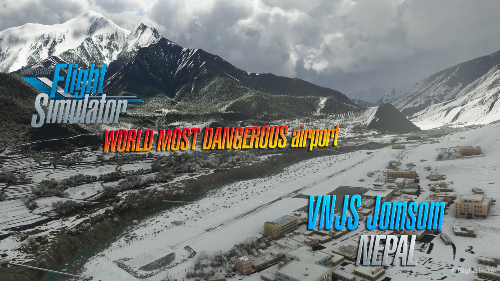
Jomsom Airport (IATA: JMO, ICAO: VNJS)is a domestic airport located in Jomsom serving Mustang District, a district in Gandaki Pradesh in Nepal.It serves as the gateway to Mustang District that includes Jomsom, Kagbeni, Tangbe, and Lo Manthang, and Muktinath temple, which is a popular pilgrimage for Nepalis and Indian pilgrims.
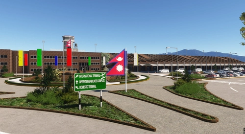
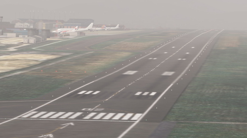
The airport resides at an elevation of 8,976 feet (2,736 m) above mean sea level.It has one asphalt paved runway designated 06/24 which measures 2,424 by 66 feet (739 m × 20 m).There is a down slope of 1.75% up to about 418 feet (127 m) from the threshold of runway 06.There is a terminal building for passengers.
There are daily flights between Pokhara Airport and Jomsom during daylight hours in good weather.Although the flying distance is short and flight time just 20 minutes, very high mountains between Pokhara and Jomsom, including Dhaulagiri (8,167 m or 26,795 ft) and Tukuche (6,920 m or 22,703 ft) on the west and Nilgiri Central (6,940 m or 22,769 ft) and Annapurna (8,091 m or 26,545 ft) on the east, require planes to fly through the Kali Gandaki River gorge. With Jomsom Airport located at the head of the gorge, high terrain surrounding the airport presents a hazard when a go-around is required and when, as is frequently necessary after mid-morning, a turn is required at Jomsom to land into southerly winds. Heat from the sun in the Mustang District causes strong southerly winds in the Kali Gandaki River gorge and at Jomsom after early morning.
Cloud cover, changing visibility, and high winds, often mean flights are delayed or the airport closed.
The airport is available throughout the year but visibility is not adequate for visual flight rules flightabout 15% of the time. As wind speeds increase during and the day and high wind speeds often prevent airportoperation after midday, airlines schedule flights to Jomsom for the early morning when wind speeds are low. Airlines operate a shuttle service between Jomsom and Pokhara and planes are turned around as rapidlyas possible at each airport in order to complete as many flights as possible before wind speeds atJomsom become too high or visibility forces the suspension of flights.
Comments(63)
Log in to join the discussion
Log In
over 2 years ago
over 2 years ago
over 2 years ago
over 2 years ago
over 2 years ago
over 3 years ago
DHC6 cannot accelerate on ground. Is it a bug?
over 2 years ago
over 3 years ago
Love this scenery, having been there myself. There's a slight bug where the scenery warps itself up on the river bend just North of runway. Probably introduced in the new update, I see a lot of places with this problem.
about 4 years ago
Great Scenery, but could you please make it compatible with ORBX Himalaya Mesh? there are alot of huge terrain errors.
Thanks! :-)
about 4 years ago
This is basically payware quality, awesome! Can you look into the Orbx Himalayas mesh incompatiblity maybe? Would be nice to use the two together.
Plan to fly a Pokhara-Jomsom trip in memory of the recently crashed Tara Air Twotter...
Update: after flying the trip, yes, I confirm, there are ugly canyons south of (in the valley) and around the airport using with the Orbx mesh. Otherwise the airport itself looks great.
about 4 years ago
there seems to be a problem with elevation data when using the Orbx Himalayas Mesh. I get a lot of steep slopes with stretched textures and a gorge around the south of the airport
about 4 years ago
https://www.youtube.com/watch?v=QeNYQJnFENA this is how it looks for me
over 4 years ago
What a fun airport to fly into. Great work!
over 4 years ago
Please make it compatible with the update 7. Thanks!
over 4 years ago
funcionou msfs2020 versão 7 ok muito obrigado lindo cenário parabéns
almost 5 years ago
Good work! Thanks a lot!
You can find a review here:
https://flightnews24.de/?p=2760&preview=true&_thumbnail_id=2769
almost 5 years ago
Jomsom is relative easy.. the most hard in my opinion Dolpa and Simikot, try it and let me know
almost 5 years ago
Will do. Thanks for the tip!
almost 5 years ago
Just update Dolpa at 1.3
Take a look... in my opinion the landing experience more close to landing on a carrier
Jomsom Airport VNJS (Nepal) V1.4
Experience the unique Jomsom Airport (VNJS) in Nepal with this scenic add-on by Sergio Del Rosso. Explore Mustang District and its popular pilgrimage destinations, while navigating the challenging high terrain and weather conditions of the region.

User Reviews
26 reviews
More Information
Version History
Featured in Collections(1)
Related
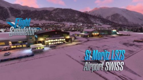
Saint Moritz - Samedan Airport LSZS (Swiss) v2.5
Explore the updated version 2.5 of Saint Moritz - Samedan Airport LSZS by Sergio Del Rosso, featuring various improvements such as windsock fixes and removal of glider cover. Located in the stunning Engadin valley of Switzerland, this regional airport presents a challenging experience due to its difficult topography and thin air at high altitude. With its one runway and lack of scheduled passenger flights, the airport primarily accommodates general aviation traffic including private jets and propeller aircraft.
by Sergio Del Rosso
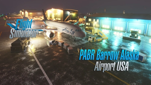
Barrow Utqiagvik Wiley Post-Will Rogers Memorial Airport (USA Alaska) v1.5
Explore the Barrow Utqiagvik Wiley Post-Will Rogers Memorial Airport in Alaska with this v1.5 scenery by Sergio Del Rosso. This detailed add-on features updated airport buildings, a static helicopter model, improved city streets visibility in snow, and realistic snow heaps near the runway and taxiways. Experience the northernmost airport in the US, named after legends Will Rogers and Wiley Post, with this comprehensive update.
by Sergio Del Rosso

LIRI | Salerno Costa d'Amalfi Airport v1.6 (Italy)
Discover the enhanced version of Salerno Costa dAmalfi Airport in Italy with v1.6 by Sergio Del Rosso. Experience an extended runway, adjusted runway elevations, new taxiways, and updated parking positions, among other improvements. Explore this airport, also known as Salerno-Pontecagnano Airport, situated near the beautiful coastal areas of Amalfi and Cilento in southern Italy.
by Sergio Del Rosso
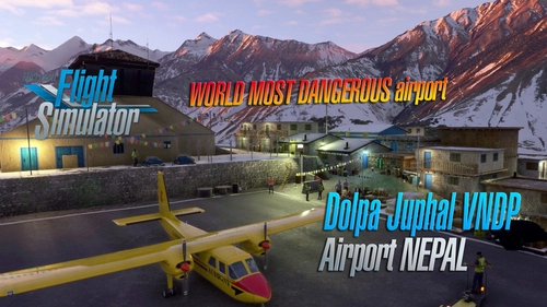
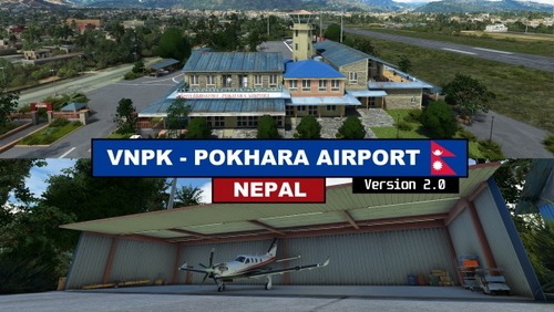
Dolpa Juphal Airport VNDP (Nepal) V1.4
Experience the beauty of Dolpa Juphal Airport in Nepal with this add-on by Sergio Del Rosso. Enhancements include revamped textures, new buildings, and a detailed village area. Explore the only airport serving Dolpa District at an elevation of 8,200 feet above sea level with a blacktopped runway.
by Sergio Del Rosso
about 2 years ago
I have fun.
https://www.youtube.com/watch?v=-DTmdWR6o58