Description
Cripple - Iditarod checkpoint #11
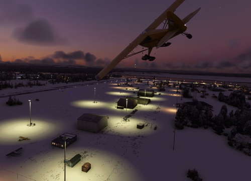
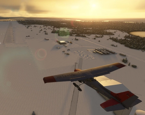
Like Finger Lake, Cripple Airstrip is not a year-round airport. It is built each year using snowplows and snow machines by the Iditarod organization and the Iditarod Air Force. It is built on approximately the same location each year. As such, the airport ID "PXCR" is a fictional code.
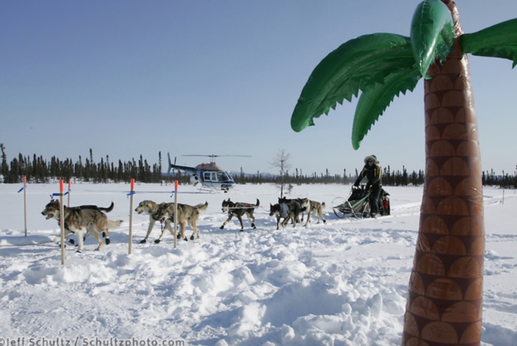
Today, Cripple, population zero, isn’t a village; it’s only a place on the Innoko River in the former Iditarod Mining District. The checkpoint takes its name from an old steamboat landing located nearby on the river. During the Gold Rush between 1908 and 1925, $35 million in gold, including some of the largest nuggets ever mined were taken from the area. It’s always a guess as to exactly where the checkpoint will be located. It’s dependent upon overflow and other surface conditions. Generally, it’ll be somewhere near the Poorman airstrip. Abandoned buildings, trucks and bulldozers still sit near the airstrip. The Cripple checkpoint is a maze of tents amongst inflatable palm trees where mushers either experience frigid cold in extreme winter gear or enjoy sunny warmth while wearing Hawaiian attire.
Cripple Airstrip is one of 24 airstrips and airports on the Iditarod Trail that runs from Anchorage to Nome. The Iditarod Airforce is a group of pilots who volunteer their time and planes to service the 24 race checkpoints. Their missions include delivering food for the teams, picking up injured sled dogs, and many other logistical services for the volunteers who manage the checkpoints.
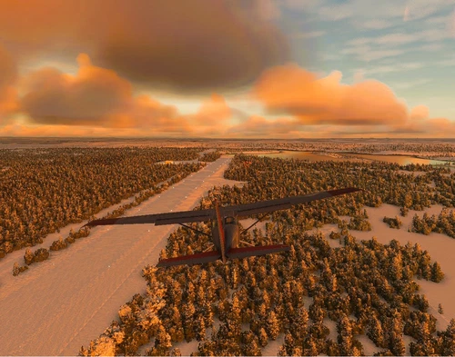
Dimensions: 2891 x 65ft / 880 x 20m
Surface: Turf / Gravel, in poor condition
Runway: 02/20
To learn more about the Iditarod, its airports, and the race itself, go to the Iditarod.com website. I’ve included a link to a short video, Wings of the Iditarod that features the Iditarod Airforce.
To replicate Iditarod conditions, I recommend setting your sim Weather parameters to:
Month = March. Snow Depth = 29”. Temperature = 0 degrees.
Installation:
Copy the airstrip folder inside of the WinZIP file into your MSFS Community folder.
Many thanks to the creators of the Required and Recommended libraries. If you have not previously installed these libraries in your Community folder, some objects may not be visible in your sim. Remember, you only have to install these one time. Also, go to the sim marketplace and download the free UK2000 Scenery Common Library. All Microsoft World Updates should be installed also.
Easter Egg is hidden.
BTW: I could not find a library that had inflatable palm trees or plastic flamingos. Perhaps one of these fine creators will help out.
Comments(6)
Log in to join the discussion
Log Inabout 6 hours ago
over 4 years ago
This is cool! However some assets are missing such as chairs?
over 4 years ago
I have used a lot of objects from user libraries. If you look under "Dependencies" you will see the 8 libraries that I have borrowed objects from. Have you downloaded and installed them? It's a bit of a pain, but you do it once and it will help with a lot of airport downloads.
over 4 years ago
Yep got them all pal.
about 6 hours ago
Cripple Airstrip (PXCR)
Like Finger Lake, Cripple Airstrip is not a year round airport. It is built each year using snow plows and snow machines by the Iditarod organization and the Iditarod Air Force. It is built on approximately the same location each year. As such, the airport ID "PXCR" is a fictional code.

User Reviews
1 reviews
Location
More Information
Version History
This is a major update making this airstrip both MSFS 2020 and 2024 compatible. Non-standard scenery objects were replaced with standard scenery objects.
Related
McGrath Airport (PAMC)
McGrath: Population 400 -- McGrath is located in the interior of Alaska. The only way to get here is by airplane, unless you’re crazy enough to drive a snow-machine or mush your dog team on the Historic Iditarod Trail. The airport covers an area of 641 acres at an elevation of 341 feet. It has two runways: 16/34 is 6,000 by 100 feet with an asphalt surface and 5/23 is 2,000 by 60 feet with a gravel surface. It handles an average of 30 flights per day, 80% commercial, and 20% general aviation.
by 55tom55
Nikolai Airport (PAFS)
Nikolai: Population 125 -- This is the first of many Native villages along the Iditarod Trail. In 1963, the local residents cleared their own airstrip. This made year-round access to the outside world possible. This is Iditarod checkpoint #7. To learn more about the Iditarod, it's airports, and the race itself, go to the Iditarod.com website.
by 55tom55
PAOM Nome AK Version 3 20
Another complete rebuild of my PAOM scenery
by Mountainair
Skwentna Airport (PASW)
Skwentna has a population of about 30 people and lies on the south bank of the Skwentna River at its junction with Eight Mile Creek. This small village is located west of the Mat-Su Valley and is a 70-mile flight from Anchorage. The first permanent settlers did not show up until after the Alaska Road Commission cut the Iditarod National Historic Trail in 1908. Roadhouses were later constructed along the trail, including the Old Skwentna Roadhouse, to service the prospectors, trappers, and Alaska Natives who used sled dogs to transport goods over the trail.
by 55tom55
about 7 hours ago