Description
Hello Community!
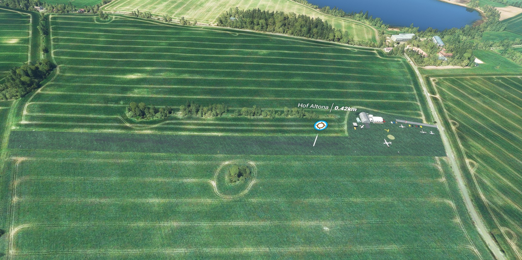
Because an user request I created another small freeware addon for MSFS 2020. This time its the "Flugplatz EDXT Sierksdorf / Hof-Altona" located in Germany (Schleswig-Holstein). Its a small german airfield, 1000m west of the village Sierksdorf, 4 Kilometers north of Scharbeutz and 3.4km south west of Neustadt (in Holstein). It has a short grass runway (03/21 - 500m/30m) and the runway elevation profile was adjusted 1:1 via Google's elevation profile. Radio contact is possible via SIERKSDORF INFO at 125.385 mHz.
The airfield has been operated by the Sierksdorf UG since 2015.
I plan to continously update this scenery. I'm always open to suggestions for improvement, praise and criticism. If you have any question or something else, write a PM or join my Discord EDHK support server.
You can find it here:
EDHK Discord Support Server
I hope you will enjoy this MSFS 2020 scenery, your feedback is always welcome!
If you like my work, then give it a positive rating, I would be pleased when you drop it a 5 Star. Thanks! :)
I wish you all relaxing flights & stay healthy,
MrMo
Known bugs/issues:
---
More informations:
EDXT @ Wikipedia
EDXT Website
Do you already know my other MSFS 2020 projects?
If not, you can find them here:
EDHK Kiel-Holtenau
EDHN Verkehrslandeplatz Neumuenster
EDHK Lights & Objects Developers Pack
ED75 Sonderflugplatz Fehmarn-Neujellingsdorf
EDHB Sonderflugplatz Grube
Comments(14)
Log in to join the discussion
Log Inalmost 2 years ago
mit dem neuen WU18 stehen ein paar Bäume auf der Piste.
Danke für die tolle Arbeit.
almost 5 years ago
Version 1.0.2 steht zum Download bereit!
Ich hoffe das jetzt erst mal alles ok ist. :)
~~~~~~~~~~~~~~~~~~~~~~~~~~~~~~
Version 1.0.2 is available for download!
I hope that everything is ok for now. :)
almost 5 years ago
Klasse, tolle Wiedererkennbarkeit, vielen lieben Dank! Jetzt hast du dir aber ´ne Pause verdient ;-) VG
almost 5 years ago
In der kommenden Version 1.0.1 ist die Runway dem original Höhenprofil angepasst. Die dazu notwendigen Daten habe ich Google entnommen. Hoffe es passt! :)
almost 5 years ago
Hi! Super, das Höhenmesh ist dir toll gelungen! Allerdings sehe ich das "T" in der aktuellen Version immer noch und direkt im Endanflug 21 sind jetzt 2 Büsche (s. Bild...)
Schönen Abend u. VG, Björn
almost 5 years ago
Moin Du,
dazu einige Fragen:
1. Hast Du die vorherige Version komplett gelöscht und dann die neue Version reinkopiert?
2. Hast Du mal die Content.xml Datei gelöscht?
Es kann sein das da ggf. Reste der alten Version vergraben sind. Die Content.xml sollte man in regelmäßigen Abständen immer mal wieder löschen, gerade wenn man mit vielen Addons arbeitet. Die Datei wird nach einem MSFS Neustart immer neu angelegt.
Werfe nach der Arbeit einen Blick drauf und lade bei Bedarf die angepasste Version hoch.
almost 5 years ago
Wahnsinn, das war schnell, ganz lieben Dank, MrMo!!! :-)
almost 5 years ago
Gern, ich war ja bisher noch nie direkt vor Ort und die Library im Editor bietet mir auch nicht so viele Möglichkeiten. Was ich aber gern noch wissen würde ist, ob die Gras-Runway ungefähr im Bezug auf Senke bzw. Erhebung ungefähr so hinkommt?
almost 5 years ago
Hmm, da ist die Schwelle zur 03 zu hoch geraten. Ich hab mal ein Anflugvideo auf die 03 hochgeladen, damit du es besser siehst:
Also die Schwelle 03 ist tief in einer Senke, dann geht es deutlich hoch bis kurz vor den ersten Hangar und dann ist es eine Art hohes Plateau bis zur Strasse. Der Platz fällt auch insg. zur Küste hin leicht ab...
Das Lande-T gibt´s in echt auch nicht, und diesen unbegrünten Fleck davor mit dem Landereiter mittendrin kenne ich aus der Realität auch nicht..
So, nu is aber genug gemeckert ;-)
Nochmals herzlichen Dank für deine schnelle Hilfe und die tolle Arbeit!! LG
almost 5 years ago
Habe den Springerkreis und das "T" nach original Bildmaterial aus dem Netz eingefügt. Die Runway werde ich entsprechend der Google Höhenprofile noch anpassen.
almost 5 years ago
Aaah, ich seh´s bei Google Maps :-) Der Kreis ist nur mit dem kleinen Rasenmäher gemäht worden, der Rest abseits der Landereiter wird mit dem Aufsitzmäher gemäht. Kurz davor muss die Aufnahme entstanden sein. Das Lande-T ist in der Realität am Windsack (s. auch mein Bild von der Flugplatzkarte der dfs). Wenn das Wetter mitspielt, fliege ich am 3.9. wieder hoch. Dann können wir uns gern vor Ort treffen, ansonsten besorge ich dir auch weiteres Fotomaterial, wenn du magst.. :-)
almost 5 years ago
Das Schwarze "T" auf Charts steht immer für "Tankstelle". Da auf der Chart ein Landeplatz für Fallschirmspringer eingezeichnet ist, kann ich mir durchaus vorstellen, dass der Runde Kreis genau wie in EDHK und weiteren Flugplätzen auch dort in real existiert und eben als Landepunkt für Selbige dient.
almost 5 years ago
Hab dir mal auf deine private Nachricht geantwortet :-)
almost 5 years ago
Gelesen und umgesetzt. Danke! ;)
EDXT Flugplatz Sierksdorf / Hof-Altona
Experience the charm of EDXT Flugplatz Sierksdorf / Hof-Altona, a small German airfield in Schleswig-Holstein with a grass runway and unique elevation adjustments. Operated by Sierksdorf UG, this freeware MSFS 2020 scenery offers radio contact via SIERKSDORF INFO at 125.385 MHz. Stay tuned for continuous updates and share your feedback with the creator.

User Reviews
2 reviews
Location
More Information
Version History
MSFS 2020 - EDXT Flugplatz Sierksdorf / Hof-Altona v1.0.3 (18. September 2021) ■ ADDED - Tons of Vegetation-Exclusion-Polygons ■ REMOVED - Vegetation objects ■ REMOVED - Ground textures ■ MODIFIED - Runway Marker to exact Bing Maps Ground overlay Known issues/bugs: ---
Related

EDHK Kiel-Holtenau + Scenery Kiel Package
Experience the small German regional airport of EDHK Kiel-Holtenau with this custom scenery package. Discover usable helipads, POIs, and extended scenery in Kiel & its surrounding regions, including a fictitious water runway. Perfect for business travelers and athletes, this airport offers excellent accessibility and flexibility with its instrument landing system. Explore a detailed recreation of Kiel-Holtenau Airport and its vibrant surroundings in this enhanced MSFS add-on.
by MrMo
EDXF Flensburg-Schaeferhaus
Explore the most northern GA Airport in Germany with EDXF Flensburg-Schaeferhaus. This ongoing project offers 3D models, updated airport data, and seasonal variations, along with historical insights. From GA Planes to Float-Aircraft, experience the diverse aircraft types allowed at this airfield. Join the developers Discord for feedback, updates, and more projects available for free.
by MrMo
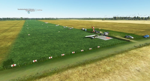
ED75 Sonderlandeplatz Fehmarn-Neujellingsdorf DE-0359
Experience the charm of a small German airfield with ED75 Sonderlandeplatz Fehmarn-Neujellingsdorf in MSFS 2020. This custom-made freeware scenery features a short grass runway and continuous updates by the creator. Join the pilot and aerodrome operator Klaus Skerra in exploring this scenic location on the island of Fehmarn.
by MrMo
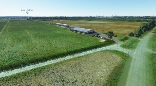
EDHB Sonderflugplatz Grube
Enhance your virtual aviation experience with the addition of the EDHB Sonderflugplatz Grube in Germany. This small airfield near Grube features a short grass runway and radio contact via GRUBE INFO. Frequent updates and a nearby aviation club add to the realism of this MSFS 2020 scenery. Explore this unique location and enjoy a variety of small airport add-ons by the creator.
by MrMo
9 minutes ago