Scenery Enhancements→Others
Slovenia VHF VOR POI
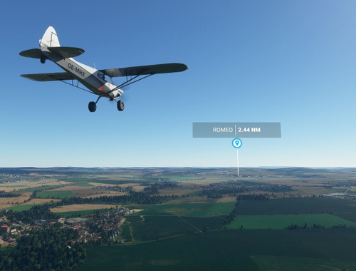
This add-on features visual representations of VHF VOR and VOR/DME radio beacons in Slovenia, integrated as Points of Interest (POIs) within Microsoft Flight Simulator 2024. The information is sourced from Navigraph AIRAC 2511 and includes notable stations such as DOLSKO (DOL) and BISTRICA (ILB). Users can enhance their navigation experience with these accurately depicted beacons in the simulator.
aletri
MSFS2024
5.0(1)
250
5.58 KB
7 months ago
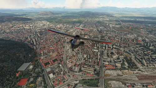
![Ljubljana City [high detail]](https://cdn.flightsim.to/images/24/ljubljana-city-350264-1679765442-fz9hr.jpg?width=500)