Description
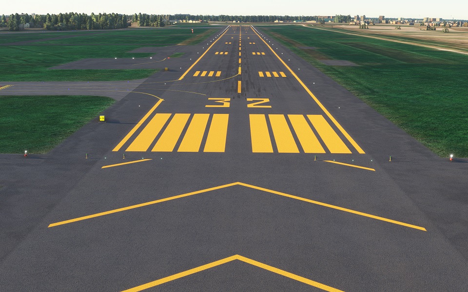
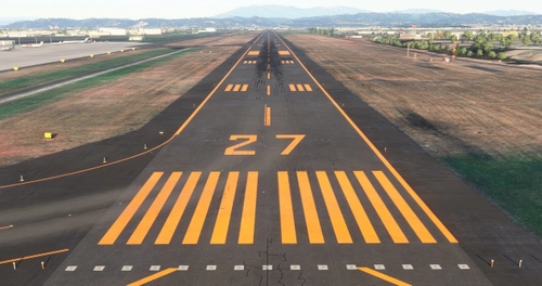
精密滑走路標示 精密滑走路
決定
ご覧いただきありがとうござい
ます。
Attention ♪
Thanks to the kindness of the following scenery creators, we have made it a compatible mod.
You can link to the download destination by clicking. We would appreciate it if you could like the author, subscribe to the channel, and follow us.
"Okadama Airport Modeling" produced by GAO CHAN
"Sapporo City" produced by macmillan61
注目♪
次のシーナリー製作者の方のご厚意により、互換MODとしていただきました。
クリックでダウンロード先にリンクできます。是非作者の方に「いいね」やチャンネル登録、フォローしていただければ幸いです。
GAO CHAN様制作の「丘珠空港モデリング」
macmillan61制作「札幌市」
https://www.youtube.com/channel/UCXyToooYx7l3H5Lj8InfOGA/videos
There are some parts that need to be adjusted, but it is expected that they will be resolved in the future.
調整が必要な個所がありますが、今後の解消していく見込みです。
It is created by surveying with Ministry of Land, Infrastructure, Transport and Tourism materials and Google.
国交省資料とGoogleで測量して作成してます。
The markings are not freehand and are therefore aligned.
マーキングはフリーハンドではないため、一直線に配置されています。
In the case of an airport in a snowy area, it is corrected to orange. The hue is suppressed within the range that does not feel strange with the default edge line.
降雪地帯の空港の場合オレンジ色に修正してます。デフォルトのエッジラインと違和感がない範囲で、色合いを抑えております。
The file size is very small because it consists only of programs.
プログラムのみで構成されているため、ファイルサイズは非常に軽量です。
We have adjusted it in consideration of the scenery that will be released from the other side in the future, but there are some sacrifices.
今後の他方からリリースされるシーナリーを考慮し調整してますが、犠牲にしてしまう部分があります。
私が公開しているPrecision Runway Markingの一覧です。 リリース
しているPrecision Runway Markingの一覧です
。
他のシーナリーと競合してオレンジ色にならない場合は、シーナリー優先順位を変更
してください。
簡単な方法は、フォルダ名を任意の名前に変更すると、最新のものとして認識され、上位に表示されます。 簡単な方法は、フォルダ名をの名前に変更することで任意の最新
のものと認識され優先順位が上位になります。
ここでは、別の方法を紹介しています。
こちらでは、別の方法を紹介しております。
https://www.tab-log.net/post-15088/
インストールについてはCommunityに解凍してご利用ください。インストールについて
、Communityに圧縮して
ご利用ください。
Comments(24)
Log in to join the discussion
Log In9 months ago
10 months ago
The link Okadama Airport Modeling" produced by GAO CHAN doesn`t work.
10 months ago
over 1 year ago
about 1 year ago
about 2 years ago
almost 4 years ago
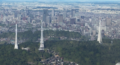
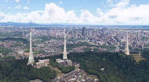
Hi Toshi Chan! I have installed your scenery together with Gao Chan's models. It looks great overall, but there seems to be a small conflict with the "SapporoCity" scenery:
https://flightsim.to/file/20363/sapporocity
It looks like this:
https://i.imgur.com/Eh8436I.jpg
Maybe you can add an exclusion zone or something to get rid of these duplicated buildings?
almost 4 years ago
Thank you for the DL. I exchanged information about compatibility with the creator of Sapporo City Scenery. We have also told you how to fix it, and we are waiting for it to be fixed. However, it seems that the creator of the Sapporo City Scenery is taking a break from creating it, so we have to wait.
over 4 years ago
I'm glad to see the airport has been updated to support Gao-chan's modelling :D. The only problem is Macmillan's scenery seems to conflict with it (at least on my end). When I have all three sceneries loaded, the photogrammetry from macmillan61's scenery overlaps with buildings at the airport. Is there a way to stop it from doing that?
over 4 years ago
DLありがとうございます!例の重複部分について、macmillan61 様へ修正の依頼をしておりまして、回答を待っておりますので今しばらくお待ちいただければと存じます。
わかり次第お知らせいたしますね。
over 4 years ago
分かりました(^^) 返事してくれてありがとうございます
almost 5 years ago
subarashii! I see helo markings. Also more orange! Cheers!
almost 5 years ago
I'm glad I made it. thank you!
Precision Runway Marking (Okadama Airport)(RJCO))
Improve airport precision with this add-on featuring aligned runway markings created using Ministry of Land, Infrastructure, Transport and Tourism data and Google surveying. The small file size ensures easy installation, but adjustments may be needed for future scenery compatibility. Available for various airports, including Okadama, New Chitose, and Kobe.

User Reviews
1 reviews
Location
More Information
Version History
Fixed the connection with the runway for the default line. Other minor corrections. デフォルトのラインについて、滑走路との接続を修正しました。その他に微修正してます。
Related
Sendai Landmarks
Explore the iconic landmarks of Sendai, Japan with this mod. Version 1.2 focuses on the east exit of Sendai Station, while Version 1.0 includes landmarks like TV tower 4 and Sendai Daikannon. Utilizing LOD20-22, this add-on aims to enhance the uniqueness of Sendai despite some frame rate drops during caching. Created using Google Earth Decoder, Blender, and color adjustments for Microsoft Flight Simulator.
by TOSHICHAN310
Precision Runway Marking 2024 (Sendai International Airport(RJSS))
Precision Runway Marking 2024 enhances the visual accuracy of Sendai International Airport (RJSS) for MSFS2024. This add-on features orange runway markings, tailored for regions that experience snowfall, and is created using data from the Japanese Ministry of Land, Infrastructure and Transport along with Google surveys. Note that it does not include building data and requires the “Japanese Airport Model Library KRC” for proper lighting setups. Adjust scenery priorities if conflicts with other add-ons arise.
by TOSHICHAN310
Sendai Landmarks 2024
We have extracted essential landmarks of Sendai from Google Maps.
by TOSHICHAN310
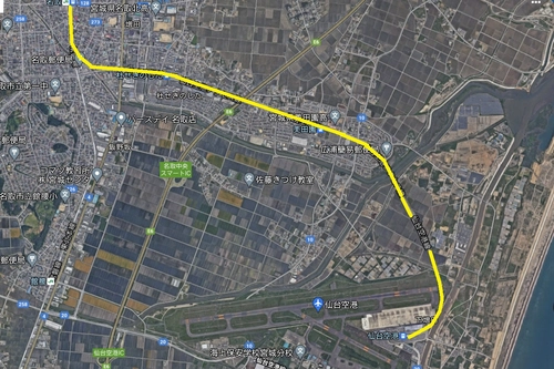
Sendai Airport Access Line
Experience enhanced realism with the Sendai Airport Access Line add-on. This mod features a detailed railroad viaduct near Rwy27, providing a unique atmosphere to your flights in Microsoft Flight Simulator. Please note that the model may be slightly inaccurate, but the attention to detail is sure to impress aviation enthusiasts.
by TOSHICHAN310
9 months ago