
Description
Project is no longer updated. Thanks
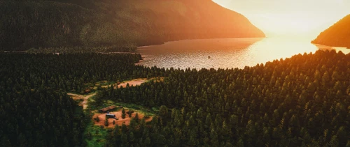
MetropoliseXbox and I are proud to present to you our collaboration for the re-creation of the Machmell Fisheries Bushstrip, located 49NM south of Bella Coola in beautiful British Columbia, Canada.
We both had started with own versions and then decided to combine forces instead of maintaining 2 separate releases.
//Features//
- ICAO code CYB2
- ~700-1000-meter long dirt/grass runway
- Wildlife and fishing boats
- 2 small GA ramp parking spots
- optimized vegetation and custom watermasking in the nearby area
- tons of little details
Comments(24)
Log in to join the discussion
Log Inover 2 years ago
almost 5 years ago
Please list longitude and latitude, because neither ICOA shows up.
almost 5 years ago
Does not show up as airport ICOA code, either CYB2 or CBY2
over 4 years ago
It does, if you have the scenery active.. CYB2
over 5 years ago
over 5 years ago
over 5 years ago
over 5 years ago
over 5 years ago
over 5 years ago
over 5 years ago
Machmell Fisheries 2020 v1.1
Discover Machmell Fisheries Bushstrip, a re-creation located in beautiful British Columbia, Canada. With a dirt/grass runway, wildlife, fishing boats, and more, this add-on offers a realistic bush flying experience near Bella Coola.

User Reviews
5 reviews
More Information
Version History
No version history available.
Featured in Collections(2)

Related
Airports Lights
Illuminate over 1200 airports worldwide with the Airports Lights add-on, featuring lights for terminals and gate areas. With more than 32,000 light poles and ongoing updates, enhance your airport visuals today. Easily install by extracting into your Community folder and experience improved airport lighting. Request additional airports and stay updated on the projects progress through the provided link.
by Andres3D
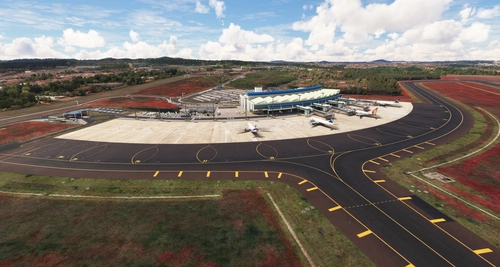
SBGO - Goiânia Airport - GO - Brazil
Enhance your Microsoft Flight Simulator experience with SBGO - Goiânia Airport in Brazil. This add-on features custom 3D models, animated Jetways, realistic runway and taxiway lights, custom markings, and aerial orthophoto for a true- to-life airport immersion. Support for narrow-body aircraft such as Airbus A320 and Boeing 737-800, with the ability to handle wide-body planes like Boeing 767 and Airbus A330. Simply extract the folder to your Community folder to begin exploring this detailed airport scenery.
by Souza Scenery & FSoares
GMME / Rabat Salé Airport
This add-on enhances GMME/Rabat Salé Airport in Microsoft Flight Simulator, ensuring compatibility with both FS2020 and FS2024. It features updated scenery, including corrections to runway lighting and terminal improvements, while removing default buildings. Additionally, it requires various other asset packs for optimal functionality and offers optional GSX PRO enhancements for users.
by joujou92
Istanbul Sabiha Gokcen International Airport
Custom-built Istanbul Sabiha Gokcen International Airport add-on for MSFS 2020 in public beta version. Enhancements include detailed airport structures and improved visuals for a more immersive flying experience. Created by developers with experience in X-Plane 11 scenery design. Free for personal use with optional donations to support the Leukemia Foundation for Children.
by Hayri Buberci, Mali Oguducu
over 1 year ago