Description
A. PROJECT DESCRIPTION
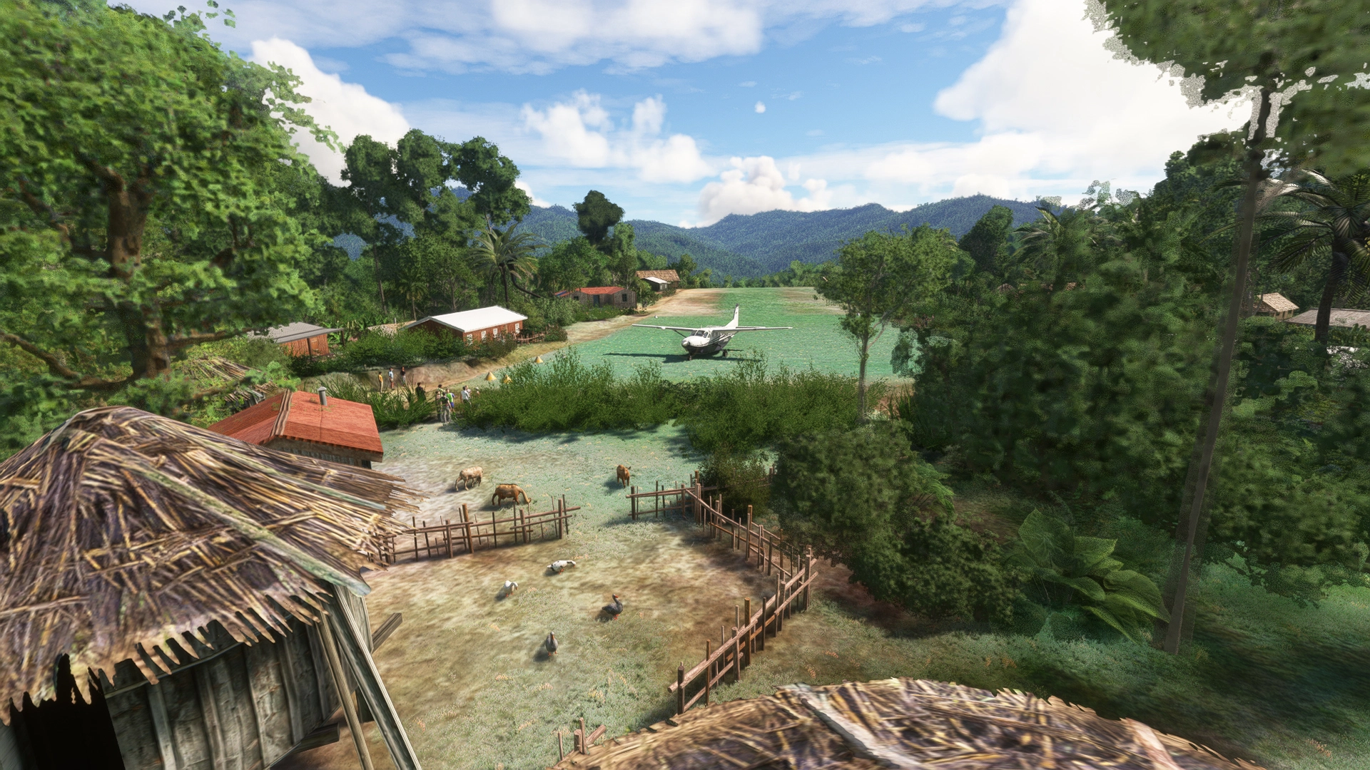
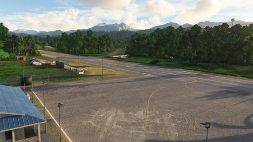
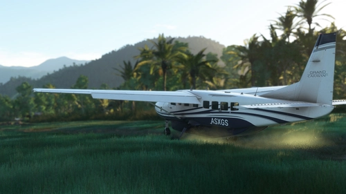
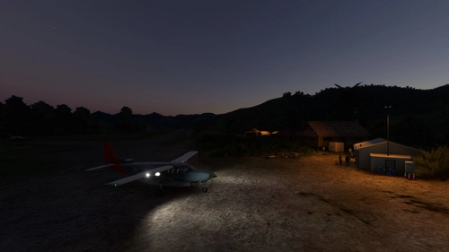
It's Rum airstrip (code ICAO: AYRQ) which is located next to Rum and Maramb villages, in Highlands region, Enga Province, Papua New Guinea. The airport has one grass/dirt strip and one GA medium parking spot. The strip operates during daylight hours only with no services available. IRL, it was reopened in 2023 after several years of being in disrepair state.
Data:
Runway 03/21 grass/dirt, with dimensions of 1840x130ft (560x40m), 8.3 deg upslope
Elevation: 3855ft/1175m msl (RP), 3792ft/1156m msl (RWY21 edge)
GPS Coords: -5.378617, 143.999243
ICAO code: AYRQ (fict)
IATA code: none
LOCAL code: none
Warning: during takeoff, landing, and taxiing, be aware of drainage ditches surrounding the runway as they pose a safety hazard.
B. FUTURE PLANS
I may try to cut down high trees at the cliff and improve the runway's profile. And fix bugs, obviously.
C. KNOWN BUGS / IMPERFECTIONS
- I cannot guarantee that the scenery will work in FS2024 as I cannot test it. Some of my sceneries work, while some others - don't.
- Aerial image may be omitted. It slightly improves ground texture resolution however, even though it's based on the very same Bing sat images.
D. INSTALLATION
The package has size of 50mb.
The package has been scanned with antivirus software in accordance with flightsim.to rules just before I uploaded it, but I can not guarantee that it will not harm your computer in any way. You known the rules! Use at your own risk.
1. Unzip the package to temporary folder.
2. Copy folder named „nice-rum-airstrip” and (optional) "nice-rum-airstrip-aerial" into your “Community” folder.
3. Enjoy!
This addon requires:
- that you have all World Updates installed, including their airports
E. CREDITS & THANKS
- Bush Divers VA community
F. COPYRIGHT AND LICENCE INFORMATION
This addon includes models and textures of AS/MS SDK libraries under Microsoft's "Game Content Usage Rules". Please note, this project is not endorsed by or affiliated with Microsoft or Asobo. You can read the rules here: https://www.xbox.com/en-US/developers/rules Apart from above mentioned elements, the rest of the project was made under CC BY-NC 4.0 International licence. Feel free to improve my addon if you know how-to, no permission needed.
G. NOTES
a/ This is my fourth scenery. This time it was an exercise in creating runway with profile. I ain't happy with the final result, tho.
b/ This location looks slightly different in real life, as I refrained from using 3rd party libraries and extensive number of objects. The goal here was to keep the package FS vanilla-friendly and small in size.
d/ I won't be available for a couple of weeks (vacation). Any answers or fixes/updates shall be expected to be late.
Yours faithfully,
Radek Koterbski (aka NightIntruder)
October 12th, 2025
CHANGELOG:
ver. 1.251012:
First release of the addon.
AYRQ Rum airstrip, Highlands, PNG
AYRQ Rum airstrip is located in the Highlands region of Papua New Guinea, near Rum and Maramb villages. This add-on features a single grass/dirt runway operating only during daylight hours, with no services available. The airstrip, measuring 1840x130ft and situated at 3855ft elevation, has been recently reopened after several years of disrepair. Users should be cautious of drainage ditches surrounding the runway during takeoff and landing.


User Reviews
2 reviews
Location
More Information
Version History
No version history available.
Related
WAUR Aboyi airport, Highlands, Indonesia
Aboyi Airport (ICAO: WAUR /fict/) is an airport located next to Aboyi village in the Highlands of Papua, Indonesia. It features two runways—one asphalt and lighted, and another of grass/dirt—along with three medium parking spots and a cargo ramp. The add-on includes basic ground services but no control tower, and aims to provide a realistic experience of this remote airstrip with plans for future enhancements.
by NightIntruder
WATI Taria airstrip, Papua, Indonesia
The WATI Taria airstrip add-on introduces airstrip located in Mamberamo Ulu, Papua, Indonesia, featuring a grass/dirt runway and basic infrastructure, partially operated by the Indonesian military. The scenery includes custom satellite imagery where necessary and is designed for daytime operations due to limited lighting. Future enhancements may include additional details in the surrounding village area, while the add-on requires two libraries for optimal functionality.
by NightIntruder
PPX Param Airstrip, Milne Bay, Papua New Guinea
Param Airstrip (ICAO: PPX) is a small, closed airstrip located in the Milne Bay province of Papua New Guinea, adjacent to Gigat and Param villages. This add-on features a single runway, a spacious parking ramp, and includes aerial imagery for enhanced realism. While designed for personal use during a cargo transport challenge within the BushDivers economy system, it is shared for those seeking improved scenery at this remote location. Note that compatibility with FS2024 is not guaranteed due to testing limitations.
by NightIntruder
AYHN Habina airstrip, Papua New Guinea
AYHN Habiina airstrip is a custom scenery package for Microsoft Flight Simulator, designed to enhance the default airport experience at this remote airstrip located in the Eastern Highlands of Papua New Guinea. With a grass/dirt runway measuring approximately 1960ft and four cold & dark parking spots, this package provides a more immersive flying experience, albeit with limited services and some known bugs. Users will need to install additional freeware library packs for full functionality, as the addon operates under the CC BY-NC 4.0 International license.
by NightIntruder
Comments(3)
Log in to join the discussion
Log In8 months ago
8 months ago
8 months ago