
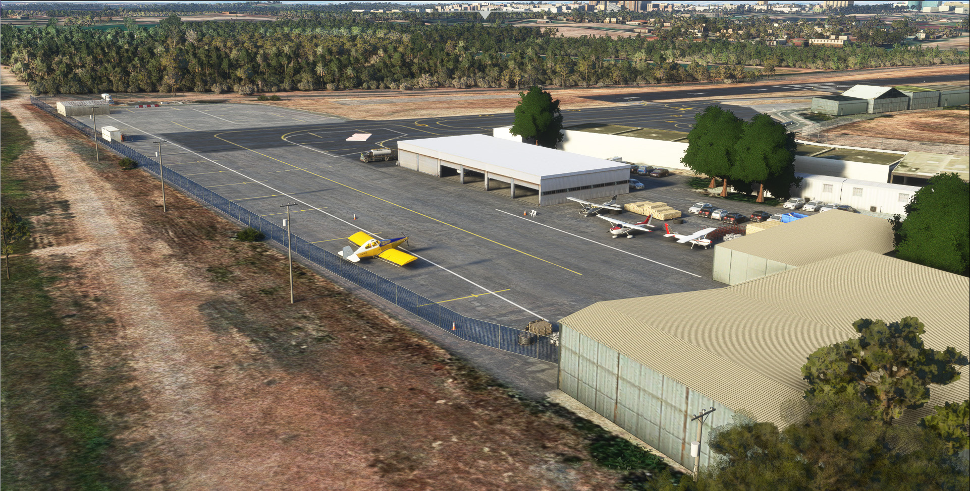
Description
***PLEASE NOTE THAT THERE IS ALSO AN AERIAL PHOTO DOWNLOAD BESIDES THE AIRPORT***
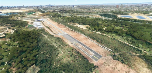
Herzlia Airfield is the home of Israel's general aviation, located in the center of the country, just north of Tel Aviv.
This scenery includes:
*Updated layout per Israeli Civil Aviation Authority
*Updated ground markings
*Custom 3d Objects
*Real world runway elevation and slope
*15 cm/pixel aerial photo
*BENQO1 instrument departure added to database
Location
LLHZ - Herzlia
Explore LLHZ - Herzlia Airfield, the central hub of Israels general aviation scene near Tel Aviv. This detailed scenery update features an accurate layout approved by the Israeli Civil Aviation Authority, enhanced ground markings, custom 3D objects, and realistic runway elevation and slope. Additionally, enjoy the high-quality 15 cm/pixel aerial photo for an immersive flying experience.


User Reviews
2 reviews
Version History
Updated runway designations from 29-11 to 28-10 Updated aprons and runway colors and materials Removed duplicate windsock
Related
LLMG - Meggido
Discover LLMG - Meggido, an Israeli GA airfield featuring a former RAF airbase nestled in the picturesque Jezreel valley. Unveil crop dusters, a flight school, and an aerial firefighting unit within its premises. Immerse yourself in custom 15 cm/pixel aerial photography, updated layouts, parkings, night lighting, and more in this detailed scenery.
by Bar Rodoy and Niv Tesler - Israeli Flight Sim Developers
LLMZ - Metzada Bar Yehuda
Explore LLMZ - Metzada Bar Yehuda, the lowest airport in the world at -1248 ft MSL, nestled near the Dead Sea and Masada in Israel. With a 1200 meters runway and GA focus, this scenery boasts updated aerial images, corrected infrastructure, custom objects, and a vibrant aerial photo. Note: The add-on requires the installation of a library pack by Colin Jeffery for full immersion.
by Bar Rodoy and Niv Tesler - Israeli Flight Sim Developers
LLIB - Rosh Pina
Explore the detailed rendition of Rosh Pina airport in northern Israel with this add-on, featuring custom 3D models, accurate layout per Israeli Civil Aviation Authority standards, aerial photo imagery, and precise ground markings. Additionally, the VORDME RWY 33 approach has been incorporated into the MSFS database for a realistic flying experience.
by Bar Rodoy and Niv Tesler - Israeli Flight Sim Developers
LLRS - Rishon Lezion
Explore Rishon Lezion LSA airstrip, the central point for LSA operations in Israel. This add-on features updated layout, ground markings, custom 3D objects, and real-world runway elevation and slope, with high-resolution aerial photos at 15 cm per pixel. Please note some known issues with elevation and vegetation adjustments around the airstrip. Additionally, ensure you have the "Windy Things" library installed for full compatibility.
by Bar Rodoy and Niv Tesler - Israeli Flight Sim Developers
Log in to join the discussion
Log InComments(13)
7 months ago
over 1 year ago
10 months ago
9 months ago
almost 3 years ago
over 3 years ago
מתי זה יעודכן לפי השינוי שנעשה בהרצליה עם המספרי מסלול המעודכנים?
about 3 years ago
היי, לצערי כרגע אין לי זמן לעדכן
over 3 years ago
איך מורידים את הכל אין איזה הסבר לאיזה תיקייה שמים כל דבר??
over 4 years ago
נראה שאין כאן את השדה...
over 4 years ago
יש שני קבצים. פוטו ושדה..
over 4 years ago
זו לא הדרך לייצג את זה כאן - זה מבלבל.
over 4 years ago
תודה רבה! אתם יכולים לעשות את אילת רמון
over 4 years ago
היי, כרגע אין לנו זמן להתעסק בו