
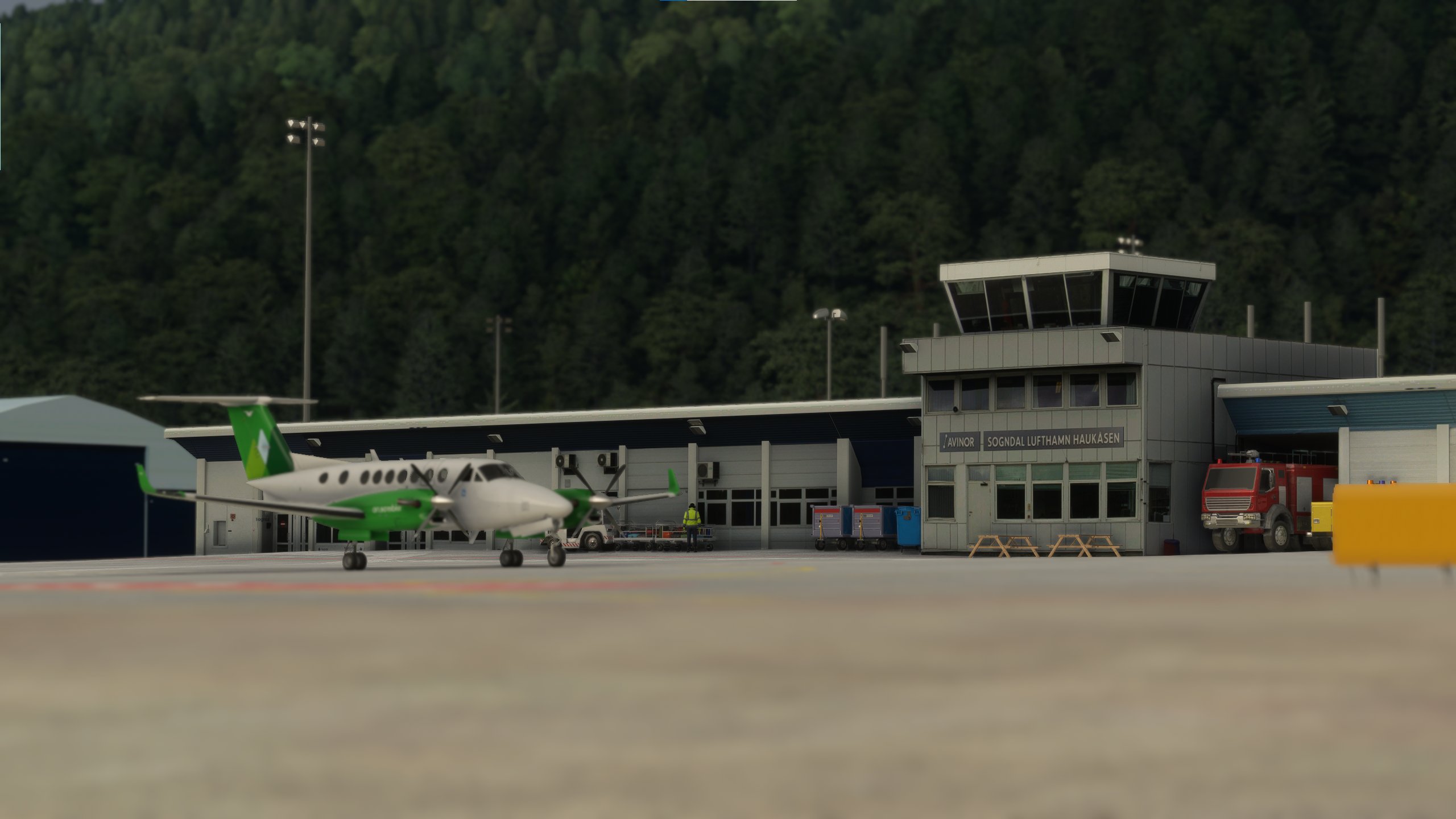
Description
Sogndal Airport, Haukåsen is a regional airport serving Sogndal Municipality and the surrounding area in Vestland, Norway. It is situated at Haukåsen, 498 meters above the longest and deepest fjord in Norway, Sognefjorden. The airport consists of a 1,180-meter (3,870 ft) runway aligned 06/24. Due to the location of the airport, winds and low visibility often make take-off and landing a challange.
FEATURES:
- Custom buildings created by Jan Tore Elvheim
- Custom high-resolution mesh from The Norwegian Mapping Authority
- Custom aerial imagery from Google Maps
- Custom runway lighting based on official airport charts
- Custom apron lighting based on official airport charts
- Custom runway and apron layout based on offiicial airport charts
- Custom ground marking textures to match the real-life markings
- Custom runway grooved texture
- Custom taxi and parking options based on the official real life airport charts
- Correct metadata for the airport
INSTALLATION:
Read the accompanying "READ ME.txt" file
KNOWN ISSUES:
- AI airplanes does not taxi to the end of the runway for takeoff
- Too much snow covers the runway due to how the simulator handles the snow
Enjoy! :D
Location
ENSG - Sogndal Airport, Haukåsen
Discover ENSG - Sogndal Airport, Haukåsen, a regional airport perched 498 meters above the stunning Sognefjorden in Vestland, Norway. Navigate the challenging winds and low visibility as you utilize the 1,180-meter runway aligned 06/24. This add-on offers custom buildings, high-resolution mesh, aerial imagery, and meticulously recreated lighting and layouts based on official airport charts. Please refer to the installation instructions for a smooth setup and note a couple of known issues affecting AI aircraft behavior and snow cover simulation.


User Reviews
3 reviews
Version History
No version history available.
Related
ENSD - Sandane Airport, Anda
Experience the scenic and challenging Sandane Airport, Anda in Norway, nestled between majestic mountains and fjords. This regional airport features custom buildings, high-resolution mesh and imagery, realistic lighting, and hundreds of custom placed objects. Follow official airport charts for accurate runway and taxi layouts, but be prepared for known issues like runway snow cover and floating cars near the tunnel.
by Augustin Winther and Jan Tore Elvheim
![[GUIDE] How to create custom aerial scenery](https://cdn.flightsim.to/images/01/vilz1WFs.png?width=500)
[GUIDE] How to create custom aerial scenery
Learn how to create custom aerial scenery in Microsoft Flight Simulator with this detailed guide, inspired by valuable insights from the FSDeveloper community. Share feedback and enhance your scenery creation skills today!
by Augustin Winther
ENBM - Voss Airport, Bømoen
Explore the scenic Voss Airport, Bømoen (ENBM) in Vestland, Norway with this add-on. Enhance your experience with added runway and apron, realistic ground markings, and corrected airport details for a more immersive flight simulation. Join the Extreme Sport Festival in June, where this airport serves as a hub for thrilling activities like parachuting and hang gliding.
by Augustin Winther
Norwegian Ground Textures
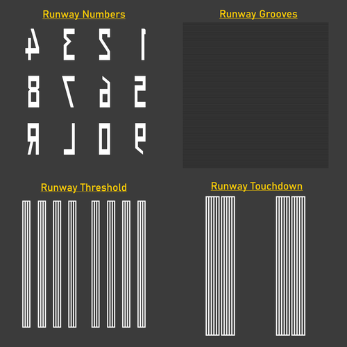
Enhance the visual fidelity of your Norwegian airport experience with this texture library featuring custom-made textures for runway grooves, thresholds, touchdowns, and runway numbers. Please note that prior knowledge of importing custom textures is required for installation.Textures include a Norwegian flair and are free to use in both freeware and payware projects with proper credit given to Augustin Winther.
by Augustin Winther
Log in to join the discussion
Log InComments(7)
almost 2 years ago
about 2 years ago
over 3 years ago
over 4 years ago
Really, really great! Perfact freeware airport along with the new Sandane in the vicinity. Recommend the trip between these two!
almost 5 years ago
Dere har gjort det igjen... Angrer fint på ORBX kjøpet nå 😅
over 4 years ago
Samme her, kjøpte ORBX ...😢😢😢 (I'm kicking myself for that ! )
almost 5 years ago
Wow, judging from the screens this looks on the same level as the ORBX version