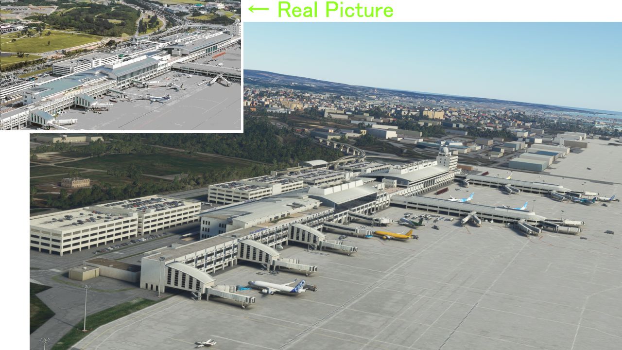
Description
This Naha scenery was created jointly by me = KAZE and Mr. Kuro .
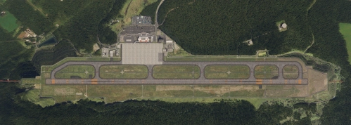
2nd runway creation 2nd runway NAV data ... Kuro
Building... KAZE
ILS is included in this scenery
ILS is 36L=111.70 18R=110.15 36R= 110.30 18L=NONE
2nd NAV data is not included.Click the link below for 2nd runway NAV data (SID/STAR/Approach).
Ver1.6.1(17.58MB)
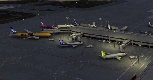
1 I added dotted pushback lines to all gates 21-44 because it was pointed out that there was no dotted line for Pushbacks.
2 I created my own materials and added the 5 lateral lines of GATE 43 and 44.
I also fixed other bugs. I posted the 5th and 6th photos about this remodeling.
Ver1.6(17.53MB)
1 Water entered between No. 1RWY and No. 2RWY, so I removed it.
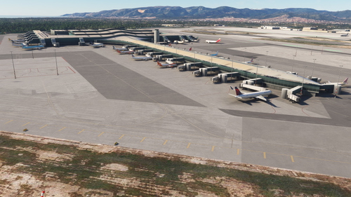
2.The GATE was changed from medium to large, and JAL and ANA were separated.
3. I dirty the runway like the real thing.
I posted a picture of the changed part on the 2nd, 3rd, and 4th sheets.
The file name has changed from the old \h044_naha to \kaze_kuro-airport-roah-naha, so please delete the old file.
この那覇シーナリーはKuroさん(クロリンさん) と 私(=KAZE)が共同でつくりました。
第2滑走路作成&難しいデーターの作成--kuroさん
建物などのobjectーーー 私=KAZE。
ファイル名が 旧¥h044_naha から ¥kaze_kuro-airport-roah-naha にかわっているので 古いファイルを削除してください。
Kuroさん作のNo2滑走路のNAVデータ(アライバル デパーチャー アプローチ)は下のリンクをクリックしてください。
V1.6.1(17.58MB)
1 プッシュバック用の線が全然引けていないと ご指摘があったので GATE21-44のすべてのGATEにおいて GOOGLEマップのとおりに プッシュバックの線を引いていきました、
(5枚目写真左)
2 GATE43 44 にある側線5本を追加しました。(5枚目写真右)
この5本の線の意味 (予想)
(A) 大きい飛行機の場合中央線にINしてきてJETWAYが2つ出てくる(GATE独り占め)
(B) 小さい飛行機の場合 側線にINし 2基のJETWAYが2機の飛行機に別々に接続する。
3 1年半前に追加しました中央線の 黒ぶち線において、少しズームで引くと線が白っぽくなってしまうバグがあったので
それをV1.6で直すつもりが忘れてしまったので 今回のV1.6.1で直しました。(6枚目の右側)
4 エプロンを走るデフォルトの道路の幅が22メートルと巨大でしかも歪んでいるので これを8メートルにして真っすぐにしました。(6枚目の写真左側)
Ver1.6(17.53MB)
1 滑走路の横つなぎ部が水浸しになっているので修正しました。
2 gateを一部heavyにして FSLTL使用時に ANAとJALの振り分けを行いました。
3 滑走路を汚しました。
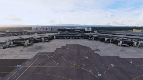
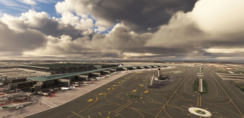
4 その他 変更ぶんは2,3,4枚目の写真とおりです。
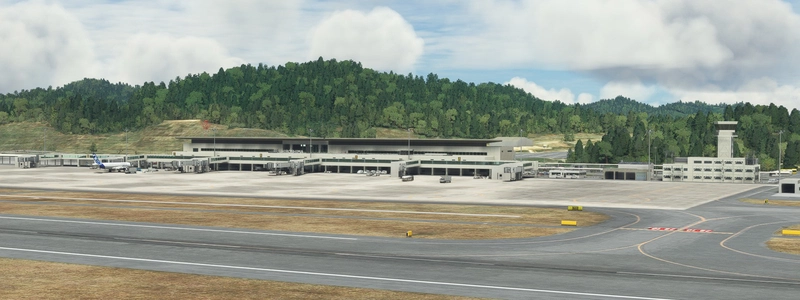
那覇については 今後、自衛隊の建物を追加していきたいと思っています。
Dependencies
Comments(107)
Log in to join the discussion
Log Inover 1 year ago
fs2020を昨年導入しましたが、kazeさんなどの努力がなければ、ここまで充実したものにはなっていません。
ほんとに感謝しています。今後のご活躍もお祈りいたします。
over 1 year ago
almost 2 years ago
almost 2 years ago
about 2 years ago
about 2 years ago
about 2 years ago
over 2 years ago
over 2 years ago
over 2 years ago
over 2 years ago
over 2 years ago
I forgot to implement ILS approaches...
over 2 years ago
もし可能なのであれば第一、第二滑走路にアレスティングワイヤーを引いてほしいのですが可能でしょうか...
over 2 years ago
DO NOT REUPLOAD to flightsim.to or other websites thank you.
over 2 years ago
almost 3 years ago
almost 3 years ago
almost 3 years ago
almost 3 years ago
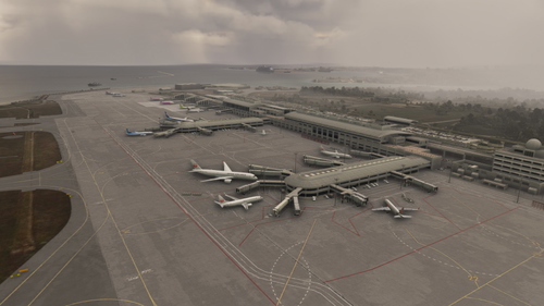
(ROAH) NAHA Airport 2022
Enhance your Flight Simulator experience with the ROAH Naha Airport 2022 add-on, a collaborative creation by KAZE and Mr. Kuro. This scenery features a second runway with NAV data provided separately, including ILS frequencies for precision approaches. Version updates bring improvements such as pushback lines, gate adjustments, and realistic runway details. Discover the detailed enhancements and updates in this immersive airport scenery for Microsoft Flight Simulator.
User Reviews
31 reviews
More Information
Version History
Ver1.6.1 1, I added dotted pushback lines to all gates 21-44 because it was pointed out that there was no dotted line for pushbacks. 2 , I created my own materials and added the 5 lateral lines of GATE 43 and 44. I also fixed other bugs.
Featured in Collections(1)
Related
![[Navdata] ROAH - Naha Airport](https://cdn.flightsim.to/images/22/naha-airport-roah-5t29p.jpg?width=500)
[Navdata] ROAH - Naha Airport
Enhance your Naha Airport experience with this NavData add-on, merging seamlessly into KAZEs scenery in Microsoft Flight Simulator. Make sure to use V1.4 or later for accurate utilization. Navigraph users are advised not to install for potential compatibility issues. Download now for an updated airport navigation data experience.
by Kurorin
ROAH Naha AI Config Enhancement (KAZE)
Enhance the AI operations at KAZEs Naha ROAH with this mod, increasing AI aircraft spawning and opened gates. Enjoy updated airline coding, optimized airline-specific coding, gate radius overhaul, and preserved original scenery files. Easy installation process for a seamless experience.
by Ryanosaurus13
ROAH Naha FSLTL Static Aircraft (MKStudios)
Enhance your experience at Naha Airport (ROAH) with this static aircraft add-on designed for the payware version by MKStudios. Utilizing FSLTL models, it brings a more dynamic atmosphere to the airport without the need for the FSLTL Injector. Please note that this enhancement places static aircraft, which may limit access to some gates, and requires specific aircraft models for full functionality.
by StaticSceneries
ROAH Naha FSLTL Static Aircraft
Enhance your virtual airport experience with ROAH Naha FSLTL Static Aircraft add-on. This scenery uses FSLTL models to bring life to the Naha airport without the need for FSLTL Injector. Compatible with FSLTL Base models, these static aircraft add a realistic touch while maintaining performance. Please note that some gates are not usable due to the placement of these aircraft.
by StaticSceneries
12 months ago