Description
This package contains an improved scenery of Long Tieng (Lima Site 20 Alternate) airport, as well as two smaller bonus air strips nearby: Sam Thong (Lima Site 20) and Xieng Dat (Lima Site 26). The scenery only uses default MSFS/Asobo object libraries (which is why the file size is so small).
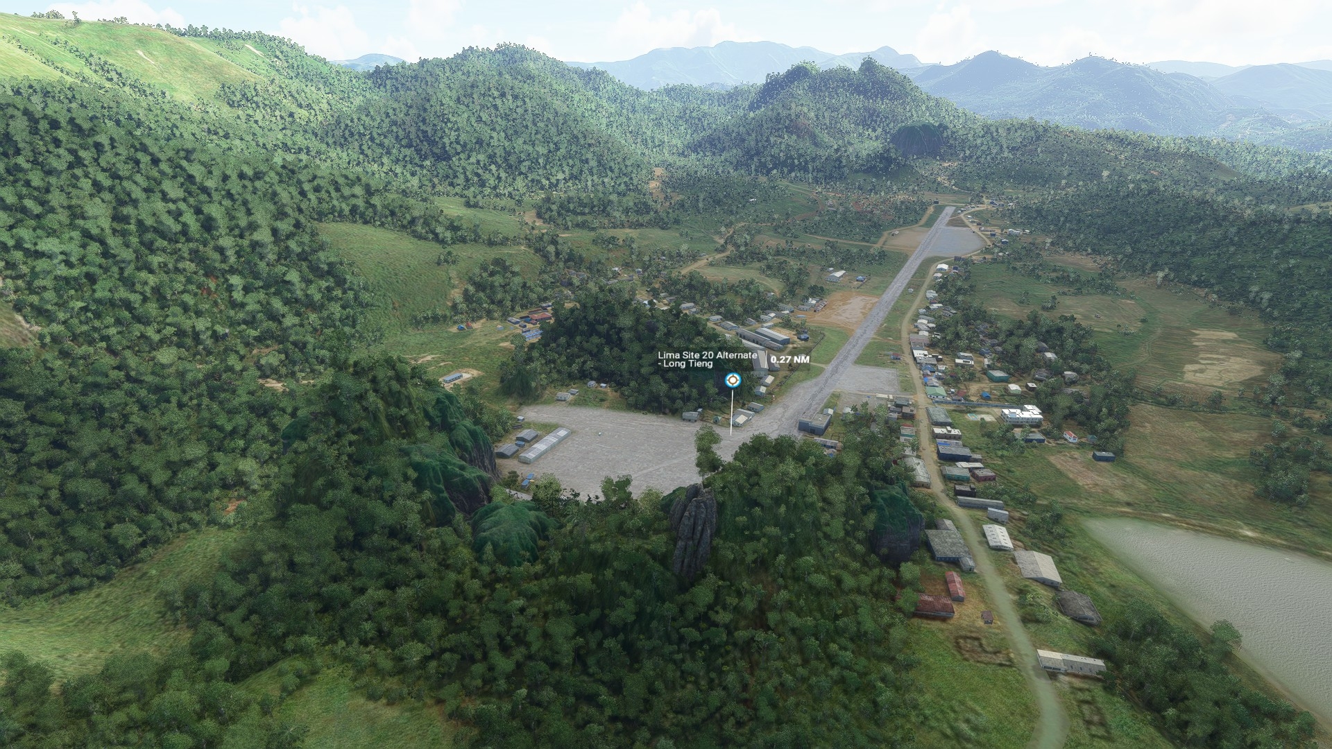
LS20A (Long Tieng) features revisions to terrain, including karst (limestone cliffs) around the airfield, additional buildings, changes to vegetation (smaller, sparser trees in certain areas to better reflect local landscape), a paved runway and parking pads, as well as a helipad on Skyline Ridge overlooking the airfield - plus numerous "flavour objects" and a few easter eggs.
LS20 and LS26 feature more modest updates, with earth runways suitable for smaller aircraft, as well as some added buildings and flavour objects. There are also elevation changes, particularly at LS26 where the Nam Ngum river's elevation for a couple of miles north and south of the airfield has been tweaked.
----------
Hidden in a high mountain valley in northern Laos lay the remains of an aviation legend. For a brief period in the 1960s-70s, when it was not even marked on any maps, Long Tieng - also known as "Lima Site 20 Alternate" or "Sky", was simultaneously all of the following:
This scenery pack makes it flyable once again! It doesn't quite bring Long Tieng up to the height of its glory days - but spruces it up just enough to be serviceable and ready for traffic.
"Alternate" certainly offers up some challenging flying. While the high, bowl-shaped plateau among sharp karst peaks offered an ideal location for shielding it from attack and observation - flying here is far removed from any modern forms of safety. On the south end of the airfield, a steep, off-angle approach is required for a safe landing. Only northbound landings and southbound takeoffs are possible - owing to the unique terrain feature (otherwise known as a cliff) on the north end of the runway, which pilots called the "vertical air brake"... for reasons which should be self-explanatory!
------
NOTES (v 0.1):
-------------------------------------------------------
INSTALLATION
Unzip contents of this folder to your Community add-ons folder (where this is located depends on your installation).
LS20A (Long Tieng) features revisions to terrain, including karst (limestone cliffs) around the airfield, additional buildings, changes to vegetation (smaller, sparser trees in certain areas to better reflect local landscape), a paved runway and parking pads, as well as a helipad on Skyline Ridge overlooking the airfield - plus numerous "flavour objects" and a few easter eggs.
LS20 and LS26 feature more modest updates, with earth runways suitable for smaller aircraft, as well as some added buildings and flavour objects. There are also elevation changes, particularly at LS26 where the Nam Ngum river's elevation for a couple of miles north and south of the airfield has been tweaked.
----------
Hidden in a high mountain valley in northern Laos lay the remains of an aviation legend. For a brief period in the 1960s-70s, when it was not even marked on any maps, Long Tieng - also known as "Lima Site 20 Alternate" or "Sky", was simultaneously all of the following:
- One of the world's busiest airfields, seeing hundreds of takeoffs and landings on its busiest days.
- One of the world's largest refugee camps, home to over 40,000 Laotian Hmong displaced by war.
- The headquarters of a secret guerrilla army and a small de-facto independent air force, made up of covert US personnel (most notably the Raven forward air controllers flying O-1 Bird Dogs), and a group of American-trained Hmong pilots called Chaopakao flying armed T-28s as attack aircraft.
- The largest CIA facility outside the US, with the highest density of sophisticated radio antennas per square mile anywhere in the world during that time.
This scenery pack makes it flyable once again! It doesn't quite bring Long Tieng up to the height of its glory days - but spruces it up just enough to be serviceable and ready for traffic.
"Alternate" certainly offers up some challenging flying. While the high, bowl-shaped plateau among sharp karst peaks offered an ideal location for shielding it from attack and observation - flying here is far removed from any modern forms of safety. On the south end of the airfield, a steep, off-angle approach is required for a safe landing. Only northbound landings and southbound takeoffs are possible - owing to the unique terrain feature (otherwise known as a cliff) on the north end of the runway, which pilots called the "vertical air brake"... for reasons which should be self-explanatory!
------
NOTES (v 0.1):
- The depiction of the airfields neither represents their current state (where they have been abandoned for decades), nor exactly as they would have looked at their peak in the late 60s-early 70s - but somewhere in between. Think of them more as partial, modern-day restorations.
- There may be some inconsistencies in the way cliffs immediately next to the runway at Long Tieng are displayed when zooming in from longer distances (e.g. floating objects, objects popping in). These should display correctly once you get closer.
- NO AI TRAFFIC: at the moment, while the airfields are fully usable for player aircraft - they are not configured for AI use, and you will not see AI aircraft, vehicles, or ground crews at any of them. This may be revised in later updates.
- CAR TRAFFIC: unfortunately, Long Tieng's runway is currently considered a road in MSFS - and I was not able to remove AI cars from it. If you plan to use it - I suggest turning off road traffic (set it to 0 from Generall Options => Traffic) when using the Long Tieng runway. Looking into ways to correct this.
-------------------------------------------------------
INSTALLATION
Unzip contents of this folder to your Community add-ons folder (where this is located depends on your installation).
Comments(17)
Log in to join the discussion
Log InMSFS 2020MSFS 2024
Laos - Long Tieng scenery pack (3 airfields)
Experience the historical legacy of Laos with this scenery pack featuring Long Tieng Airport and two bonus air strips. Updated terrain, buildings, vegetation, and smaller details bring these airfields to life, offering a glimpse into their fascinating past as hubs of covert military operations. Fly into the high mountain valley of Long Tieng, once a bustling airfield with a rich history during the Secret War in Laos, and explore its unique challenges and hidden easter eggs.
Downloads1K
Version0.1
File Size101.21 KB
Published5 years ago
Updated5 years ago

User Reviews
4.9
9 reviews
5
89%
4
11%
3
0%
2
0%
1
0%
Location
More Information
Version History
No version history available.