
Description
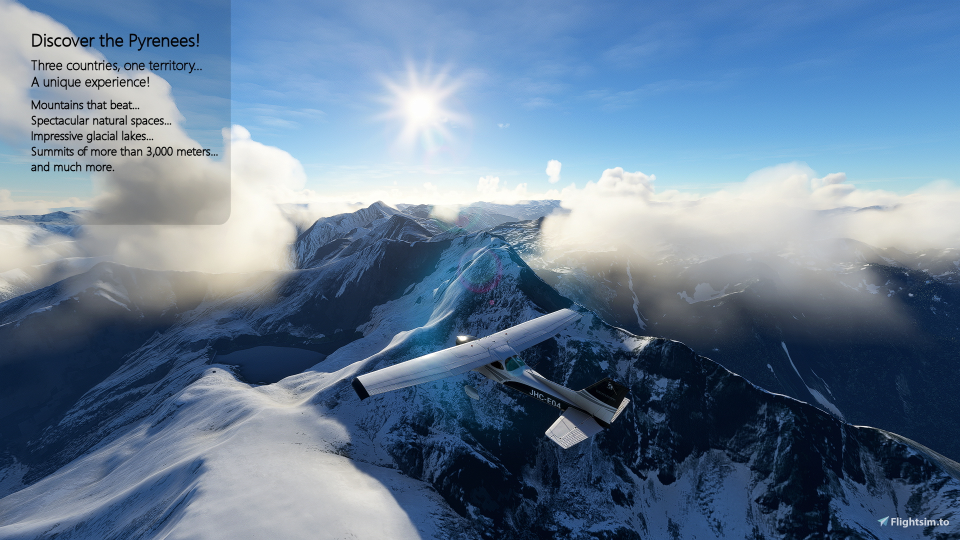
Discover the Pyrenees! #1
Three countries, one territory... a unique experience!
A different way to discover the Pyrenees: BushTrip and Mission at the same time. In each leg you will have to perform a mission to complete your BushTrip. Mountains that beat... Spectacular natural spaces... Impressive glacial lakes... Summits of more than 3,000 meters... and much more.
The Pyrenees, together with the Rhine, the Danube and perhaps the Ural mountains, are one of the orographic formations that have historically constituted a natural border between territories. Inhabited since prehistory, over the centuries they have seen how their valleys were crossed by Carthaginians, Romans, Arabs and Christians.
With an extension of 430 km, the Pyrenees unfold from Cap de Creus, in the Mediterranean, to the Cantabrian mountain range and form a natural barrier between the Iberian Peninsula and the rest of the European continent. Its natural wealth is unquestionable. Infinite. A mountain range of contrasts that connects two seas, the Cantabrian and the Mediterranean, through imposing peaks, ancient glaciers and endless forests. Places of special natural, geological and landscape wealth that value the great diversity of the Pyrenees. Here we find such obvious contrasts as the three-thousanders of the Maladeta massif and the Mediterranean setting of Cap de Creus.
Thanks to its peaks over 3,000 meters high and its spectacular valleys and glacial lakes, it is a popular tourist destination. In winter, the snow-covered slopes attract skiers and snowboarders. After the cold, with the thaw and the explosion of spring, they turn bright green and become a hiking mecca. There is no shortage of places to practice whitewater sports or, for those seeking tranquility, hot springs and spas where you can relax. But they also keep other secrets. The inhabitants of the Pyrenees are lovers of their traditions and their culture and many of their towns are presided over by beautiful Romanesque churches, traces of the past in which the character of their people was forged, tough but at the same time friendly.
This first part of the Pyrenees is made up of four legs and we will basically discover the Catalan Pyrenees, which occupies almost half of the entire Pyrenees. We will pass through the Eastern Catalan Pyrenees, the French Catalan Pyrenees, Andorra, the Arriège and the Country of Comminges and the Western Catalan Pyrenees.
You will be flying the Cessna 172 Skyhawk (G1000) and have the weather window active so you can experience all the routes at different times and seasons. At the beginning of each leg, the plane is parked and in a Cold & Dark situation. If you want to start the plane quickly, just press the "CTRL + E" keys and activate the lights. You also have a flight plan available with all legs (Pirineus 01.pln).
I hope you enjoy it!
Discover the Pyrenees! #2: https://flightsim.to/file/38464/discover-the-pyrenees-2
Discover the Pyrenees! #3: https://flightsim.to/file/40574/discover-the-pyrenees-3
Note: BushTrip created with BushTripInjector, many thanks to its creator BuffyGC for her support and help, and with LittleNavMap by Alexander Barthel. Spanish/English translations: Google Translator. I also thank the authors of the photographs included in each leg. Music by Musictown from Pixabay.
Installation:
You have two .rar files available:
- Pyrenees_01 CAT-ESP-ENG.rar: contains the text and audio files in Catalan (es-ES), Spanish (es-MX) and English
- Pyrenees_01 ESP-ENG.rar: contains the text and audio files in Spanish (es-ES, es-MX) and English
Once the corresponding file has been downloaded, unzip the file and copy all the folders “pir-pirineos-Exx -CAT” and/or “pir-pirineos-Exx” and “pir-pirineos-E01s” in the "Community" folder of your MSFS.
If you have an older version installed, first delete all the "pir-pirineos-Exx" and/or “pir-pirineos-Exx -CAT" and "pir-pirineos-E01s" directories from the "Community" folder.
Location
Discover the Pyrenees! #1
A different way to discover the Pyrenees: BushTrip and Mission at the same time. In each leg you will have to perform a Mission to complete your BushTrip. Mountains that beat... Spectacular natural spaces... Impressive glacial lakes... and much more.


User Reviews
9 reviews
Version History
Activated the 'Meeting Point' indication Readjusted to MSFS Release 1.37.19.0
Related
Welcome to Catalonia!
Catalonia is very rich in natural scenery, with 15 sites declared to be natural parks and areas as remarkable as the Aigüestortes i Estany de Sant Maurici National Park and Monserrat Mountain. In the south, we can note the Ebre Delta, one of the most important wetland areas of the Mediterranean, which is home to up to 330 bird species, half of those in the whole of Europe.
by Joanhoc
Kamchatka… land of fire and ice
The volcanoes of Kamchatka... World Heritage Site. Geysers, volcanoes, majestic cone-shaped mountains, lakes, limitless glaciers, vast forests, rivers full of salmon and parks with wild animals. Kamchatka… a volcanic paradise in the kingdom of the grizzly bear.
by Joanhoc
Discover the Pyrenees! #2
A different way to discover the Pyrenees: BushTrip and Mission at the same time. In each leg you will have to perform a mission to complete your BushTrip… Mountains that beat... Spectacular natural spaces... Impressive glacial lakes... and much more.
by Joanhoc
Welcome to Aragon!
Its natural wealth is unquestionable. Infinite. It is a land of contrasts that connects the high peaks of the Pyrenees with the steep mountains of Teruel, through the arid steppes of the Ebro. This great variety in such a small space has generated an exceptional landscape that surprises us with its extreme and impressive contrasts of climates, soils, flora, fauna and ecosystems.
by Joanhoc
Log in to join the discussion
Log InComments(21)
about 3 years ago
about 3 years ago
I am very happy that you liked.
over 3 years ago
me he descargado los archivos CAT pero solo se escucha en ingles , como puedo cambiar las voces a catalan?
over 3 years ago
Al descargar los archivos CAT tienes opción a los tres idiomas: catalán, español e inglés.
Para cambiar de idioma tienes que cambiar el idioma del MSFS2020 desde:
Options -- General Options -- Misc -- International Settings -- Language – ES-ES
Si seleccionas el idioma ES-ES los textos y las voces están en catalán.
Si seleccionas el idioma ES-MX los textos y las voces están en español.
Si seleccionas cualquier otro idioma los textos y las voces están en inglés.
Cuando cambies de idioma tendrás que reiniciar el MSFS2020.
Espero haberte ayudado.
over 3 years ago
la avioneta practicamente no gira al hacer el taxeo. le pasa a alguien mas?
over 3 years ago
Hola,
Gracias por tu puntuación. Me alegro de que te gusten estos recorridos.
En lo referente a la avioneta lo he probado y a mí me funciona como siempre. A lo mejor tienes que actualizar algún controlador… Aquí no sé cómo ayudarte.
over 3 years ago
A great trip with wonderful landscapes. It is very beautiful and interesting!
10/10 thanks for your amazing work.
over 3 years ago
Thanks a lot for your score. I'm delighted that you enjoy these tours.
over 3 years ago
Moltes gracias Joan.
Salutacions cordials desde l´Amporda.
Albert
over 3 years ago
Albert, moltes gràcies per la teva puntuació. Aquesta ruta comença a la teva terra 😊... M’alegro molt de que t’agradi. Salutacions.
about 4 years ago
Muchas gracias por el esfuerzo de crear estas rutas! Al igual que las demás, está genial. Creo que he "fallado" la primera misión, no obstante, porque al aterrizar ha sonado un "Noooo" :P No hice la parada a mitad del recorrido
PS: sí que es verdad que la música está un poco alta en relación al resto de sonidos (uso un visor HP G2 con sus auriculares, quizá con un equipo mejor no se nota tanto)
about 4 years ago
Muchas gracias por tu valoración Darcaem. Si… en estas cuatro rutas tienes que realizar una o varias paradas para completar los recorridos. Si no las realizas, al aterrizar te dice que no has realizado la misión de forma correcta. He creído que de esta manera los recorridos son más entretenidos y también poder descubrir así otros aeródromos.
En lo referente al sonido, he estado investigando y buscando niveles de referencia para que el sonido sea más ajustado para todos los ordenadores y creo que he conseguido unos niveles mucho mejor. Los estoy ajustando y, al mismo tiempo, estoy actualizándolo para que las voces se escuchen también en inglés. Me gustaría saber tu opinión cuando los actualice.
over 4 years ago
This looks good, and it is, mostly, except for a few VERY annoying 'features'; the main one being the VERY annoying, and way too loud, voice, in Spanish, and the VERY annoying music and chimes! there are no chimes in a 170, so what are you thinking?! I don't want to go into settings to turn down/off volume so I can't hear it. It's annoying, and shouldn't be there, and for anyone who doesn't speak Spanish, it's very VERY annoying!
Now, the real problems with this is - The Nav Log - which is a complete mess! Almost all the POI text is incorrect. Beginning at POI9, the rubbish begins; It says to head in a 'SW' direction, at 354°!! That is NOT SW! Again, with POI10 'head NW on a heading of 225°'. 225°is NOT NW! This mess goes on and on. At POI20 it tells you to decend to 1500'! If I did that I'd crash into a mountain/the ground!!! POI23 tells you to land at ORDIS, but ORDIS is not POI23!
about 4 years ago
Hi, I'm sorry you didn't like the voices because they were in Spanish. As far as the volume is concerned, I will try to reduce it more… currently it is already reduced to a quarter of its real volume and on each computer it is different.
With regard to the POIs, you have made a mess of yourself starting with POI8. You have interpreted that you were at POI9 when in fact you were at POI8 and so on until the end. For this reason the instructions to follow from the NavLog did not fit you.
At POI8 it tells you: “Head north until you reach the….” and the direction to go from this point is 354.
At POI9 it says: “Change to a south-westerly direction and follow the…” and you have to follow direction 225.
And so on until the end.
about 4 years ago
Hi, I wanted to thank you, because after reading your comment regarding the volume of the voices, I have been researching and looking for reference levels to make the sound more adjusted for everyone and I think I have achieved much better levels.
On the other hand, let me tell you that bushtrips can now be done in several languages and that I am updating it so that voices in English can also be heard. I would also like that when you make comments you always make them positive, since carrying out these bushtrips takes a long time and we can always improve them together. I would like to know your opinion when I update them later.
over 4 years ago
Espectacular… has mezclado cada BushTrip con una misión. Las vistas impresionantes. Gran trabajo.
Felicitaciones al creador.
over 4 years ago
Si, este recorrido por esta parte de los Pirineos es muy espectacular. Me alegro mucho de que te haya gustado. Muchas gracias por tu valoración.
over 4 years ago
Estos recorridos son excelentes y muy bien documentados con las voces, la música y las instrucciones del copiloto. Es un placer volar y descubrir los Pirineos de esta manera. Además, son muy entretenidos ya que tienes que aterrizar y despegar varias veces en cada recorrido para recoger a personas o material. Sin duda 5 estrellas.
over 4 years ago
Me alegro mucho de que te haya gustado. Esto me da ánimos para realizar más. Muchas gracias por tu valoración.