
Description
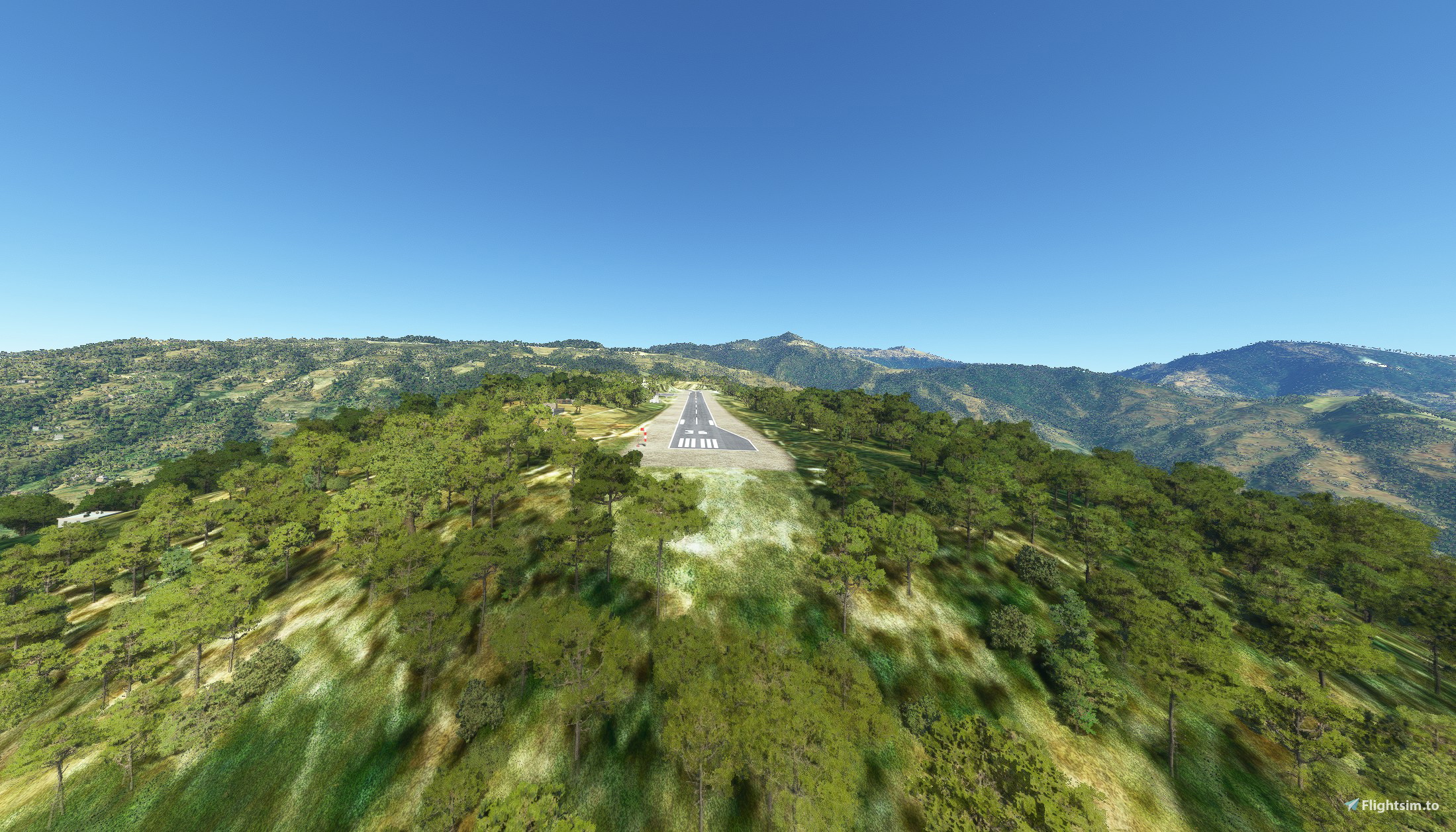
Thamkharka Airport (ICAO: VNTH) is a domestic airport located in Khotehang serving Khotang District, a district in Province No. 1 in Nepal
Airport type Public
Elevation amsl : 5.238 ft / 579 m
Owner : Government of Nepal
Operator : Civil Aviation Authority of Nepal
Coordinates 27.0482° or 27° 2' 53.4" north 86.8577° or 86° 51' 27.8" east
Runways Direction 18/36
Runways Dimension 630 m x 20 m / 2.067 ft x 66 ft
Service : AFIS / Visual Flight Rules (VFR)
Type of Aircraft : DHC6, L410, Y12, C208
The Mod must be unzipped and introduced in the Community folder
There is the VNTHF Waypoint, created for the occasion and not existing in the aeronautical charts, south of Runway 36 at 4NM, for reference to the approach of Runway 36.
Fly over this Waypoint at 6,000 ft with bow at 179 ° and set the altitude at 5,300 ft for the approach to Runway 36.
L'aeroporto di Thamkharka (ICAO: VNTH) è un aeroporto nazionale situato a Khotehang che serve il distretto di Khotang, un distretto della provincia n. 1 del Nepal.
Tipo Aeroporto: Pubblico
Elevazione AMSL: 5.238 ft / 579 m
Proprietario: Governo del Nepal
Operatore: Civil Aviation Authority of Nepal
Coordinate: 27.0482° or 27° 2' 53.4" nord 86.8577° or 86° 51' 27.8" est
Direzione Runways : 18/36
Dimensioni Runways : 630 m x 20 m / 2.067 ft x 66 ft
Servizi: : AFIS / Visual Flight Rules (VFR)
Tipologia di Aeromobili: DHC6, L410, Y12, C208
La Mod deve essere zippata e introdotta nella cartella Community
E’ presente il Waypoint VNTHF, creato per l’ occasione e non esistente nelle carte aeronautiche, a sud della Runway 36 a 4NM, per riferimento all’ approach della Runway 36.
Sorvolare questo Waypoint a 6.000 ft con prua a 179° e impostare a 5.300 ft l’ altitudine per l’ approccio alla Runway 36.
Location
Thamkharka Airport VNTH - Nepal
Thamkharka Airport VNTH - Nepal is a public airport located in Khotehang, serving Khotang District in Province No. 1, Nepal. The airport features a single runway with dimensions of 630m x 20m and is suitable for aircraft like DHC6, L410, Y12, and C208. The add-on includes the VNTHF Waypoint for reference during the approach to Runway 36, enhancing the flying experience in this region of Nepal. Remember to unzip and install the mod in the Community folder for a seamless integration into Microsoft Flight Simulator.

User Reviews
1 reviews
Version History
No version history available.
Featured in Collections(1)

Related
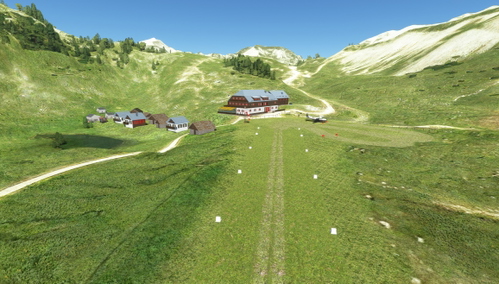
Sennes Rifugio Fictional ITALY LIVP
Experience a fictional military airfield in Italy with Sennes Rifugio add-on for Microsoft Flight Simulator. Explore the history of Cold War training missions with Cessna L-19 Bird Dog and Piper J-3 Cub aircraft. Discover a realistic recreation of this abandoned runway in South Tyrol, complete with custom features and an RNAV flight plan included. Assisted by pilot Pier74 I-PIER and 3D support from Lucio Barelli, this mod offers a unique and immersive flying experience.
by Giampa_PoL
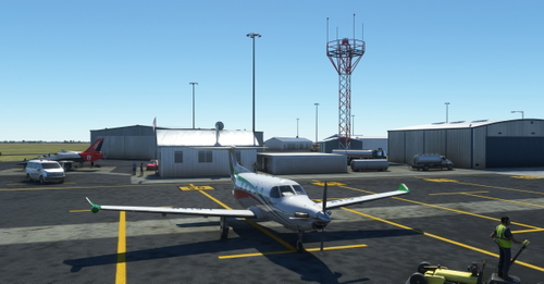
Littlefield Municipal Airport, Texas U.S.A. KLIU
Littlefield Municipal Airport is a small airport in Texas, United States. The airport is located at latitude 33.92390 and longitude -102.38700. The airport has 2 runways: 1/19 and 13/31 The ICAO airport code for this field is KLIU. The other closest courses are Rose Ranch Airport and Muleshoe Municipal Airport.
by Giampa_PoL
pol-luci-lsza
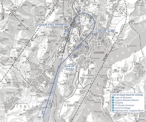
Enhance your flight simulation experience with the LSZA Lugano Runway Lead-in Lighting System for RWY19. This add-on features accurate positioning of flash light pylons based on real GPS data, providing a realistic approach to Lugano LSZA "CIRCLING CHARLIE RWY 19". Enjoy improved runway lighting for a more immersive landing experience.
by Giampa_PoL
Log in to join the discussion
Log InComments(8)
over 2 years ago
over 3 years ago
Unfortunately non compatible with Orbx Himalayas mesh
over 4 years ago
Hi Giampa_PoL, thanks for creating this addon in Nepal!
over 4 years ago
Grande lavoro, complimenti, sempre impeccabili le tue mod!
over 4 years ago
Fantastico lavoro, grande esperienza di volo.
over 4 years ago
If you just put the coordinate in, then your location link will work:
27.049295° 86.856912°
Thanks for the fun airfield.
over 4 years ago
Thanks for your help, it's my first time posting and I didn't know the coordinate format.
Glad you like it
over 4 years ago
Happy to help any way I can.