VERY IMPORTANT:
-The default ingame imagery displays several graphical artifacts for Isle of Man. In order to enjoy this scene, please use MSFS2020 Map Enhancement mod ( https://flightsim.to/file/19345/msfs-2020-google-map-replacement ) and select "Bing (latest)". DO NOT select Google imagery as it features similar issues to the default one.
-In order to see the boats in the scenes, you need to download Seafront Core Library which is availalble for free in MSFS store
New in v1.0: added Marine Drive Arch, Derby fort and St Michaels Chapel
The Isle of Man, also known as Mann, is a self-governing British Crown Dependency in the Irish Sea between Great Britain and Ireland. As head of state, Charles III holds the title Lord of Mann and is represented by a Lieutenant Governor. The government of the United Kingdom is responsible for the isle's military defence and represents it abroad.
The Isle of Man has designated more than 250 historic sites as registered buildings. This mod contains only a few of them.
-Peel Castle was originally constructed by Norwegians. The castle stands on St Patrick's Isle which is connected to the town by a causeway. It is now owned by Manx National Heritage and is open to visitors during the summer.
-Castle Rushen is a medieval castle located in the Isle of Man's historic capital, Castletown, in the south of the island. It towers over the Market Square to the south-east and the harbour to the north-east. The castle is amongst the best examples of medieval castles in Europe and is still in use as a museum and educational centre.
-The Great Laxey Wheel (also known as Lady Isabella) is built into the hillside above the village of Laxey. It is the largest surviving original working waterwheel in the world.Designed by Robert Casement, the wheel has a 72-foot-6-inch (22.1 m) diameter, is 6 feet (1.8 m) wide and revolves at approximately three revolutions per minute. The wheel was built in 1854 to pump water from the Glen Mooar part of the Great Laxey Mines industrial complex. It was named "Lady Isabella" after the wife of Lieutenant Governor Charles Hope, who was the island's governor at that time.
-Corrin’s Tower is a large square building, 50 feet high located south of Peel. It was erected around 1806 by Thomas Corrin who owned this hill and other property in the neighbourhood. Thomas Corrin often stayed on the third floor reading by a small fireplace. As a consquence, the windows on all three floors of the east side of the tower are blocked up, due to complaints that ships were mistaking the tower light for the Peel breakwater light.
-Milner's Tower on Bradda Head was built in 1871 by public subscription as a memorial to the benefactor of Port Erin, William Milner, who did much to help the village fishermen and the poor.
-The Tower of Refuge is a stone-built castellated structure which was erected on St Mary's Isle (also known as the Conister Rock) in Douglas Bay in order to afford shelter to mariners wrecked on the rock.
-Port St Mary is a village district in the south-west of the Isle of Man. The village takes its name from the former Chapel of St Mary which is thought to have overlooked Chapel Bay in the village. The mod also features the telecommunication tower standing above the village.
-Thousla Cross commemorates the rescue of the crew of the French schooner Jeune St Charles that was wrecked on Thousla Rock in 1858
-Sir Percy Cowley Monument is a memorial stone dedicated to one of the island’s greatest conservationists. Sir William Percy Cowley was instrumental in the formation of the Manx National Trust and helped the Isle of Man gain more autonomy from the United Kingdom through constitutional reform through his work as a High Baliff and Deemster, as well as his work as Chairman of the War Consultative Committee.
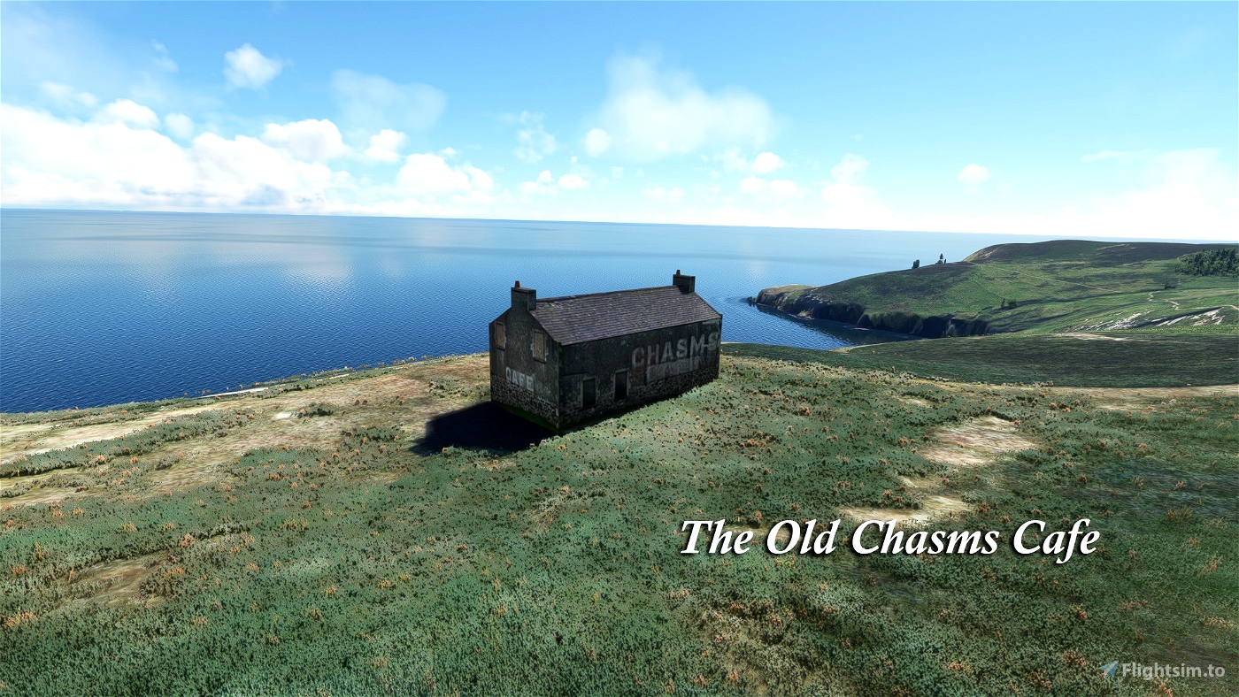
-The Old Chasms Cafe is a derelict building located in the cliffs south of Port St Mary. Little information is known about it.
- New in v1.0 Marine Drive Arch: this ornate gateway marks the entrance to Marine Drive which leads along the cliffs from Douglas to the resort of Port Soderick.
- New in v1.0 Derby Fort: this former military fort is situated on St Michael's Isle. The fort was constructed by James Stanley, the 7th Earl of Derby and Lord of Mann in 1645, during the English Civil War, to protect the then busy port of Derbyhaven.
- New in v1.0 Saint Michael's Chapel: the remains of this 12th century chapel are located just south of Derby Fort.
The landmarks have been manually recreated from various photos and videos from the internet.
This mod is not intended for sale or resale.


2 months ago
CaptainMoonlight
3 months ago
Superthirteen13
7 months ago
7 months ago
mv46
LePapeBorgia
10 months ago
Archer374