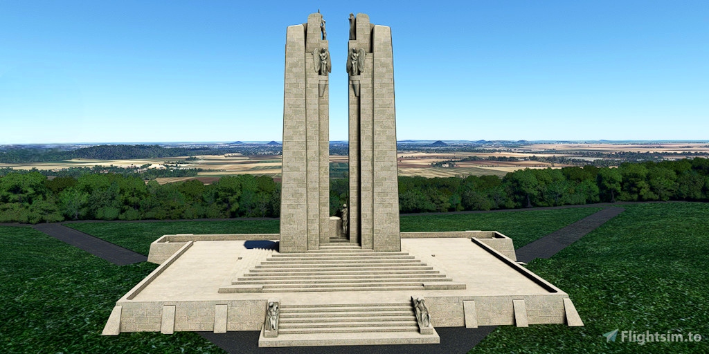
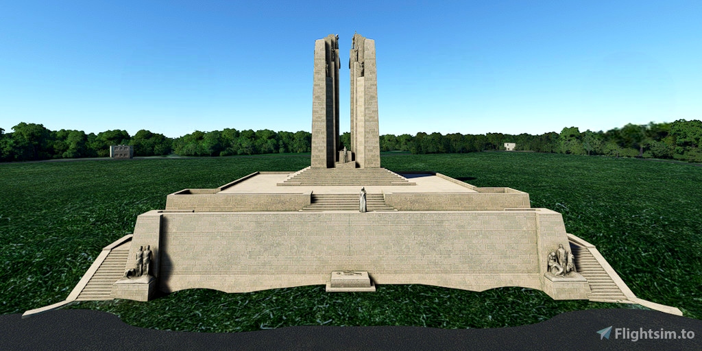
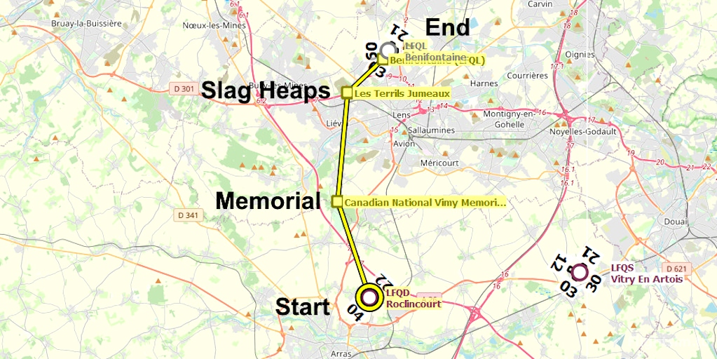
The Canadian National Vimy Memorial is a site in France dedicated to the memory of Canadian Expeditionary Force members killed during the First World War. It also commemorates Canadian soldiers who died in the First World War who have no known grave.
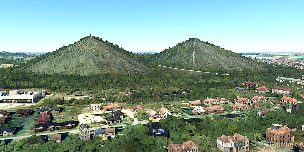
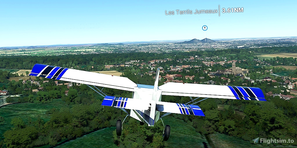
Les Terrils Jumeaux are slag heaps, where rocks were dumped after being transported to the surface during mining. The use of transport systems, like conveyor belts, created huge, circular pyramids. While flying between the Canadian memorial and Les Terrils, look around. There are many other visible slag heaps.
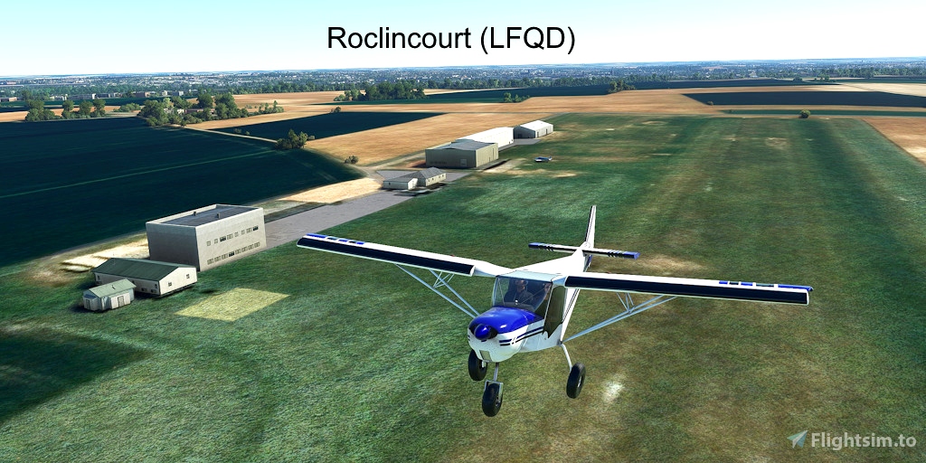
Runway that departs in the direction of the flight plan: 04
Distance: 9 nautical miles
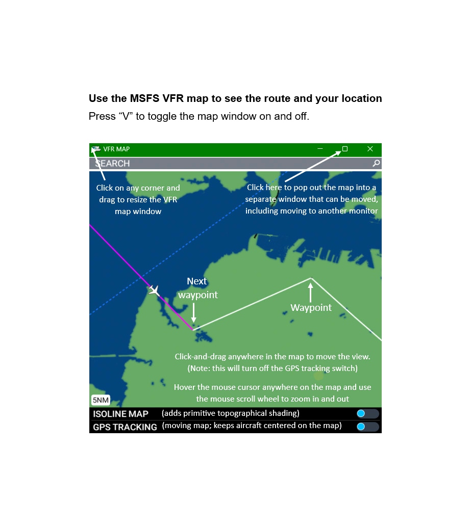
No navigation or GPS instruments are required; simply follow the on-screen markers.
Do not engage the copilot or autopilot. They may alter or suppress waypoints.
MSFS settings for the best experience with this flight plan: Options > Assistance Options >
- Piloting > AI Radio Communications (ATC) > Off (required to properly display the waypoints)
- Navigation Aids > Route and Waypoints > On
- Points of Interest > Landmark Markers > On
- Points of Interest > City Markers = Off (optional - declutters the screen)
- Points of Interest > Display Direction to Chosen POI > Off (disables confusing destination marker during flight)
- Points of Interest > Display All Labels > Off
- User Experience > ATC Enforce Flight Plan > On (prevent current conditions from overriding selected runway number)
How to Use This Flight Plan
- Unzip the downloaded file into any folder.
- The flight plan is the file that has the “ .pln ” filename extension.
- MSFS > Welcome tab > World Map > Press Spacebar twice (More > Load) > Load From ...
- Navigate to where you saved the flight plan and select it.
- In the "From" airport, select the departure runway (provided in this description, above).
- Click on the Flight Conditions window at the top right to adjust time and month.
- Click on "Fly" at the bottom right of the screen.

 FederFlyer


Remember Them Lest We Forget.
6 months ago
6 months ago
FederFlyer
NightHawk1867