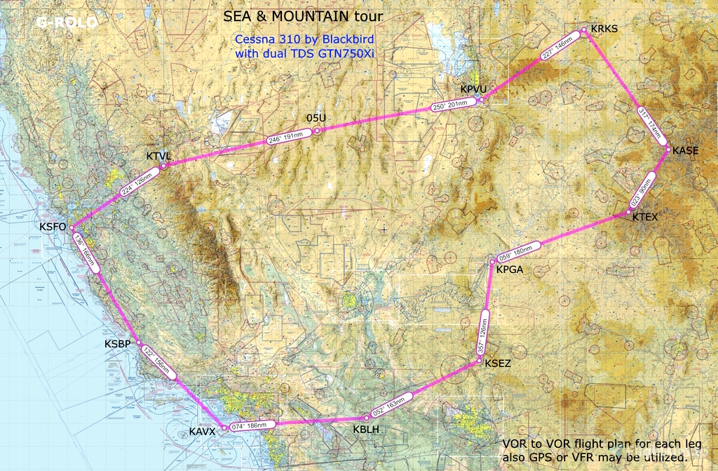

This tour is a circuit between twelve aerodromes ranging from easy international airports to very difficult airfields. A general map is provided showing all the legs with distance and bearing. To make the routes I've used SkyVector, on some of the twelve resulting pdf are the airports diagrams. To select the airplane take on account the smallest and complicated airfields, like Telluride or Aspen. Extract the zip file with the flight plans and the map on a folder. Accept the challenge and enjoy the sea and mountain tour.

 RoloBach


Very nice tour, great sceneries. Thank you!
10 months ago
fStopper
A beautiful and interesting round trip. Thank you for the work.
Friendly greetings from Switzerland
1 years ago
Homofaber
Really enjoying this with the C310. Did the first 3 legs so far, now in Sedona... Cheers!
1 years ago
DestinedWind530