
Description
Story:
Little Navmap (LNM) is a great tool, most of you already know and use it for your flightplans or even as VFR extension map,
to see life "where you fly" on a more comfortable map. Keyword: Sim connection
Using the embedded or connected maps so far was mainly comfortable as long as you flew or planned your trips in countries where lating letters
are used. If you wanted to fly in arabic, asian, or eurasian countries, the maps quite often displayed to local names in the local language and
local script. So i.e. Chinese in Chinese characters. For most of us who are non Chinese - unreadable.
For this reason I got in contact with the developer of LNM and asked if he could add a worldwide map, using latin characters. He came back to me
and told me, it's not on him, it's based on the tiles, the maps receive back from the server - But he forward me as well a link to another forum (avsim)
where this topic was already discussed and there was one guy who served allready some further map extensions for LNM (I'll share the link with you below)
What was/is still missing is - when it comes to open source, having an OSM (street or topo) map worldwide in english or at least readable latin letters, even for smaller towns and villages etc. For example the displayed letters in China are still mainly Chinese letters especially for smaller cities.
What I did now, I analysed a little bit the files which are relevant to receive the information from
several map servers and changed slightly the code to receive the tiles.*1
Mandatory:
Little Navmap (You can download it here)
How to install (additional maps):
1. Extract the zip file.
2. Open the folder where Little Navmap is installed on your system. For example c:\Little Napmap
3. Copy the complete extracted folders into the earth subfolder of Little Navmap - Based on our example:
C:\Little Navmap\data\maps\earth
4. (Re)start Littel Navmap. Now the new additional maps should be available for selection.
They are named: osm-de, osm-fr & osm-tf outdoors
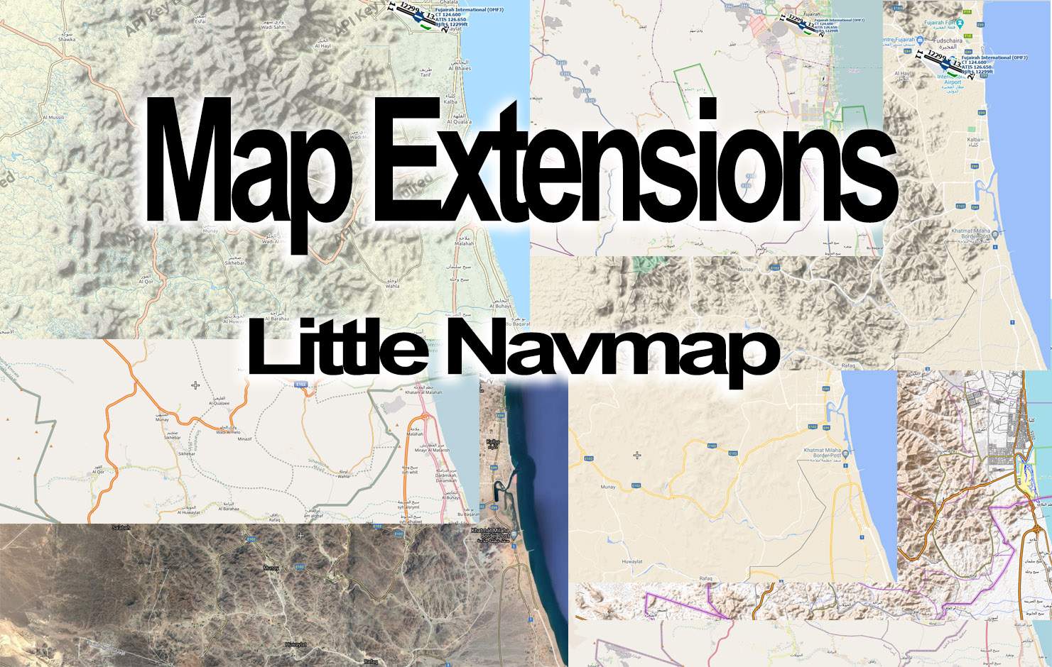
Picture descriptions: for comparison (based on LNM Ver: 2.6.6.)
Picture location: Somewhere in UAE. (all screenshots taken from the same place but differents map selections)
Pic01: Displays screenshot of the already available OSM OpenStreetMaps - Almost all names are Arabic.
Pic02: Similar to Pic.01 but diplayed as OpenTopoMap - Almost all names are Arabic.
Pic06: Displays as screenshot of the added OSM OpenStreetMaps in German. - Almost all names are now in Arabic & German (or local names in readable latin letters)
Pic07: Displays as screenshot of the added OSM OpenStreetMaps in French. - All names (if available*2) are now in Arabic & French (or local names in readable latin letters)
Pic08: Displays as screenshot of the added Thunderforest outdoor map - Almost all names are now in Arabic & English and as a benefit the map
is a kind of a Topo Map but. you'll see the watermark of the API-Key note*3, regardless (for planning purposes) it works with the watermark.
Added Map extensions for download (in one file):
- OSM OpenStreetMaps iworldwide additional in German or English
- OSM OpenStreetMaps iworldwide additional in French*2 or English
- Thunderforest outdoor (topo)map worldwide in English
External link for more LNM map extensions:
i.e. several Scandinavian related maps, several US. related maps and others
you can find here
Disclaimer: All map data are provided free of charge and public accessibility.
--------------------
*1: The developer of LNM (Alexander Barthel) gave me the permission to share the slightly modified files for free, since they are running under a public GNU LGPL anyway.
*2: The French language has not yet been adopted so well globally. This is why it is sometimes missing and the original labels are displayed.
*3: Sorry, couldn't find a solution in the dgml file so far to establish a connection with a vlid api-key. (did some tests). If someone has an idea and is more familiar with that, I'm happy when you come back to me.
Map extensions for Little Navmap (LNM)
Enhance your flight planning experience with worldwide Latin letter naming map extensions for Little Navmap (LNM). Explore OSM OpenStreetMaps in English, German, and French, as well as Thunderforest outdoor maps for global flight navigation. Download and install additional maps to view readable Latin letters for towns and villages across various regions.


User Reviews
1 reviews
Version History
No version history available.
Related

Neckar Valley - River bushtrip (DE,EN,ES,FR,IT,PL,PT,RU)
Embark on a scenic flight along the picturesque Neckar Valley, from Heidelberg to Stuttgart, with this MSFS bushtrip. Available in multiple languages and featuring two predefined aircraft models. Explore the beautiful German landscape with stopovers in key locations like Mannheim, Speyer, and Heilbronn. Enjoy a one-hour journey, taking in the sights and landmarks along the way.
by BWilli

Lahn Valley - River bushtrip (DE,EN,ES,FR,IT,PL,PT,RU)
Embark on a scenic bush trip along the Lahn Valley from Wetzlar to Koblenz, available in multiple languages and compatible with two aircraft models. Enjoy a curvy flight following the Lahn river, with the opportunity for daring landings and exploration below 800 feet. Discover picturesque views and experience a taste of Germany in this immersive add-on.
by BWilli

Zugspitze - Rescue mission (DE,EN)
Embark on a thrilling rescue mission to Germanys highest mountain, the Zugspitze, in this MSFS addon. Play the role of a daring pilot flying the Zlin Aviation Savage Cub to save stranded individuals in treacherous conditions. Experience a real stopover on the Schneeferner glacier and navigate through challenging weather obstacles. Are you ready for the ultimate aviation challenge?
by BWilli
Log in to join the discussion
Log InComments(19)
10 months ago
over 1 year ago
about 3 years ago
almost 3 years ago
about 2 years ago
over 4 years ago
I don't know if anyone is still looking for this answer, but if you get an API key from Thuderforest then the place to put it is in the .dgml file. Look for the four lines below and add your own key with a 'query' variable.
<!-- OSM content delivery network German proxy servers -->
<downloadUrl protocol="https" host="a.tile.thunderforest.com" path="/outdoors/" query="apikey=#32_digits_of_your_API_key_here#"/>
<downloadUrl protocol="https" host="b.tile.thunderforest.com" path="/outdoors/" query="apikey=#32_digits_of_your_API_key_here#"/>
<downloadUrl protocol="https" host="c.tile.thunderforest.com" path="/outdoors/" query="#32_digits_of_your_API_key_here#"/>
over 4 years ago
Try this.
https://github.com/h0wardch3ng/map-extensions-for-little-navmap
over 4 years ago
Amazing. Thanks.
over 5 years ago
over 5 years ago
over 5 years ago
over 5 years ago
over 5 years ago
Google Maps (Default)
Google Maps (Satellite)
Google Maps (Terrain)
U.S. VFR Sectionals
U.S. IFR Enroute Low
U.S. IFR Enroute High
U.S. IFR Area Charts
U.S. Terminal Area Charts (TAC)
U.S. Helicopter Route Charts
here you get more maps for LNM
over 5 years ago
Check my description above
It was already mentioned and linked ;-)
"External link for more LNM map extensions:
i.e. several Scandinavian related maps, several US. related maps and others
you can find here"
over 5 years ago
over 5 years ago
The map is from Thunderforest. www.thunderforest.com
You have to register, to get rid of the watermark. As a registered user you are allowed to download 150,000 tiles/month if you want more you have to pay. I didn't apply for an api key and put it into the file. Because - depending on the amount of users downloading this, all togheter will soon run out of tiles memory with one and the same api key and btw. I'm not sure if this is allowed.
If you register yourself, then you have slightly to modify the request file and place there your key manually. I haven't done that so far either but I'll try.
over 5 years ago
After some tests with a valid api-key to establish a connection to the thunderforest map, I didn't find a solution. So either here's someone who's more familiar with that and can support or we have to live with that, that the api-key watermark remains in the map.
Sorry that I have no better information but I did my best in research for the necessary changings in the dgml file, but haven't find anything when it comes to api-key usage or better, the way the tile request is internally handled does not fit with the settings thunderforest forward to me.
over 5 years ago
over 5 years ago