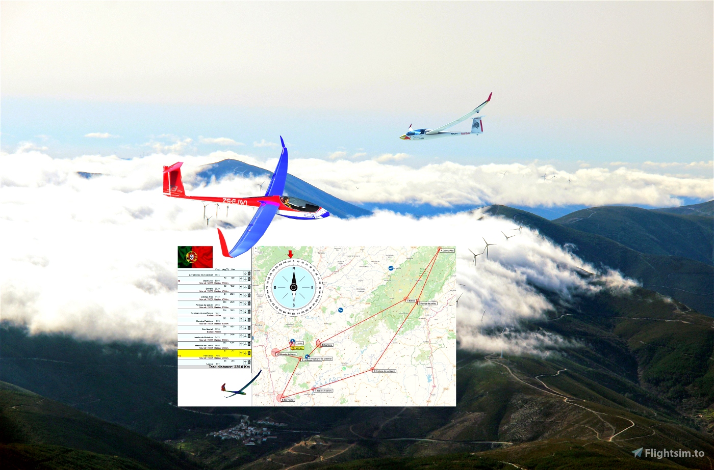
Distance:224km.Length:1-1.5h. .
Difficulty: medium . .
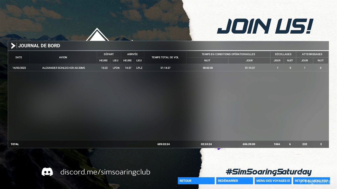
PORTUGAL.
Departure: LPCN
Destination: LPLZ
Distance: 224km
Length: 1 - 1.5h
Difficulty: medium
Weather report:
Few clouds
15 kts wind from N
Real weather
Notes:
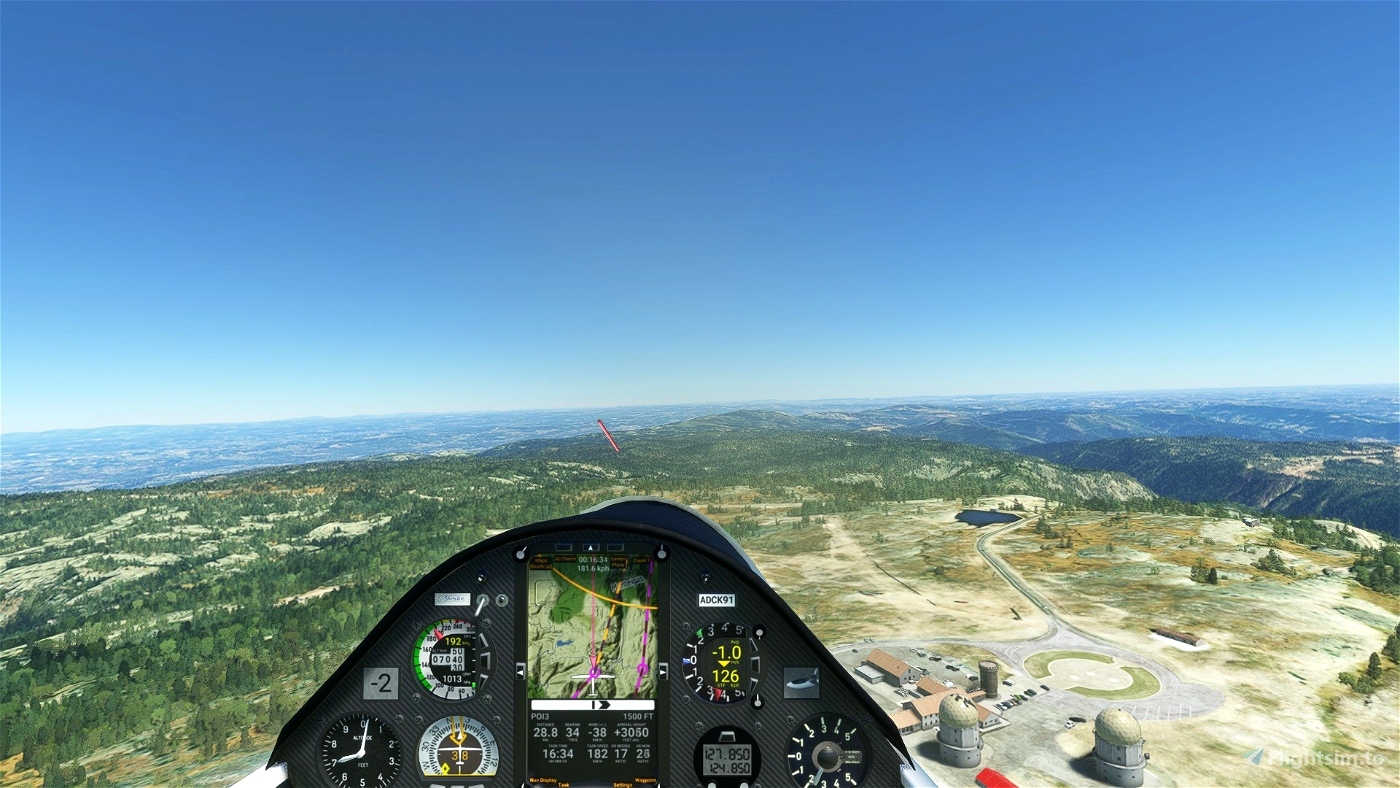
Use the ridges
----
Use and look to GPS to validate all crossing points (notification when done).
Use your catapult to take off.
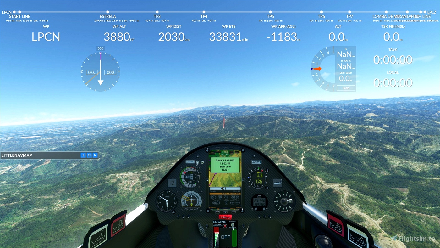
When you have reached 4500 feet, turn Left to unhook the cable .
Use and look to GPS to validate all crossing points (notification when done).
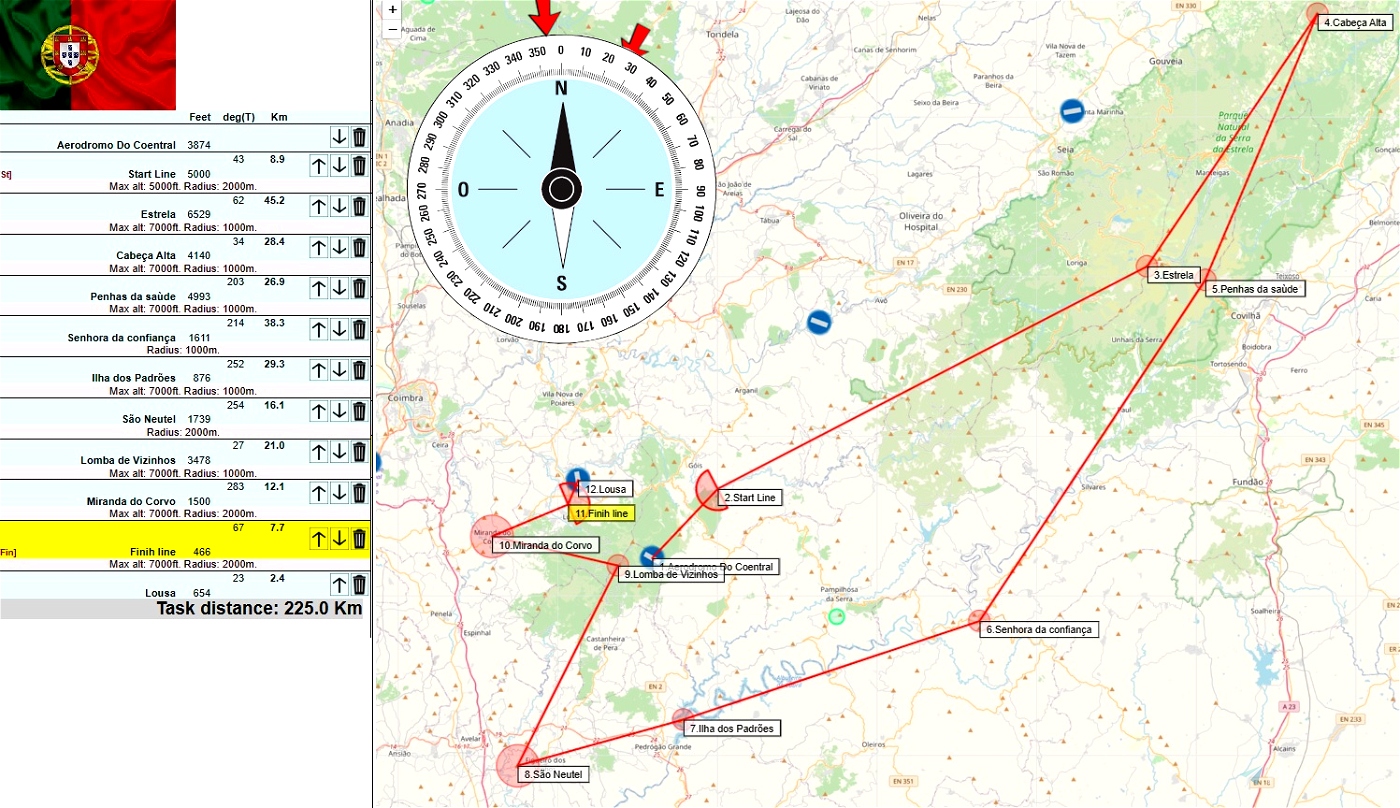
5000 Maximum height to pass the POI1 start line.
---------------
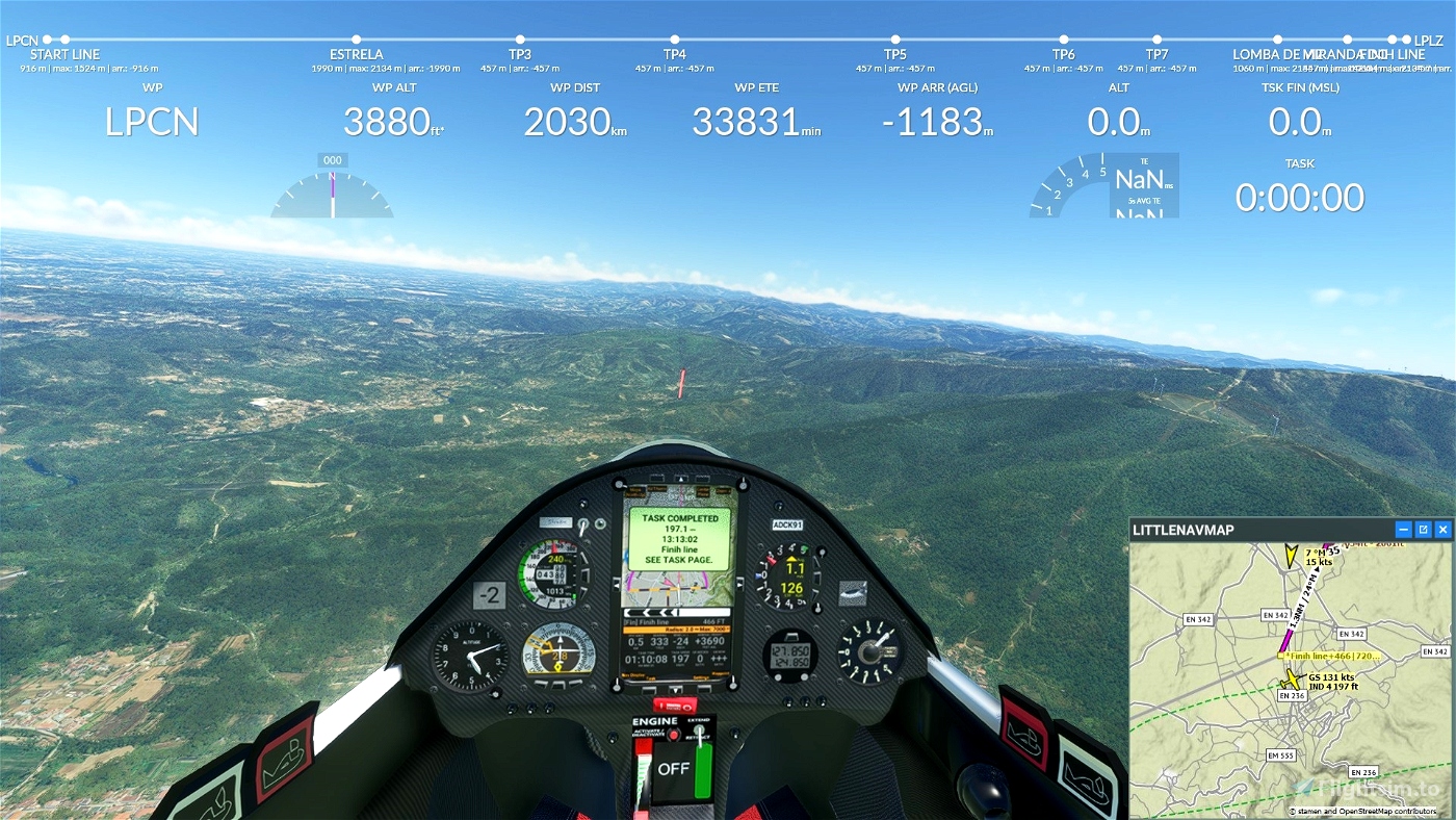
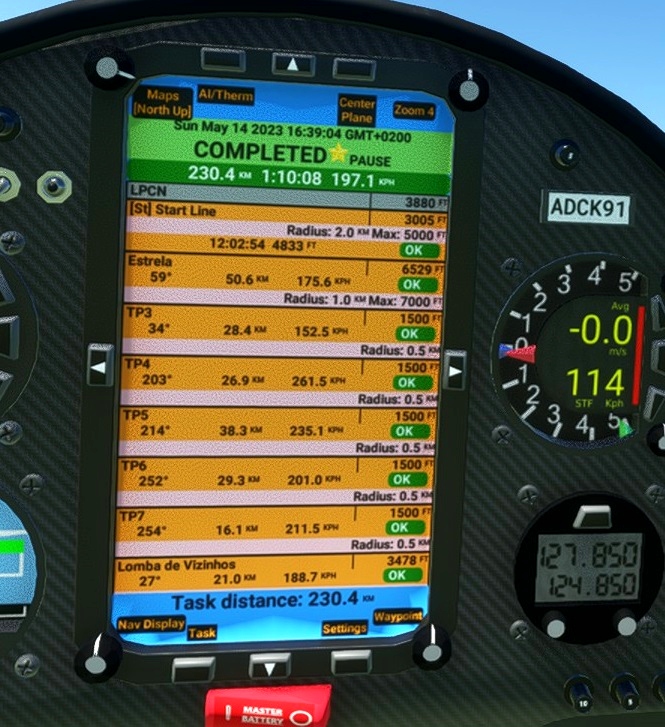
LPCN Aeródromo Do Coentral 3880
POI1: Starting line. Elevation 5000 feet maxi
POI2: Estrela Elevation 6529 feet 7000 feet maxi
POI3: Cabeça Alta Elevation 4140 feet 7000 feet maxi
POI4: Penhas da saùde Elevation 4993 feet 7000 feet maxi
POI5: Senhora da confiança. Elevation 1611 feet 7000 feet maxi
POI6: Ilha dos Padrões. Elevation 870 feet 7000 feet maxi
POI7: São Neutel. Elevation 1739 feet 7000 feet maxi
POI7: Lomba de Vizinhos. Elevation 3478 feet 7000 feet maxi
POI7: Miranda do Corvo. Elevation 1500 feet 7000 feet maxi
POI7: Finih line. Elevation 466 feet 7000 feet maxi
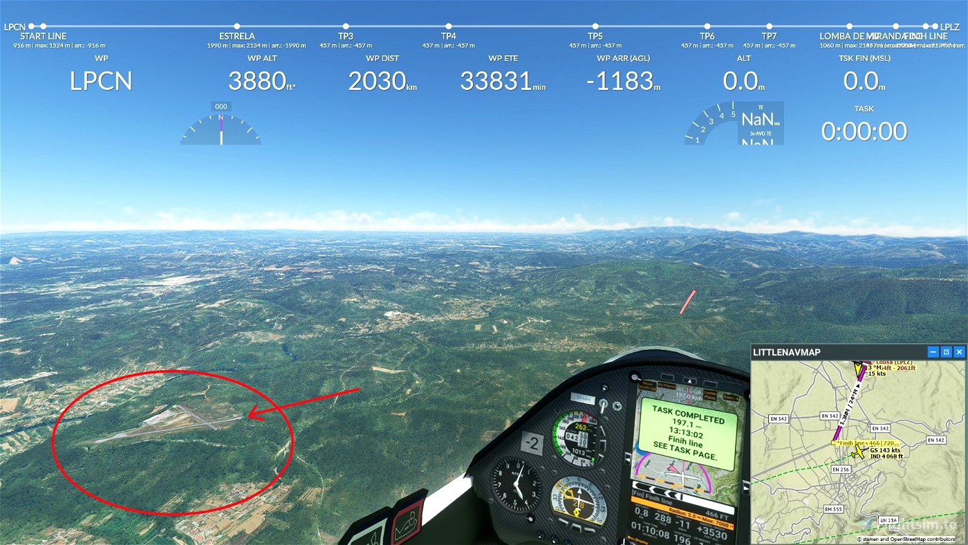
go Landing on Lousã Airport - LPLZ 654 feet
Turn off your main battery when you have landed
Glider ride on Portugal with AS33me. You take off using your winch from LPCN Coentral airfield .
.Use your winch to take off...
MADoloSimulations
ASS33 me 1.91
https://fr.flightsim.to/file/15090/as-33-me
SCC Sim Soaring Club
https://www.twitch.tv/videos/1534299342
https://www.youtube.com/GeorgOrtner
https://www.instagram.com/simsoaringclub/
https://discord.me/simsoaringclub
Got Friends
Discus-2c: Premium
https://fr.flightsim.to/product/discus-2c-premium

 ADCKillerman

