Description
This is primarily an in-game interface for Little Navmap desktop software, a popular free flight planner, navigation tool, airport info browser, and so on.
It's not an 'official' thing. I'm not affiliated with Little Navmap author. I just enjoy their work very much.
Versions prior to 2.0.0 have been tested by me on MSFS 2020, while newer versions not, they reportedly work (not the EFB plugin obviously).
Features
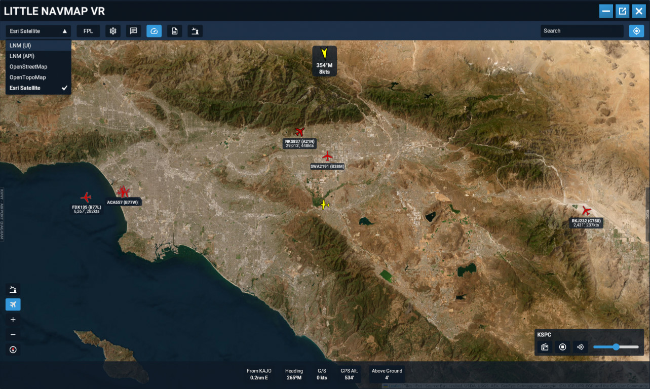
- Little Navmap integration - map, flight plan, airport data
- Additional online maps (OpenStreetmap, OpenTerrain, Esri Satellite, CartoDB)
- Weather map overlays (OpenWeatherMap, RainViewer)
- Charts - plate, approach, sid, star (FAA only, by Aviation API)
- Telemetry - instruments like current altitude, speed, position
- Document browser supporting images and PDFs (single/multi-page, subfolders)
- ATC services integration: Vatsim/vPilot, IVAO, Pilot2ATC, Say Intentions, Beyond ATC
- Radio station player, windows media session control (e.g. Spotify, Tidal and so on)
- Can be run as a toolbar panel (2020/24) or EFB application (2024)
Potential anti virus warnings
This addon includes unsigned executables, which can trigger false positives from antivirus tools or Windows SmartScreen. These systems use heuristics and reputation checks, so new or uncommon files are often flagged automatically and can even be temporary blocked/quarantined for some users.
The files aren’t signed because obtaining a cheapest code signing certificate would cost me about $200 for the first year — not practical for freeware.
Your options:
- Don't use it
- Sponsor the code signing certificate
- Or trust it and run it (VirusTotal scan results)
Reporting bugs and support
I don’t have time to provide individual support — life, programming, and other projects keep me busy. I also don’t get notifications from flightsim.to, and the comment or private message system isn’t ideal for that sort of things.
To help, there documentation provided the package. I also have set up a Discord server for this addon. Join if you want to: report issues, access testing builds, propose features, ask others for support.
Join Discord
Documentation
Note it's not a drag and drop installation and reading documentation is recommended.
- See README.html in the package.
- Versions prior to 2.0.0 - Online Documentation
Roadmap / Wishlist
- Planned:
I'll be connecting to LNM nav database(s) directly and see what can I do with it
- Drop me an idea on Discord
- Not planned:
Navigraph - "We are not able to support your implementation with the Charts API. Little Navmap has a very high feature overlap with our own Charts application, and we don't support Charts API in such applications even though your implementation is not directly affiliated with LNM and is running in the virtual cockpit. Our Charts app is already available as an in-game panel".
- ChartFox - not responsive.
- Scratchpad/note taking - buy yourself a cheapest Wacom or Huion tablet and use OpenKneeboard. Best way to do it in VR.
- Controller support - I currently don't have VR controllers and/or can't make myself to use them.
Acknowledgements and Thanks
Alexander Barthel for Little Navmap
Ian Cowan for Aviation API
Volodymyr Agafonkin for Leaflet
Ross Alan Carlson for vPilot and its plugin interface
Alex Segler for RadioBrowser
Support the author
I make it in my free time and truth be told, primarily for myself to have fun and support my hobby. But if you'd like to keep me motivated or maybe you feel I've saved you money by making this free, then:
- Share some feedback.
- ❤️ Big thanks ❤️ for people who have used donation links!
Little Navmap VR Panel
It's a panel displaying Little Navmap content and other online maps for a quick reference, primarily meant for VR users. User interface is inspired by popular EFB software and it's meant to provide a feeling of having an iPad in the cockpit. Supports viewing PDFs and integrates with online ATC services. Provides playback of local radio stations in the area.

Supporters
macson_g
£25
stanley550
£20
rodje
£15
pmb
£15
Afton236
£10
sboslo
£10
Mouldy
£10
LarryDavid
£10
JosZan
£10
dumpfbacke
£10
Egotroubler
£10
Spudpicker
£10
mauben
£10
trilotus
£10
pmb
£10
tgp7777777
£10
pchauffo
£10
glider1001
£7
Lazfree
£5
Fliegomat
£5
saky
£5
Poppapete
£5
southernbus101
£5
Zahavio
£5
otip84
£5
SixDegrees
£5
derek
£5
steve5031
£5
Sift5805
£5
marxair
£5
BillEvansAlone
£3
Bill2slo
£2
Stevo183
£1
User Reviews
95 reviews
More Information
Version History
- same as 2.3.2, but recompiled for SU5, it required changes to the manifest to work.
about 2 months ago