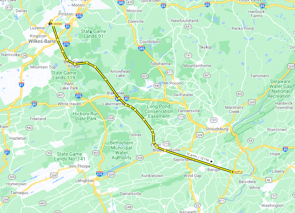
What is today's Pennsylvania Route 115 was formerly the Sullivan Trail, a route that follows the path taken by General John Sullivan during his expedition in the American Revolutionary War. This flight plan follows that route, and is 46 nautical miles. There are two files in the zipped download -- a .pln file for loading into the sim from the World Map screen and a .lnmpln file if you want to follow the route in Little Navmap.
We depart from Wilkes-Barre-Wyoming Valley Airport (KWBW). The first waypoint takes us over the site of the Wyoming Monument (not currently modeled); the other waypoints are placed for the purpose of following Route 115 accurately. (The destination airport, Gap View (49PA), has scenery, available here.)
The Sullivan Trail ends at today's U.S. Route 209 at Brodheadsville, but we continue southeast for just over 12 nautical miles, over Cherry Valley Wildlife Refuge, to our destination.

 newtestleper


Absolutely love it! Thank you for this. I took this discovery flight a few days ago to commemorate the Battle of Wyoming. When the leaves are off the trees, I can see the runway threshold at KWBW from my front door and Queen Ester's Rock from my backdoor. Also called Bloody Rock, it was where any patriots captured during the battle were tortured during the night. The Native American queen herself supposedly delivered the coup de grace by beating their heads in with a club. It is probably a case of "history being written by the victor" because the Battle of Wyoming certainly took place, but the atrocities attributed to the Native Americans have been exaggerated and become legend. The event itself was known as the "Wyoming Massacre". The details may have been distorted nearly from the start because General Washington needed a good reason to send out Colonel Sullivan to commit genocide and attempt to wipe out all Native Americans in 3 of the 13 original colonies. Very few people know these details, even those in the area who take part in the yearly reenactment of the battle. One other note, the trees which surround the Wyoming Monument (the ossuary for those who died in battle) make it impossible to see in game. Should anybody want to take on the challenge of updating the monument for MSFS, I will be happy to provide pictures and details that cover every square inch. Again great job, and thank you for sharing your time, talent, and knowledge with this historic flight.
3 years ago
C0SM0S