Summary AI Generated
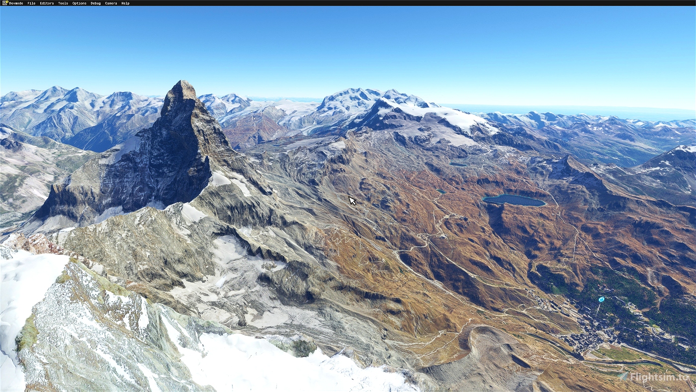
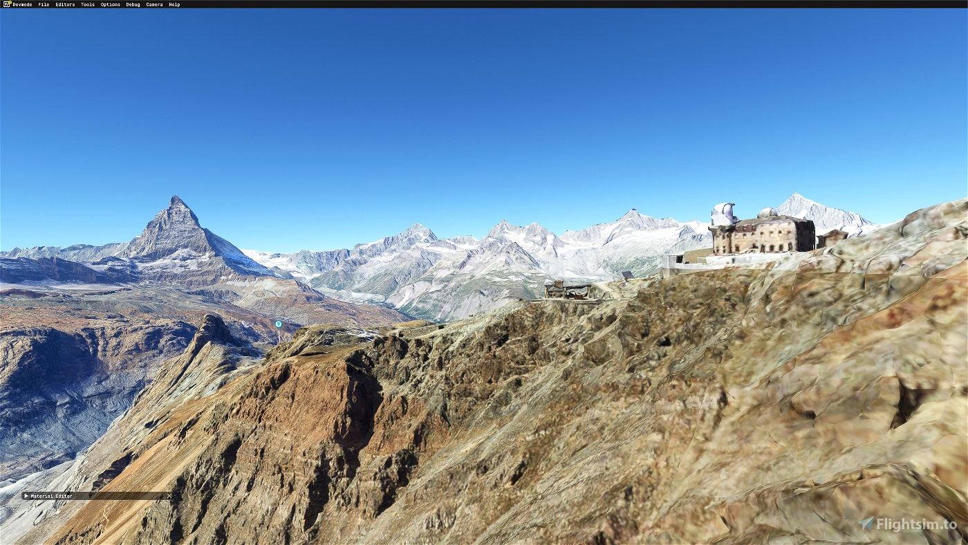
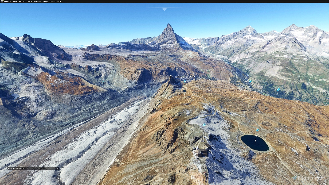
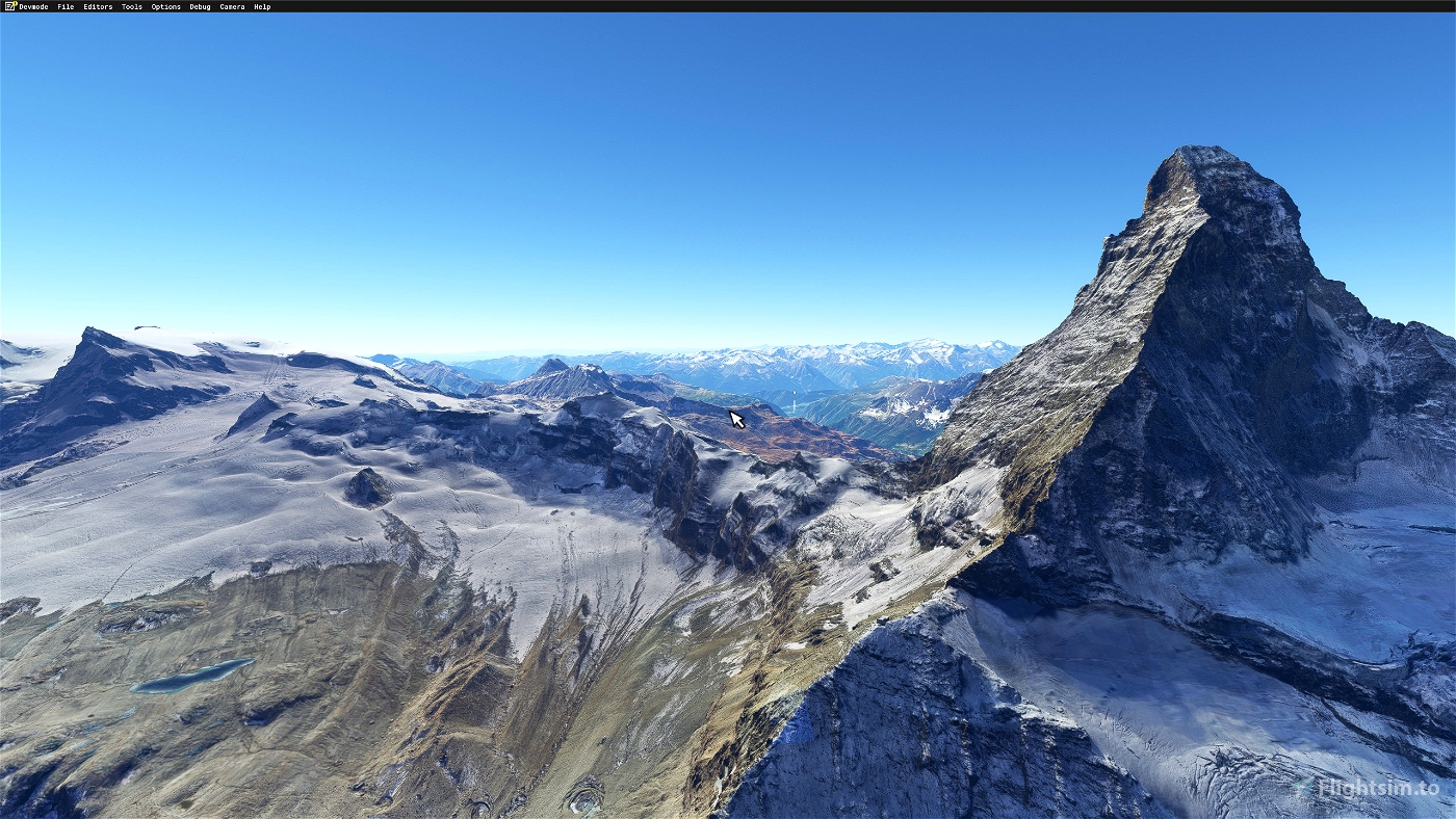
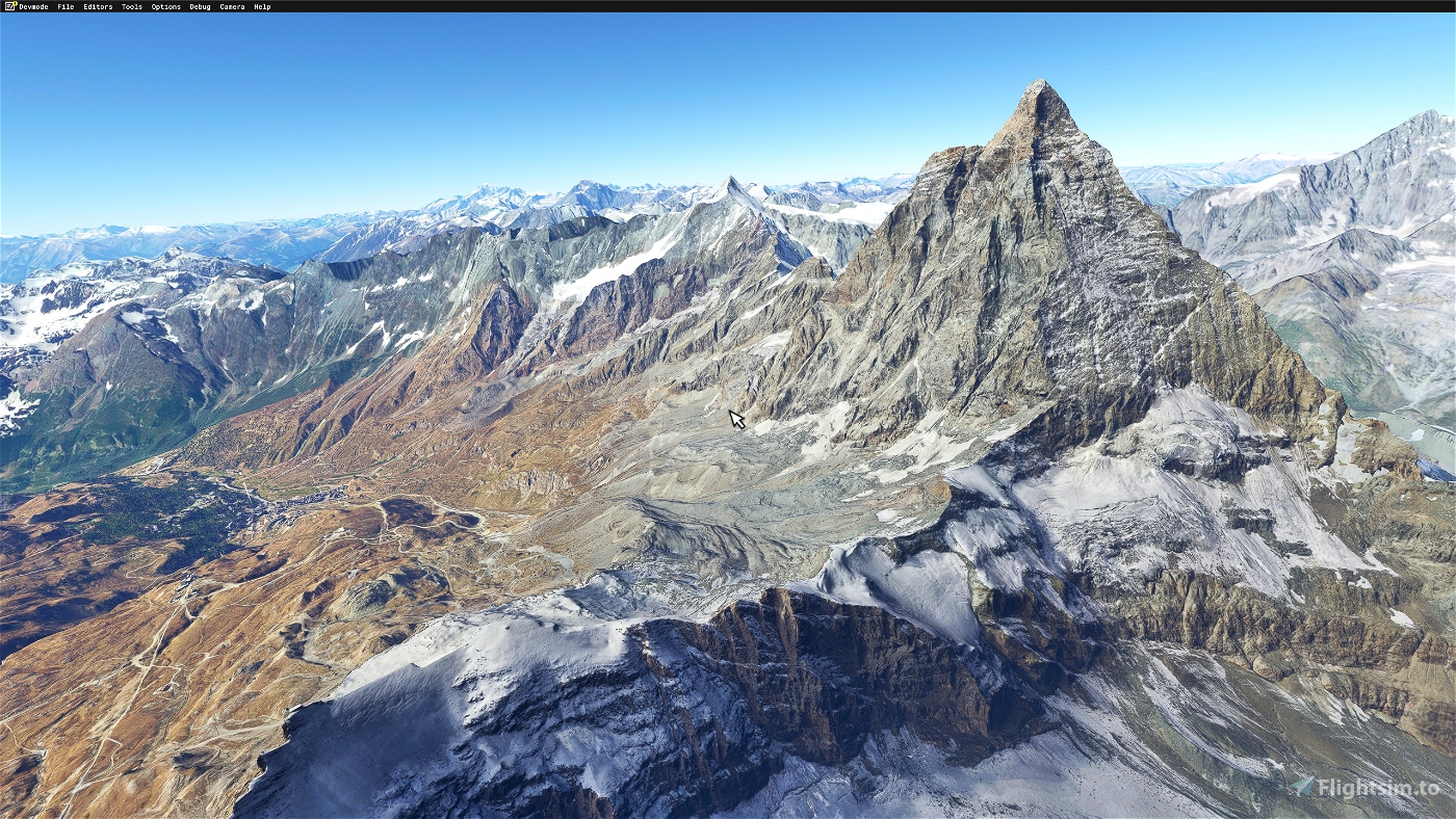
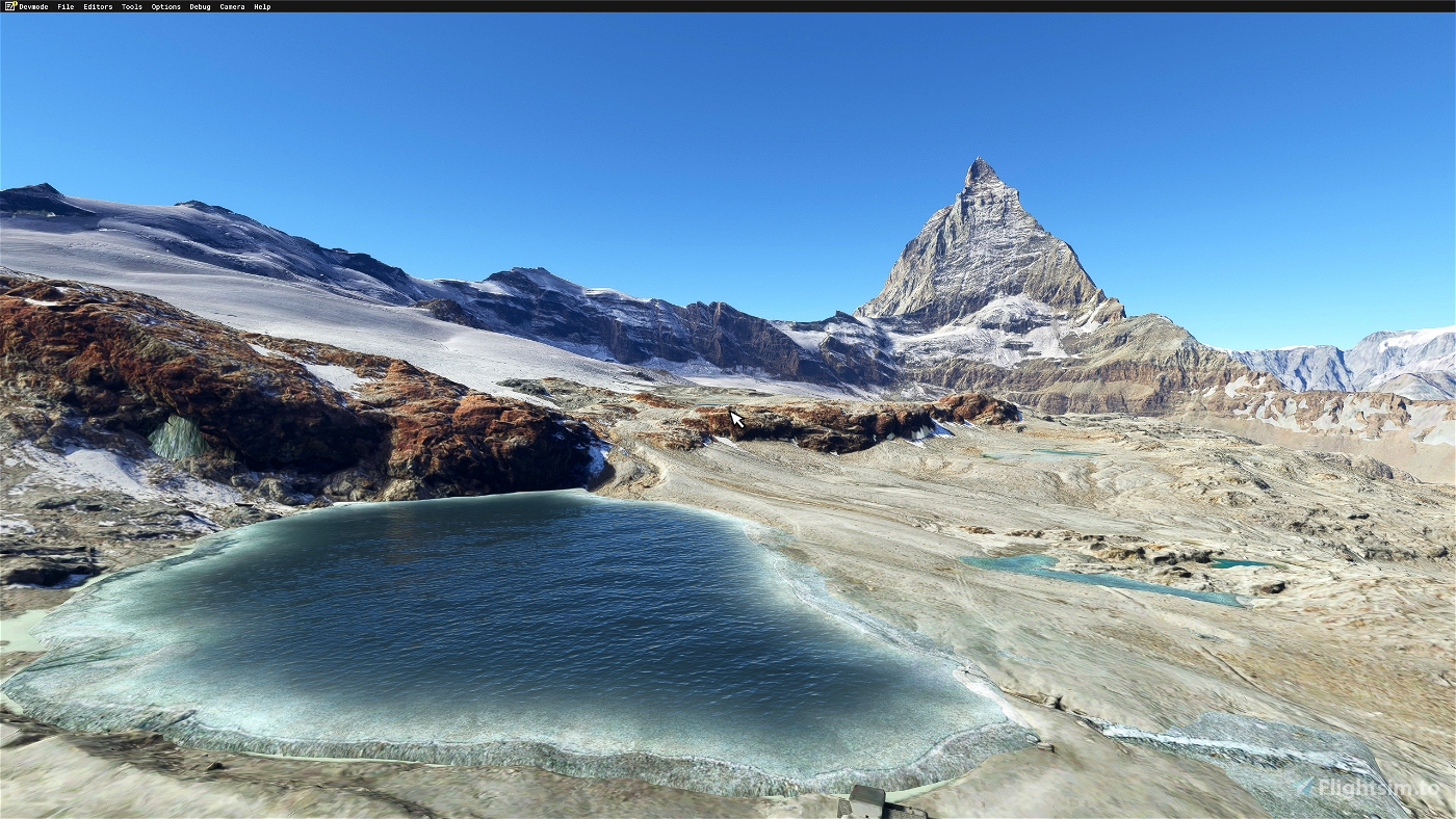
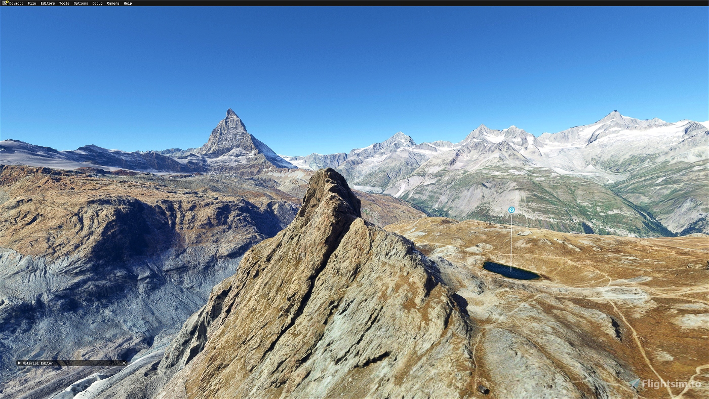
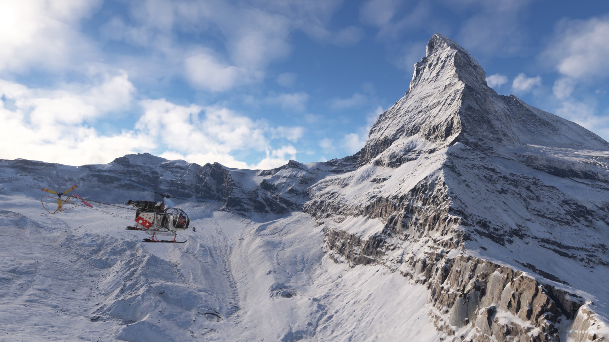
The Matterhorn is, with its altitude of 4,478 meters, the 12th peak of the Alps. It is located on the Italian-Swiss border, between the canton of Valais and the Aosta Valley. It overlooks the Swiss town of Zermatt to the northeast and the Italian town of Breuil-Cervinia to the south


4 months ago
Bobitaly
6 months ago
4 months ago
DemoKen
umberto45
9 months ago
4 months ago
Atkamen
Scania_500
Thank you in advance.
9 months ago
rav707
Sorry I can only give 5 stars! Simply stunning!!! Thank you so much for making this.
12 months ago
11 months ago
DemoKen
wilsonjpr
Very Noice!
1 years ago
sonicviz
Vielen Dank für die tolle Arbeit. Sieht sehr schön aus!
1 years ago
CHlapf
really a very nice icon mountain, never seen better in Flightsimulation! Thank you!!!
1 years ago
machuca99
hello does this work with the dlc where you can buy it where the hörndlihütte is in it today ?????
1 years ago
Toni_feuz
1 years ago
Red_Ronnl
Oh does this go out to the Aosta altiport?
1 years ago
Hi, Unfortunately there is no google modeling in 3d between Aosta airport and matterhorn
1 years ago
DemoKen
Parorng
Großartig - vielen Dank! Es ist eine reine Freude, in dieser so detaillierten Scenerie zu fliegen! Auch LOD und Framerate sind prima.
1 years ago
Ulrich11
Really GREAT - Thank you very much.
I would fully support Jonwait's thoughts and proposals, thank you too.
And I have a big dream: To fly around in YOUR scenery of both shores of lake of Zurich Switzerland one day (including Pfannenstil and Albis hills)...
1 years ago
Housi
Can you help with Catalina Island in California? It is currently look like melting lava around the island.
1 years ago
hi, unfortunately no 3d modeling in google for Catalina Island, only bing 2d images. :(
1 years ago
DemoKen
DC6Pilot
Nice work. However, does it excludes Wombii project liftsm redwings or free Hornli hut or Monte rosa hut ?
1 years ago
Hi, i'm not sure but in general i replace everything with google map, except the airports.. I'll check later
1 years ago
DemoKen
Jonwait